Related Research Articles

The Sabine River is a 360-mile (580 km) long river in the Southern U.S. states of Texas and Louisiana, From the 32nd parallel north and downstream, it serves as part of the boundary between the two states and empties into Sabine Lake, an estuary of the Gulf of Mexico.

Sabine County is a county located on the central eastern border of the U.S. state of Texas. As of the 2020 census, its population was 9,894. The county was organized on December 14, 1837, and named for the Sabine River, which forms its eastern border.

Lampasas County is a county located on the Edwards Plateau in the U.S. state of Texas. As of the 2020 census, its population was 21,627. Its county seat is Lampasas. The county is named for the Lampasas River.

Houston County is a county located in the U.S. state of Texas. As of the 2020 census, its population was 22,066. Its county seat is Crockett. Houston County was one of 46 entirely dry counties in the state of Texas, until voters in a November 2007 special election legalized the sale of alcohol in the county.

Sabine Parish is a parish located in the U.S. state of Louisiana. As of the 2020 census, the population was 22,155. The parish seat and largest town is Many.

Fisher is a village in Sabine Parish, Louisiana, United States. The population was 230 at the 2010 census, down from 268 in 2000.

Mayfield Township is a civil township of Lapeer County in the U.S. state of Michigan. The population was 7,988 at the 2020 Census.

Hemphill is a city in and the county seat of Sabine County, Texas, United States. The population was 1,029 at the 2020 census. It is the county seat of Sabine County. It is located on State Highway 87 at the junction of State Highway 184, and is surrounded by the Sabine National Forest and the Toledo Bend Reservoir.

Toledo Bend Reservoir is a reservoir on the Sabine River between Texas and Louisiana. The lake has an area of 185,000 acres (750 km2), the largest man-made body of water partially in both Louisiana and Texas, the largest in the South, and the fifth largest by surface acre in the United States. The dam is capable of generating 92 megawatts of electrical power. The dam itself is located in the northeast corner of Newton County, Texas; however, that county includes very little of the reservoir, as most of it extends northward into parts of Sabine and DeSoto parishes in Louisiana, and Sabine, Shelby, and Panola counties in Texas.

Central Oregon is a geographic region in the U.S. state of Oregon and is traditionally considered to be made up of Deschutes, Jefferson, and Crook counties. Other definitions include larger areas, often encompassing areas to the north towards the Columbia River, eastward towards Burns, or south towards Klamath Falls. These three counties have a combined population of 200,431 as of the 2010 census, with Deschutes the largest of the three counties, having approximately four times the population of the other two counties combined. As of 2015, the most populous city in the region is Bend, with an estimated 87,014 residents. As defined by the three county definition, Central Oregon covers 7,833 square miles (20,290 km2) of land. Central Oregon has had 3 record tourism years beginning in 2012. Over 2.2 million people visited Central Oregon in 2012 and again in 2013.
Bronson is an unincorporated community in west central Sabine County, Texas, United States. It is located on U.S. Route 96 at the junction of State Highway 184, nine miles west of Hemphill. The ZIP Code for Bronson is 75930.
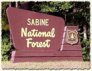
Sabine National Forest is located in East Texas near the Texas-Louisiana border. The forest is administered together with the other three United States National Forests and two National Grasslands located entirely in Texas, from common offices in Lufkin, Texas. There are local ranger district offices located in Hemphill.
Texla is a ghost town in northern Orange County, Texas, United States, in the southeastern part of the state. It is located northwest of Orange, just west of Mauriceville. The site was originally called Bruce, after the postmaster Charles G. Bruce, who served when the office opened in 1905. The first sawmill to operate there was known as the Harrell-Votaw Lumber Company with proximity to the Orange and Northwestern Railway. The following year, the R. W. Wier Lumber Company out of Houston took over operations. The site was renamed Texla, due to its proximity to Louisiana. The owner Wier sold out to the Miller-Link Lumber Company in 1917. The peak population of the town reached an estimated 600 residents. In 1918 the mill was destroyed by fire, but was rebuilt in 1919 with a double-circular mill of the same size. Within a year, the Peavy-Moore Lumber Company of Deweyville took ownership, and operated the site until the nearby timber became exhausted. In 1929, the mill was dismantled and the site was abandoned.
From 1945 until 1977, a sawmill operated under the name Texla Lumber Company in nearby Mauriceville, according to the Texas Forestry Museum.
David Robert Wingate was an American lumber businessman and plantation farmer who served in the Confederate Army as the commissioner of defense for Jefferson County, Texas, during the American Civil War. Overcoming numerous financial setbacks throughout his lifetime, he remained a successful industrialist. He owned hundreds of slaves.
Burkeville is an unincorporated community in northern Newton County, Texas, United States. It sits at the intersection of State Highways 63 and 87, 10 miles west of the Sabine River. The Burkeville Independent School District serves the resident students.

Farm to Market Road 1 (FM 1) is a Farm to Market Road in the U.S. state of Texas, maintained by the Texas Department of Transportation (TxDOT). FM 1 was the first such to be designated in Texas. This 18.6-mile (29.9 km) road provides access from rural areas of East Texas to U.S. Highway 96 (US 96).
The Grabow riot or Grabow massacre was a violent confrontation that took place between private police hired by management and labor factions in the timber industry near Grabow (Graybow), Louisiana, on July 7, 1912. The clash left three union workers and a company security employee dead, including union leader Asbury Decatur ("Kate") Hall, and an estimated fifty wounded. It was a crucial event in attempts to organize locals and unionize sawmill workers in Louisiana and east Texas in a series of events known as the Louisiana-Texas Lumber War of 1911-1912.
Korbel is an unincorporated community in Humboldt County, California. It is located 1.5 miles (2.4 km) east-southeast of Blue Lake, at an elevation of 154 feet. The ZIP Code is 95550.

The forests in the U.S. state of Texas have been an important resource since its earliest days and have played a major role in the state's history. The vast woodlands of the region, home to many varieties of wildlife before Europeans first showed up, provided economic opportunities for early settlers. They continue to play an important role economically and environmentally in the state.
References
- ↑ "History of East Mayfield - Sabine County, Texas – Toledo Bend Lake". toledo-bend.com. 2020-10-22. Archived from the original on October 22, 2020. Retrieved 2024-06-03.
{{cite web}}: CS1 maint: unfit URL (link) - ↑ Barlow, Ronald (August 28, 2021). "Riding to School". Hemphill Daily News. Archived from the original on June 3, 2024. Retrieved June 3, 2024.
- ↑ "Site of East Mayfield Historical Marker". www.hmdb.org. Retrieved 2024-06-03.
31°20′29″N93°51′53″W / 31.3415°N 93.8647°W
 | This article about a location in Sabine County, Texas is a stub. You can help Wikipedia by expanding it. |