
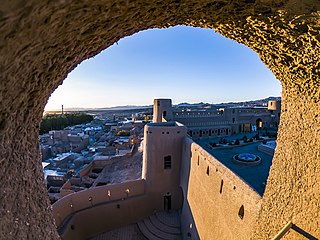
Bam is a city in the Central District of Bam County, Kerman province, Iran, serving as capital of both the county and the district.

Iran is subdivided into thirty-one provinces, each governed from a local centre, usually the largest local city, which is called the capital of that province. The provincial authority is headed by a governor-general, who is appointed by the Minister of the Interior subject to approval of the cabinet.

The Saffarid dynasty was a Persianate dynasty of eastern Iranian origin that ruled over parts of Persia, Greater Khorasan, and eastern Makran from 861 to 1002. One of the first indigenous Persian dynasties to emerge after the Islamic conquest, the Saffarid dynasty was part of the Iranian Intermezzo. The dynasty's founder was Ya'qub bin Laith as-Saffar, who was born in 840 in a small town called Karnin (Qarnin), which was located east of Zaranj and west of Bost, in what is now Afghanistan. A native of Sistan and a local ayyār, Ya'qub worked as a coppersmith (ṣaffār) before becoming a warlord. He seized control of the Sistan region and began conquering most of Iran and Afghanistan, as well as parts of Pakistan, Tajikistan and Uzbekistan.

A qanāt or kārīz (کَارِیز) is a water supply system that was developed in ancient Iran for the purpose of transporting usable water to the surface from an aquifer or a well through an underground aqueduct. Originating approximately 3,000 years ago, its function is essentially the same across the Middle East and North Africa, but it is known by a variety of regional names beyond today's Iran, including: kārēz in Afghanistan and Pakistan; foggāra in Algeria; khettāra in Morocco; falaj in Oman and the United Arab Emirates; and ʿuyūn in Saudi Arabia. In addition to those in Iran, the largest extant and functional qanats are located in Afghanistan, Algeria, China, Oman, and Pakistan.

Kerman is a city in the Central District of Kerman County, Kerman province, Iran, serving as capital of the province, the county, and the district.

Tabas is a city in the Central District of Tabas County, South Khorasan province, Iran, serving as capital of both the county and the district.
Iran has been divided into regions in a number of different ways historically. It has been divided into five administrative regions since 2014.

South Khorasan province is one of the 31 provinces of Iran, located in the eastern part of the country. Its capital is the city of Birjand. In 2014, the province was placed in Region 5. This province is bordered to the north by Razavi Khorasan Province, to the northwest by Semnan Province, to the west by Isfahan and Yazd Provinces, to the south by Kerman Province, to the southeast by Sistan and Baluchestan Province, and to the east by Afghanistan. The area of this province is 151,913 square kilometers, making it the third largest province in Iran after Kerman and Sistan and Baluchestan. According to the 2016 census, its population is 768,898, ranking it as the 28th province in the country in terms of population. This province is the third largest province in Iran.

Dasht-e Kavir or the Kavir Desert, also known as Kavir-e Namak or the Great Salt Desert, is a large desert lying in the middle of the Iranian Plateau. It is about 800 kilometres (500 mi) long by 320 kilometres (200 mi) wide with a total surface area of about 77,600 km2 (30,000 sq mi), making it the world's 24th largest desert. The desert stretches from the Alborz mountain range in the north-west to the Dasht-e Lut in the south-east. It is spread across the Iranian provinces of Khorasan, Semnan, Tehran, Isfahan and Yazd.

Greater Khorasan is a historical eastern region in the Iranian Plateau in West and Central Asia that encompasses western and northern Afghanistan, northeastern Iran, the eastern halves of Turkmenistan and Uzbekistan, western Tajikistan, and portions of Kyrgyzstan and Kazakhstan.
Birjand is a city in the Central District of Birjand County, South Khorasan province, Iran, serving as capital of both the county and the district. The city is known for its saffron, barberry, jujube, and handmade carpet exports.

Sabzevar is a city in the Central District of Sabzevar County, Razavi Khorasan province, Iran, serving as capital of both the county and the district.

Kashmar is a city in the Central District of Kashmar County, Razavi Khorasan province, Iran, serving as capital of both the county and the district. Kashmar is near the river Shesh Taraz in the western part of the province, and south of the province's capital Mashhad, in Iran, from east to Bardaskan, west to Torbat-e Heydarieh, north to Nishapur, south to Gonabad. Until two centuries ago, this city was named Torshiz (ترشیز).

Ferdows is a city in the Central District of Ferdows County, South Khorasan province, Iran, serving as capital of both the county and the district. It is about 345 kilometres (214 mi) south of Mashhad and 200 km northwest of Birjand. Ferdows is on the main axis connecting Yazd, Kerman, Isfahan, Bushehr, Hormozgan and Fars provinces to Mashhad. Ferdows city is 1293 meters above sea level.

Northern Iran, is a geographical term that refers to a relatively large and fertile area, consisting of the southern border of the Caspian Sea and the Alborz mountains.
The Karai, Qarai, or Qara ("Black") Tartars are a Turkic tribe found in Khorasan, Azerbaijan, Kerman, and Fars.
Bojnord is a city in the Central District of Bojnord County, North Khorasan province, Iran, serving as capital of the province, the county, and the district. It is about 701 km (436 mi) from Tehran. and 237 km away from Mashhad, the capital of Razavi Khorasan province.

The Baloch in Iran(Balochi: ایرانءِ بلۏچ) are an ethnic group residing in the southeastern and east regions of Iran.

The Alborz range, also spelled as Alburz, Elburz or Elborz, is a mountain range in northern Iran that stretches from the border of Azerbaijan along the western and entire southern coast of the Caspian Sea and finally runs northeast and merges into the smaller Aladagh Mountains and borders in the northeast on the parallel mountain ridge Kopet Dag in the northern parts of Khorasan. All these mountains are part of the much larger Alpide belt. The Alborz range is divided into the Western, Central, and Eastern Alborz Mountains. The Western Alborz Range runs south-southeastward almost along the western coast of the Caspian Sea. The Central Alborz runs from west to east along the entire southern coast of the Caspian Sea, while the Eastern Alborz Range runs in a northeasterly direction, toward the northern parts of the Khorasan region, southeast of the Caspian Sea. Mount Damavand, the highest mountain in Iran measuring 5,610.0 m, is located in the Central Alborz Mountains. Mount Damavand is the 12th most prominent peak in the world and the second most prominent in Asia after Mount Everest.

Southern Iran consists of the southern mountain ranges of Zagros and Central Iranian Range, Khuzestan Plain and the northern coasts of Persian Gulf and Strait of Hormuz.
