The Eastville Workhouse (officially named the Barton Regis workhouse) was a workhouse situated at 100 Fishponds Road, in Bristol, U.K. [1] It was converted into a home for the elderly in the 1920s, and demolished to make way for housing in 1972. [2]

The Eastville Workhouse (officially named the Barton Regis workhouse) was a workhouse situated at 100 Fishponds Road, in Bristol, U.K. [1] It was converted into a home for the elderly in the 1920s, and demolished to make way for housing in 1972. [2]
The workhouse was built in 1847 to a design by Samuel T. Welch as the Clifton Poor Law Union workhouse; it was renamed in 1877 when the Union was renamed Barton Regis in order to remove the stigma felt by the citizens of Clifton. [3]
In 2012, the site of its burial ground, long-forgotten, was identified as an area of open space known locally as Rosemary Green. Bristol Radical History Group established that more than 3500 inmates of the workhouse had been buried there between 1855 and 1895, before being crudely disinterred when the workhouse was demolished. A memorial was erected at the site in November 2015, and a second memorial was erected in 2019 at the location where they had been reburied in unmarked graves in nearby Avonview cemetery. [4] [5]

Bristol Rovers Football Club are a professional football club in Bristol, England. They compete in League One, the third tier of the English football league system. The club's official nickname is "The Pirates", reflecting the maritime history of Bristol. The local nickname of the club is "The Gas", derived from the gasworks next to their former home, Eastville Stadium. Since 1996, the club has played home matches at the Memorial Stadium in Horfield.

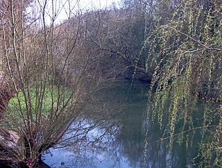
The Frome, historically the Froom, is a river that rises in Dodington Park, South Gloucestershire and flows southwesterly through Bristol to join the river Avon. It is approximately 20 miles (32 km) long, and the mean flow at Frenchay is 60 cubic feet per second (1.7 m3/s). The name Frome is shared with several other rivers in South West England and means 'fair, fine, brisk'. The river is known locally in east Bristol as the Danny.

Stapleton is an area in the northeastern suburbs of the city of Bristol, England. The name is colloquially used today to describe the ribbon village along Bell Hill and Park Road in the Frome Valley. It borders Eastville to the South and Begbrook and Frenchay to the North. It comprises an eclectic mix of housing mainly from the Victorian, Edwardian, inter-war and late 20th century periods.

Easton is an inner city area of the city of Bristol in the United Kingdom. Informally the area is considered to stretch east of Bristol city centre and the M32 motorway, centred on Lawrence Hill. Its southern and eastern borders are less defined, merging into St Philip's Marsh and Eastville. The area includes the Lawrence Hill and Barton Hill estates.
Fishponds is a large suburb in the north-east of the English city of Bristol, about 3 miles (5 km) from the city centre. It has two large Victorian-era parks: Eastville Park and Vassall's Park. The River Frome runs through both with the Frome Valley Walkway alongside it. A restored mill found at Snuff Mills near the Vassall's Park end of the river has kept its original waterwheel, which can still be seen and heard turning. Eastville Park has a large boating lake with central wildlife reserves. Fishponds is mainly residential. Two main bus routes pass through. Housing is typically terraced Victorian. The high street shops include an international supermarket, Asian food store, charity shops, takeaways and Lidl, Aldi and Morrisons supermarkets. It has a small student population from the presence of the Glenside campus of the University of the West of England. The name Fishponds derives from when it was a quarry district, like nearby Soundwell. The empty quarries became large fishponds, which have since been filled in. One remained until the mid-1970s, when it was officially closed: a popular swimming area named "The Lido" by locals. It now belongs to an angling club.

Redland is a neighbourhood in Bristol, England. The neighbourhood is situated between Clifton, Cotham, Bishopston and Westbury Park. The boundaries of the district are not precisely defined, but are generally taken to be Whiteladies Road in the west, the Severn Beach railway line in the south and Cranbrook Road in the east.

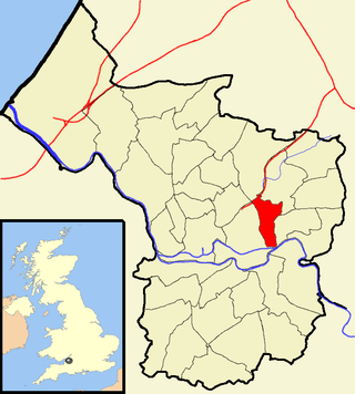
Eastville is the name of both a council ward in the city of Bristol in the United Kingdom and a suburb of the city that lies within that ward. The Eastville ward covers the areas of Eastville, Crofts End, Stapleton and part of Fishponds. Notable places within the ward include Bristol Metropolitan Academy and Collegiate School, and the Bristol and Bath Railway Path also passes through the ward.

Luton Rural District was a local authority in Bedfordshire, England from 1894 to 1974. It covered an area which almost surrounded but did not include the towns of Luton and Dunstable.

The Diocese of Bristol is an ecclesiastical jurisdiction or diocese of the Church of England in the Province of Canterbury, England. It is based in the city of Bristol and covers South Gloucestershire and parts of north Wiltshire, as far east as Swindon. The diocese is headed by the Bishop of Bristol and the Episcopal seat is located at the Cathedral Church of the Holy and Undivided Trinity, commonly known as Bristol Cathedral.

Bristol Tramways operated in the city of Bristol, England from 1875, when the Bristol Tramways Company was formed by Sir George White, until 1941 when a Luftwaffe bomb destroyed the main power supply cables.

Southmead Hospital is a large public National Health Service hospital, situated in the area of Southmead, though in Horfield ward, in the northern suburbs of Bristol, England. It is part of the North Bristol NHS Trust. The 800-bed Brunel Building opened in May 2014, to provide services, which transferred from Frenchay Hospital in advance of its closure. The hospital site covers 60 acres (24 ha).

The English city of Bristol has a number of parks and public open spaces.
The history of Bristol Rovers F.C., an English football club based in Bristol, England, covers their entire history from their formation in 1883 as the Black Arabs until the present day.

Greenbank is a small informal district in the city of Bristol, England, nestling between Easton to the west, Eastville to the north-east, Clay Bottom and Rose Green to the east, and Whitehall to the south. The area is mainly one of 1890s terraced housing with some present millennium housing on the north eastern edge of the cemetery. Nearly all of the housing is in the north-east of Easton electoral ward, though the road Greenbank View and the cemetery are in Eastville electoral ward.

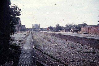
Fishponds railway station was a station in Fishponds, Bristol, England, which was closed by Dr Beeching's cuts in the 1960s.

The Bristol Corporation of the Poor was the board responsible for poor relief in Bristol, England when the Poor Law system was in operation. It was established in 1696 by the Bristol Poor Act. The main promoter of the act was a merchant, John Cary, who proposed "That a spacious workhouse be erected in some vacant place, within the city, on a general charge, large enough for the Poor, who are to be employed therein; and also with room for such, who, being unable to work, are to be relieved by charity."

Blackberry Hill Hospital is an NHS psychiatric hospital in Fishponds, Bristol, England, specialising in forensic mental health services, operated by the Avon and Wiltshire Mental Health Partnership NHS Trust. The hospital also offers drug and alcohol rehabilitation inpatient services, and is the base for a number of community mental health teams.

Barton Regis was an ancient hundred of Gloucestershire, England. Hundreds originated in the late Saxon period as a subdivision of a county and lasted as administrative divisions until the 19th century.

Dulwich Community Hospital was a hospital located in Dulwich, in South London.
The 1893–94 season was the eleventh to be played by the team now known as Bristol Rovers, and their tenth playing under the name Eastville Rovers. The first team continued to play in the first division of the Bristol & District League, while the reserves became founding members of the second division of the same competition.