Edge Development Option

Last updated

Edge Development Option (EDO) comprises a set of C++ computer libraries produced by Boeing that allows to quickly build 2D and 3D visualization software similar to Google Earth, in order to display satellite imagery and create virtual scenarios for displaying sensor, 3D models, 4D (time-dependent) tracks and for line-of-sight and smart volume analysis. EDO is a toolkit based on EDGE Whole Earth, a software program developed by a company named Autometric, now part of Boeing. While EDGE was initially mainly developed for SGI machines, EDO is mainly Windows-based. EDO retained much of EDGE's functionality but allowed greater flexibility for developers, i.e. the ability to integrate EDO functionality into their own application leveraging on EDO's libraries. Google Earth is the more famous heir to the 3D applications EDGE and EDO.[ citation needed ]

C++ general purpose high-level programming language

C++ is a general-purpose programming language that was developed by Bjarne Stroustrup as an extension of the C language, or "C with Classes". It has imperative, object-oriented and generic programming features, while also providing facilities for low-level memory manipulation. It is almost always implemented as a compiled language, and many vendors provide C++ compilers, including the Free Software Foundation, Microsoft, Intel, and IBM, so it is available on many platforms.

Boeing Aerospace and defense manufacturer in the United States

The Boeing Company is an American multinational corporation that designs, manufactures, and sells airplanes, rotorcraft, rockets, satellites, and missiles worldwide. The company also provides leasing and product support services. Boeing is among the largest global aircraft manufacturers; it is the fifth-largest defense contractor in the world based on 2017 revenue, and is the largest exporter in the United States by dollar value. Boeing stock is included in the Dow Jones Industrial Average.

Google Earth 3D globe-based map program created by Google

Google Earth is a computer program that renders a 3D representation of Earth based primarily on satellite imagery. The program maps the Earth by superimposing satellite images, aerial photography, and GIS data onto a 3D globe, allowing users to see cities and landscapes from various angles. Users can explore the globe by entering addresses and coordinates, or by using a keyboard or mouse. The program can also be downloaded on a smartphone or tablet, using a touch screen or stylus to navigate. Users may use the program to add their own data using Keyhole Markup Language and upload them through various sources, such as forums or blogs. Google Earth is able to show various kinds of images overlaid on the surface of the earth and is also a Web Map Service client.

However, unlike Google Earth, EDO and EDGE were not just 3D or 2D visualisation applications, but they allowed for analysis, e.g. line of sight analysis, and therefore were also used for military applications. EDO provides a continuous display of surveillance and reconnaissance sensors’ positions and fields-of-view, including terrain constraints. The open interface can also deliver real-time data surveillance and reconnaissance feeds using data displayed in a 3-D visualization environment. With precision sensor analysis, satellites and air and ground-based platforms, essential intelligence can be collected in real time. For these reasons, a licensed copy of EDO was also installed in the White House.[ citation needed ] In addition, outside the United States, the Australian Defence Force uses a licensed copy of this software (FORCE LEVEL EW IN THE AUSTRALIAN DEFENCE FORCE by Anthony Finn, Greg Chalmers, and Adrian Pincombe).

White House Official residence and workplace of the President of the United States

The White House is the official residence and workplace of the President of the United States. It is located at 1600 Pennsylvania Avenue NW in Washington, D.C. and has been the residence of every U.S. President since John Adams in 1800. The term "White House" is often used as a metonym for the president and his advisers.

In 2005, EDO was renamed BDO (BattleScape Developer option), and a full-fledged application, named BattleScape, was released together with the toolkit. Mark Turner was the first lead engineer for BDO, followed by Brian Griglak and since 2010 by Valentino Zocca.
Related Research Articles

A geographic information system (GIS) is a system designed to capture, store, manipulate, analyze, manage, and present spatial or geographic data. GIS applications are tools that allow users to create interactive queries, analyze spatial information, edit data in maps, and present the results of all these operations. GIS sometimes refers to geographic information science (GIScience), the science underlying geographic concepts, applications, and systems.

Remote sensing Acquisition of information at a significant distance from the subject

Remote sensing is the acquisition of information about an object or phenomenon without making physical contact with the object and thus in contrast to on-site observation, especially the Earth. Remote sensing is used in numerous fields, including geography, land surveying and most Earth Science disciplines ; it also has military, intelligence, commercial, economic, planning, and humanitarian applications.

Graph drawing visualization of node-link graphs

Graph drawing is an area of mathematics and computer science combining methods from geometric graph theory and information visualization to derive two-dimensional depictions of graphs arising from applications such as social network analysis, cartography, linguistics, and bioinformatics.

In-Q-Tel

In-Q-Tel (IQT), formerly Peleus and known as In-Q-It, is an American not-for-profit venture capital firm based in Arlington, Virginia. It invests in high-tech companies for the sole purpose of keeping the Central Intelligence Agency, and other intelligence agencies, equipped with the latest in information technology in support of United States intelligence capability. The name, "In-Q-Tel" is an intentional reference to Q, the fictional inventor who supplies technology to James Bond.

NASA WorldWind open-source virtual globe developed by NASA

WorldWind is an open-source virtual globe. It was first developed by NASA in 2003 for use on personal computers and then further developed in concert with the open source community since 2004. As of 2017, a web based version of WorldWind is available online. An Android version is also available.

Satellite imagery imagery of the Earth or another astronomical object taken from an artificial satellite

Satellite imagery are images of Earth or other planets collected by imaging satellites operated by governments and businesses around the world. Satellite imaging companies sell images by licensing them to governments and businesses such as Apple Maps and Google Maps.

VTK open-source, freely available software system for 3D computer graphics, image processing and visualization

The Visualization Toolkit (VTK) is an open-source, freely available software system for 3D computer graphics, image processing and visualization. VTK consists of a C++ class library and several interpreted interface layers including Tcl/Tk, Java, and Python. Kitware, whose team created and continues to extend the toolkit, offers professional support and consulting services for VTK. VTK supports a wide variety of visualization algorithms including: scalar, vector, tensor, texture, and volumetric methods; and advanced modeling techniques such as: implicit modeling, polygon reduction, mesh smoothing, cutting, contouring, and Delaunay triangulation. VTK has an extensive information visualization framework, has a suite of 3D interaction widgets, supports parallel processing, and integrates with various databases and GUI toolkits such as Qt and Tk. VTK is cross-platform and runs on Linux, Windows, Mac and Unix platforms. At its core VTK is implemented as a C++ toolkit, requiring users to build applications by combining various objects into an application. The system also supports automated wrapping of the C++ core into Python, Java and Tcl, so that VTK applications may also be written using these programming languages.

Prefuse

Prefuse is a Java-based toolkit for building interactive information visualization applications. It supports a rich set of features for data modeling, visualization and interaction. It provides optimized data structures for tables, graphs, and trees, a host of layout and visual encoding techniques, and support for animation, dynamic queries, integrated search, and database connectivity.

Kitware New York technology company specializing in the research and development of open-source software in the fields of computer vision, medical imaging, visualization, 3D data publishing and technical software development

Kitware, Inc. is a technology company headquartered in Clifton Park, New York. The company specializes in the research and development of open-source software in the fields of computer vision, medical imaging, visualization, 3D data publishing and technical software development. In addition to software development, the company offers other products and services such as books, technical support, consulting and customized training courses.

The Commercial Joint Mapping Toolkit, or CJMTK is the DoD standard mapping toolkit for C2I software. It is a replacement for the previous United States Department of Defense (DoD) Joint Mapping Toolkit (JMTK) that utilizes commercial off-the-shelf (COTS) components.

Space and Missile Systems Center Part of the US Air Force Space Command at Los Angeles Air Force Base in California

The Space and Missile Systems Center (SMC) is a part of Air Force Space Command of the United States Air Force, located at Los Angeles Air Force Base in El Segundo, Los Angeles County, California. SMC is the Air Force’s product center for the development and acquisition of space and missile systems.

FCS Network

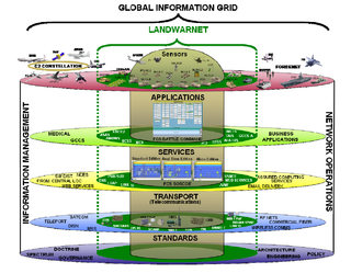
The FCS Network - Brigade Combat Team (BCT) Network consists of five layers that combine to provide seamless delivery of data to forward-deployed Army units.

A remote sensing software is a software application that processes remote sensing data. Remote sensing applications are similar to graphics software, but they enable generating geographic information from satellite and airborne sensor data. Remote sensing applications read specialized file formats that contain sensor image data, georeferencing information, and sensor metadata. Some of the more popular remote sensing file formats include: GeoTIFF, NITF, JPEG 2000, ECW, MrSID, HDF, and NetCDF.

Opticks (software)

Opticks is a remote sensing application that supports imagery, video, synthetic aperture radar (SAR), multi-spectral, hyper-spectral, and other types of remote sensing data. Opticks supports processing remote sensing video in the same manner as it supports imagery, which differentiates it from other remote sensing applications. Opticks was initially developed by Ball Aerospace & Technologies Corp. and other organizations for the United States Intelligence Community. Ball Aerospace open sourced Opticks hoping to increase the demand for remote sensing data and broaden the features available in existing remote sensing software. The Opticks software and its extensions are developed by over twenty different organizations, and over two hundred users are registered users at http://opticks.org. Future planned enhancements include adding the ability to ingest and visualize lidar data, as well as a three-dimensional (3-D) visualization capability.

RemoteView

RemoteView is the family name of a group of software programs designed by Textron Systems Geospatial Solutions to aid in analyzing satellite or aerial images of the Earth's surface for the purpose of collecting and disseminating geospatial intelligence. The National Geospatial-Intelligence Agency (NGA) was a user of RemoteView software.

Orfeo toolbox

Orfeo Toolbox (OTB) is a library for remote sensing image processing. The project was initiated by the French space agency (CNES) in 2006 and is under heavy development. The software is released under a free licence; a number of contributors outside CNES are taking part in development and integrating into other projects. The goal is to provide potential users of satellite images with all the tools necessary to use these images. The library is originally targeted at high resolution images acquired by the Orfeo constellation: Pleiades satellites and Cosmo-Skymed but also handles other sensors.

Autometric Inc. was a company spun out of Paramount Pictures to work with early satellite imagery.

References

    Map all coordinates using: OpenStreetMap  ·  Google Maps
    Download coordinates as: KML  ·  GPX