Related Research Articles
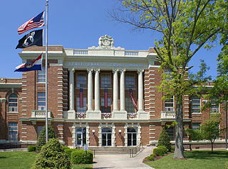
Scott County is a county located in the southeastern portion of the U.S. state of Missouri. As of the 2010 census, the population was 39,191. Its county seat is Benton. The county was organized in 1821 and named for U.S. Representative John Scott, the first federal representative from Missouri. Scott County comprises the Sikeston, MO Micropolitan Statistical Area, which is also included in the Cape Girardeau-Sikeston, MO-IL Combined Statistical Area. The county is home to Scott County Central High School, which has won 18 state championships in boys basketball—the most of any high school in the state.
Dred Scott v. Sandford, 60 U.S. 393 (1857), was a landmark decision of the United States Supreme Court in which the Court held that the United States Constitution was not meant to include American citizenship for people of African descent, regardless of whether they were enslaved or free, and so the rights and privileges that the Constitution confers upon American citizens could not apply to them. The Supreme Court's decision has been widely denounced, both for how overtly racist the decision was and its crucial role in the near collapse of the United States of America four years later. Bernard Schwartz said that it "stands first in any list of the worst Supreme Court decisions—Chief Justice Hughes called it the Court's greatest self-inflicted wound." Junius P. Rodriguez said that it is "universally condemned as the U.S. Supreme Court's worst decision". Historian David Thomas Konig said that it was "unquestionably, our court's worst decision ever."

Georgetown is a home rule-class city in Scott County, Kentucky, United States. The 2020 population was 37,086 per the United States Census Bureau. It is the 6th-largest city by population in the U.S. state of Kentucky. It is the seat of its county. It was originally called Lebanon when founded by Rev. Elijah Craig and was renamed in 1790 in honor of President George Washington. It is the home of Georgetown College, a private liberal arts college. Georgetown is part of the Lexington-Fayette, KY Metropolitan Statistical Area. At one time the city served as the training camp home for the NFL's Cincinnati Bengals.

Gray Summit is an unincorporated community and census-designated place (CDP) in Franklin County, Missouri, United States. The population was 2,701 at the 2010 census. Also called "Gray's Summit", it was founded by Daniel Gray of New York, who built a hotel here in 1845. It is located on Missouri Route 100 just north of Interstate 44.

Scott City is a city in Cape Girardeau and Scott counties in the U.S. state of Missouri. The population was 4,565 at the 2010 census. The Scott County portion of Scott City is part of the Sikeston Micropolitan Statistical Area, while the Cape Girardeau County portion is part of the Cape Girardeau–Jackson, MO-IL Metropolitan Statistical Area.

Southern Illinois, also known as Little Egypt, is the southern third of Illinois, principally along and south of Interstate 64. The area has a unique cultural and regional history. Although part of a Midwestern state, this region is aligned in culture more with that of the Upland South than the Midwest. Part of downstate Illinois, it is bordered by the two most voluminous rivers in the United States: the Mississippi below its connecting Missouri River to the west and the Ohio River to the east and south with the Wabash as tributary.
The territory of the United States and its overseas possessions has evolved over time, from the colonial era to the present day. It includes formally organized territories, proposed and failed states, unrecognized breakaway states, international and interstate purchases, cessions, and land grants, and historical military departments and administrative districts. The last section lists informal regions from American vernacular geography known by popular nicknames and linked by geographical, cultural, or economic similarities, some of which are still in use today.
The Plain Dealer is the major newspaper of Cleveland, Ohio, United States. In fall 2019, it ranked 23rd in U.S. newspaper circulation, a significant drop since March 2013, when its circulation ranked 17th daily and 15th on Sunday.

Helianthus is a genus comprising about 70 species of annual and perennial flowering plants in the daisy family Asteraceae. Except for three South American species, the species of Helianthus are native to North America and Central America. The common names "sunflower" and "common sunflower" typically refer to the popular annual species Helianthus annuus, whose round flower heads in combination with the ligules look like the sun. This and other species, notably Jerusalem artichoke, are cultivated in temperate regions and some tropical regions as food crops for humans, cattle, and poultry, and as ornamental plants. The species H. annuus typically grows during the summer and into early fall, with the peak growth season being mid-summer.
Liberty Township may refer to:

The Battle of Dry Wood Creek, also known as the Battle of the Mules, was fought on September 2, 1861, in Vernon County, Missouri, during the American Civil War. After his victory at the Battle of Wilson's Creek on August 10, Sterling Price and the Missouri State Guard moved further north into Missouri. A force of Union troops under James H. Lane moved from Fort Scott, Kansas to attempt an interception of Price's army, and set an ambush along Dry Wood Creek. Price's Missouri State Guard troops outnumbered Lane's Kansas troops, and after a two hour skirmish forced Lane to retreat to Fort Scott. In their retreat, Lane's troops abandoned their supplies and mules to the Missourians. Price followed up his victory by continuing his northward march, culminating in another victory at the siege of Lexington, September 13 to 20, before returning south shortly afterwards.
The action at Blue Mills Landing, also known as the Battle of Liberty, was a battle of the American Civil War that took place on September 17, 1861, in Clay County, Missouri. Union forces unsuccessfully attempted to prevent pro-Southern Missouri State Guards from northwestern Missouri from crossing the Missouri River near the confluence with the Blue River to reinforce Sterling Price at Lexington.

John Bullock Clark Sr. was a politician who served as a member of the United States Congress and Confederate Congress.

The Bedford Shale is a shale geologic formation in the states of Ohio, Michigan, Pennsylvania, Kentucky, West Virginia, and Virginia in the United States.
National Weather Service Paducah is a weather forecast office responsible for monitoring weather conditions for 58 counties in the states of Kentucky, Illinois, Indiana and Missouri. The Paducah office is relatively new compared to others, having been built in 1984. The office is in charge of weather forecasts, warnings and local statements as well as aviation weather. It is also equipped with a WSR-88D (NEXRAD) radar, and an Automated Surface Observing System (ASOS) that greatly increase the ability to forecast.
Scott is an unincorporated community in Cole County, in the U.S. state of Missouri. The community is located on Grays Creek just northwest of Jefferson City.
Grays Point is an extinct town in Scott County, in the U.S. state of Missouri.
References
- ↑ Edison Shrum (1984). The History of Scott County, Missouri. Sikeston, Missouri: Scott County Historical Society. p. 278.
- ↑ "Cemetery oddities". 2014-09-25. Retrieved 2020-11-15.
| | This article about a Missouri politician is a stub. You can help Wikipedia by expanding it. |