Related Research Articles

Wheathampstead is a village and civil parish in Hertfordshire, England, north of St Albans. The population of the ward at the 2001 census was 6,058. Included within the parish is the small hamlet of Amwell.

Everton is a small rural village of about 200 dwellings and civil parish in the Central Bedfordshire district of Bedfordshire, England about 9 miles (14 km) east of the county town of Bedford.

Silchester is a village and civil parish about 5 miles (8 km) north of Basingstoke in Hampshire. It is adjacent to the county boundary with Berkshire and about 9 miles (14 km) south-west of Reading.

St George's Church is in Everton, Liverpool, Merseyside, England. It is recorded in the National Heritage List for England as a designated Grade I listed building, and is the earliest of three churches in Liverpool built by John Cragg, who used many components in cast iron which were made at his Mersey Iron Foundry. It is an active Anglican parish church in the Diocese of Liverpool, the Liverpool archdeaconry, and the Liverpool North deanery.

Bainton is a village and civil parish in the Peterborough Unitary Authority area of Cambridgeshire, England. Bainton is on the southern edge of the Welland valley and lies 7.4 miles (11.9 km) north-west of Peterborough and 4 miles (6.4 km) east of Stamford. Ashton is a neighbouring hamlet and lies approximately 1 mile (1.6 km) south-east of Bainton within the same civil parish. At the time of the 2001 census, the parish's population was 305 people and by the 2011 census the parish's population was 290 people.

Stebbing is a small village in the Uttlesford district of northern Essex, England. The village is situated north of the ancient Roman road Stane Street. It is 6.4 miles (10.3 km) from the nearest railway station (Braintree), and 7.6 mi (12.2 km) from nearest airport. The village has a pub and a bowling green and has a population of about 1,500.

Cheswardine is a rural village and civil parish in north east Shropshire, England. The village lies close to the border with Staffordshire and is about 8 miles north of Newport and 5 miles south east of Market Drayton. At the 2001 Census, the parish, had a population of 991 people, increasing to 1,076 at the 2011 Census.

Iping is a village and parish in the Chichester district of West Sussex, England. It lies within the civil parish of Stedham with Iping, just off the A272 road 2 miles (3.2 km) west of Midhurst. The village lies on the River Rother.

Oliver's Battery is a civil parish in Hampshire, England, of some 700 households located just to the south of the City of Winchester. The parish was formed in 1956 from part of Compton parish. The parish does not include the whole of the settlement known informally as Oliver's Battery, with the northern boundary following the A3090 and therefore excluding Oliver's Battery Road North.
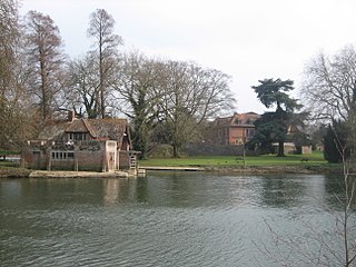
Mongewell is a village in the civil parish of Crowmarsh, about 1 mile (1.6 km) south of Wallingford in Oxfordshire. Mongewell is on the east bank of the Thames, linked with the west bank at Winterbrook by Winterbrook Bridge. The earthwork Grim's Ditch, now part of The Ridgeway long-distance footpath, passes through the northern part of it and is a scheduled ancient monument.

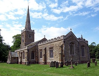
Honington is an English village and civil parish in the South Kesteven district of Lincolnshire. It lies just north of the junction between the A153 and A607 roads, about 5.5 miles (8.9 km) north of Grantham and 8 miles (12.9 km) west of Sleaford.

Everton is a village in the civil parish of Hordle, 2+1⁄2 miles (4.0 km) west of Lymington, in the English county of Hampshire.

Legsby is a small village and civil parish in the West Lindsey district of Lincolnshire, England. The population of the civil parish at the 2011 census was 193. It is situated approximately 13 miles (20 km) north-east from the city and county town of Lincoln and 3 miles (5 km) south-east from the town of Market Rasen.
Hainton is a village and civil parish in the East Lindsey district of Lincolnshire, England. It is situated on the A157 road, 10 miles (16 km) west from Louth and 5 miles (8 km) south-east from Market Rasen.

Kingsland is a small village and civil parish in the English county of Herefordshire, 5 kilometres (3 mi) north-west of Leominster. The population of the civil parish at the 2011 census was 986.

Gautby is a village in the East Lindsey district of Lincolnshire, England. The village is situated 6 miles (10 km) north-west from the town of Horncastle, and is part of the Minting civil parish.

Waithe is a hamlet and civil parish in the East Lindsey district of Lincolnshire, England. It is on the A16, 1 mile (1.6 km) south from Holton-le-Clay and 1 mile (1.6 km) north from North Thoresby.
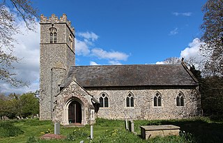
Ilketshall St John is a village and civil parish in the East Suffolk district of the English county of Suffolk. It is 2 miles (3.2 km) south-east of the market town of Bungay and is part of a group of parishes with similar names known collectively as the Saints.
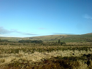
Morvil or Morfil is a remote upland parish on the southern slopes of the Preseli Mountains in north Pembrokeshire, Wales. Fishguard is 6 miles (10 km) to the northwest. The area was occupied in neolithic and Norman times, and in the past two centuries has been sparsely populated with no significant settlements developing. The parish church is dedicated to St John the Baptist.
Brill Palace was a medieval English royal residence located in the village of Brill in the Aylesbury Vale. It was within the jurisdiction of the former Ashendon Hundred.
References
- 1 2 Who was who 1929-1940, 1941
- ↑ The church has since been demolished after the parish merged with St George's Church, Everton in 1971. Lancashire Online Parish Clerk Project
- ↑ "Archival material relating to Edward Downman". UK National Archives.