
Eglin Air Force Base (AFB) is a United States Air Force base in western Florida, located about three miles (5 km) southwest of Valparaiso in Okaloosa County.

Hurlburt Field is a United States Air Force installation located in Okaloosa County, Florida, immediately west of the Town of Mary Esther. It is part of the greater Eglin Air Force Base reservation, and is home to Headquarters Air Force Special Operations Command (AFSOC), the 1st Special Operations Wing (1 SOW), the USAF Special Operations School (USAFSOS) and the Air Combat Command's (ACC) 505th Command and Control Wing. It was named for First Lieutenant Donald Wilson Hurlburt, who died in a crash at Eglin. The installation is nearly 6,700 acres (27 km2), and employs nearly 8,000 military personnel.
Ashley Chadbourne McKinley was an accomplished American aerial photographer and colonel in the U.S. Army Air Corps who helped pioneer aviation at subzero temperatures. He accompanied Richard E. Byrd as an aerial photographer on his expedition to the South Pole.

Florida's 1st congressional district is a congressional district in the U.S. state of Florida, covering the state's western Panhandle. It includes all of Escambia, Okaloosa, Santa Rosa, and Walton counties and portions of Holmes county. The district is anchored in Pensacola and also includes the large military bedroom communities and tourist destinations of Navarre and Fort Walton Beach and stretches along the Emerald Coast. The district, as ranked by the Cook Partisan Voting Index, is the most Republican district in Florida and the 15th most in the United States.

Mitchel Air Force Base also known as Mitchel Field, was a United States Air Force base located on the Hempstead Plains of Long Island, New York, United States. Established in 1918 as Hazelhurst Aviation Field #2, the facility was renamed later that year as Mitchel Field in honor of former New York City Mayor John Purroy Mitchel who was killed while training for the Air Service in Louisiana.

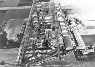
Duke Field, also known as Eglin AFB Auxiliary Field #3, is a military airport located three miles (5 km) south of the central business district of Crestview, in Okaloosa County, Florida, United States.

The Camp Pinchot Historic District is a U.S. historic district, located approximately 0.5 miles (0.80 km) north of Fort Walton Beach, Florida. The district is on Eglin Air Force Base, roughly along the west bank of Garnier's Bayou. It contains 10 historic buildings.
Scott Field Historic District began as a World War I era air base built in 1917 near O'Fallon, Illinois, and was expanded and rebuilt before World War II. The district contains primarily that portion of the base built prior to 1941, and is now contained within the renamed, expanded, and operational Scott Air Force Base. The district boundaries include 107 contributing buildings and structures, and exclude post-1945 buildings built in the areas surrounding the 1917 Main Base area.

The McKinley Climatic Laboratory is both an active laboratory and a historic site located in Building 440 on Eglin Air Force Base, Florida. The laboratory is part of the 96th Test Wing. In addition to Air Force testing, it can be used by other US government agencies and private industry.
The Operation Crossbow Site is a historic location at Eglin Air Force Base, Florida. During World War II, a reconstruction of a German V-1 flying bomb launch site was built to test the measures needed to destroy the actual bases in France.

Choctawhatchee National Forest is a United States National Forest established by President Theodore Roosevelt on November 27, 1908. The supervisory headquarters was established at DeFuniak Springs and moved to Pensacola in September 1910. It remained there until 1936 when it was relocated to Tallahassee. The Choctawhatchee's two districts were separated by what is now State Road 85.

The Edward H. White II Museum of Aerospace Medicine was a museum of the United States Air Force and was located in Hangar 9 at Brooks Air Force Base, San Antonio, Texas. Brooks Air Force Base closed in 2011 under Base Realignment and Closure Commission (BRAC) procedures, and the museum closed at the same time.

Randolph Field Historic District is a National Historic Landmark District encompassing the central portion of Randolph Air Force Base, near San Antonio, Texas, USA. Randolph Field was innovatively designed using Garden city movement principles, and includes a unique and well-preserved assemblage of Mission Revival and Art Deco architecture. Built between 1929 and 1931, it was the first permanent flight training facility of the United States military establishment, then the United States Army Air Corps and later the United States Air Force. It was listed on the National Register of Historic Places in 1996, and was declared a National Historic Landmark in 2001.

McChord Field Historic District is a historic district located within the McChord Air Force Base in Pierce County, Washington. The base is located at the base of Puget Sound. The 31 contributing buildings and 3 contributing structures included in the district all date to the establishment of McChord Field and its role in World War II. Additionally, the district is significant for its architecture representative of the period from 1938 through 1952. It was listed on the National Register of Historic Places on December 12, 2008.

The Air Armament Center (AAC) was an Air Force Materiel Command (AFMC) center at Eglin Air Force Base, Florida, responsible for development, acquisition, testing, and deployment of all air-delivered weapons for the U.S. Air Force. Weapon systems maintained by the center included the Advanced Medium Range Air-to-Air Missile, High-speed anti-radiation missile, HARM Targeting System, Joint Air-to-Surface Standoff Missile, Joint Direct Attack Munition, Miniature Air-Launched Decoy, Sensor Fuzed Weapon, and the Small Diameter Bomb. The Air Armament Center was inactivated as an AFMC center on July 18, 2012, and its functions merged into the former 96th Air Base Wing at Eglin AFB. The new organization was renamed as the 96th Test Wing the same day as a subordinate command of the Air Force Test Center at Edwards Air Force Base, California.

Choctaw Naval Outlying Field is the United States Navy's designation for an auxiliary airfield that was originally constructed during World War II as Eglin Field Auxiliary Field # 10. It is located 16.6 miles northeast of Pensacola, Florida.
Federal Prison Camp, Eglin was a Federal Bureau of Prisons minimum security prison at Auxiliary Field 6, Eglin Air Force Base in Florida.

Wagner Field,, is a component of Eglin Air Force Base, Florida. It is located northeast of the main base, 13.9 miles northeast of Valparaiso, Florida.
The Santa Rosa Island Range Complex, is a component of the Eglin AFB testing range, located 17.5 miles west-southwest of the main base, on Santa Rosa Island, sitting between the communities of Navarre and Okaloosa Island.

Blytheville Air Force Base was a United States Air Force base from 1942, until it closed in 1992. In 1988, the facility was renamed Eaker Air Force Base in honor of World War II General of the Eighth Air Force, Ira C. Eaker. It was located 3 miles (4.8 km) northwest of Blytheville, Arkansas. The facility now operates as the Arkansas Aeroplex and Arkansas International Airport.


