
Walton County is a county located on the Emerald Coast in the northwestern part of the U.S. state of Florida, with its southern border on the Gulf of Mexico. As of the 2020 census, the population was 75,305. Its county seat is DeFuniak Springs. The county is home to the highest natural point in Florida: Britton Hill, at 345 feet (105 m). Walton County is included in the Crestview–Fort Walton Beach–Destin Metropolitan Statistical Area.

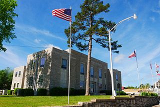
Stephenson County is a county located in the U.S. state of Illinois. According to the 2020 United States Census, it had a population of 44,630. Its county seat is Freeport. Stephenson County is included in the Freeport, IL Micropolitan Statistical Area, which is also included in the Rockford-Freeport-Rochelle, IL Combined Statistical Area.
Izard County is a county located in the U.S. state of Arkansas. As of the 2020 census, the population was 13,577. The county seat is Melbourne. Izard County is Arkansas's 13th county, formed on October 27, 1825, and named for War of 1812 General and Arkansas Territorial Governor George Izard. It is an alcohol prohibition or dry county.

Freeport is an unincorporated community in Harper County, Kansas, United States. As of the 2010 census, the population of the community was 5. It was an incorporated city up until 2017 when it dissolved.

Freeport is a borough in Armstrong County, Pennsylvania, United States. It is situated along the Allegheny River in the southwestern corner of the county. The population was 1,736 at the 2020 census.

Buffalo Township is a township in Butler County, Pennsylvania, United States. The population was 7,896 at the 2020 census.

Freeport is a city in Brazoria County, Texas, United States, located on the Gulf of Mexico. According to the 2020 census, the city population was 10,696, down from 12,049 in 2010.

For the river in Fort Bend and Brazoria Counties, Texas see: Oyster Creek (Texas).

Quintana is a town in Brazoria County, Texas, United States. Its population was 26 as of the 2020 census, down from 56 at the 2010 census.

South Boston, formerly Boyd's Ferry, is a town in Halifax County, Virginia, United States. The population was 8,142 at the 2010 census, down from 8,491 at the 2000 census. It is the most populous town in Halifax County.

Brussels is a town in Door County, Wisconsin, United States. The population was 1,136 at the 2010 census. The unincorporated communities of Brussels, Misere, and Kolberg are located in the town. The unincorporated community of Rosiere is also located partially in the town.

The A44 is a major road in the United Kingdom that runs from Oxford in southern England to Aberystwyth in west Wales.

Grand Bahama is the northernmost of the islands of The Bahamas, with the town of West End located 56 nautical miles east of Palm Beach, Florida. It is the third largest island in The Bahamas island chain of approximately 700 islands and 2,400 cays. The island is roughly 530 square miles (1,400 km2) in area and approximately 153 kilometres (95 mi) long west to east and 24 kilometres (15 mi) at its widest point north to south. Administratively, the island consists of the Freeport Bonded Area and the districts of East Grand Bahama and West Grand Bahama. Nearly half of the homes on the island were damaged or destroyed in early September 2019 by Hurricane Dorian.

East Grand Bahama is a district of The Bahamas, situated on the eastern part of the island of Grand Bahama, with a population collectively of 11,411 people.

West Grand Bahama is one of 31 districts of The Bahamas. The district covers the entire western portion of Grand Bahama island, excluding the city of Freeport, which forms its own district. Communities within West Grand Bahama include the settlements of Mack Town, Hunters, Lewis Yard, Pinder's Point, Eight Mile Rock, Hepburn Town, Bartlett Hill, Hanna Hill, Pine Dale, Martin Town, Russell Town, Jones Town, Sea Grape, Holmes Rock, Bootle Bay and the westernmost settlement of West End.

Silver Creek Township is a township in Stephenson County, Illinois. As of the 2010 census, its population was 696 and it contained 332 housing units.
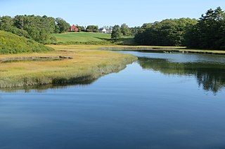
Little River is a 4.1-mile-long (6.6 km) tributary of Casco Bay in Maine, United States.

Yarmouth is a town in Cumberland County, Maine, United States, twelve miles north of the state's largest city, Portland. When originally settled in 1636, as North Yarmouth, it was part of the Massachusetts Bay Colony, and remained part of its subsequent incarnations for 213 years. In 1849, twenty-nine years after Maine's admittance to the Union as the twenty-third state, it was incorporated as the Town of Yarmouth.

Twin Buttes is a populated place on the east flank of the Sierrita Mountains approximately twenty miles south of Tucson, in Pima County, Arizona, United States. Named after a prominent hill located next to the town, Twin Buttes was founded as a small mining town circa 1903 and abandoned around 1930. Much of the actual town site is now buried underneath mine tailings, and all that remains is the Twin Buttes Cemetery.
