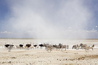
Etosha National Park is a national park in northwestern Namibia and one of the largest national parks in Africa. It was proclaimed a game reserve in March 1907 in Ordinance 88 by the Governor of German South West Africa, Friedrich von Lindequist. It was designated as Wildschutzgebiet in 1958, and was awarded the status of national park in 1967, by an act of parliament of the Republic of South Africa. It spans an area of 22,270 km2 (8,600 sq mi) and was named after the large Etosha pan which is almost entirely within the park. With an area of 4,760 km2 (1,840 sq mi), the Etosha pan covers 23% of the total area of the national park. The area is home to hundreds of species of mammals, birds and reptiles, including several threatened and endangered species such as the black rhinoceros. Sixty-one black rhinoceros were killed during poaching in Namibia during 2022, 46 of which were killed in Etosha.

Omusati is one of the fourteen regions of Namibia, its capital is Outapi. The towns of Okahao, Oshikuku and Ruacana as well as the self-governed village Tsandi are situated in this region. As of 2020, Omusati had 148,834 registered voters.

Ohangwena is one of the fourteen regions of Namibia, its capital is Eenhana. Major settlements in the region are the towns Eenhana and Helao Nafidi as well as the self-governed village of Okongo and the proclaimed settlements Ongenga and Omungwelume. As of 2020, Ohangwena had 150,724 registered voters.
Sekele is the northern language of the ǃKung dialect continuum. It was widespread in southern Angola before the Angolan Civil War, but those varieties are now spoken principally among a diaspora in northern Namibia. There are also a number of dialects spoken in far northern Namibia.
ǃKungKUUNG (ǃXun), also known as Ju, is a dialect continuum spoken in Namibia, Botswana, and Angola by the ǃKung people, constituting two or three languages. Together with the ǂʼAmkoe language, ǃKung forms the Kxʼa language family. ǃKung constituted one of the branches of the putative Khoisan language family, and was called Northern Khoisan in that scenario, but the unity of Khoisan has never been demonstrated and is now regarded as spurious. Nonetheless, the anthropological term "Khoisan" has been retained as an umbrella term for click languages in general.

Endola is an electoral constituency in the Ohangwena Region of Namibia, on the border of Angola. It had 36,659 inhabitants in 2004 and 14,100 registered voters in 2020. The district centre is the settlement of Endola. Ferdinand Ingashipola Shifidi became a councillor of the constituency in November 2014 and was re-elected in 2015 and in 2020.
Okongo is a constituency in the Ohangwena Region of Namibia, on the border to Angola. It had about 18,000 inhabitants in 2011 and 12,562 registered voters in 2020.

Onayena Constituency is an electoral constituency in the Oshikoto Region of Namibia. The district capital is the settlement of Onayena.
Okongo is a village in the Ohangwena Region of northern Namibia. It is situated about 120 kilometres (75 mi) east of Eenhana on the tarred road to Nkurenkuru. It is the district capital of Okongo Constituency.
Okambonde is a village in the northern part of Namibia. It is situated just east of Oniipa and is one of the villages used as entrance into some Uukwanyama villages such as Oshaango, Onamukulo, Okongo, and Eenhana.

Koës is a village in the ǁKaras Region of south-eastern Namibia. It is situated on the edge of the Kalahari desert and belongs to the Keetmanshoop Rural electoral constituency. The average annual rainfall is about 150-200 mm.
Nyangana is a village in the Ndiyona Constituency in Kavango East Region of north-eastern Namibia, situated 100 kilometres (62 mi) east of Rundu. The Roman Catholic mission of Nyangana is located in the village.
Ekoka ǃKung or Western ǃXuun is a variety of the ǃKung dialect cluster, spoken originally in the area of the central Namibian–Angolan border, west of the Okavango River, but since the Angolan Civil War also in South Africa.
Ondobe Yomunghudi is a village situated in northern Namibia in the Ohangwena Region. The village is named after tree species called Omunghudi that was in pan nearby during its discovery, an elderly revealed. Situated on the very edge of the Owambo region. The first thing that unique about this village is the abundance of people, unlike the rest of the country. People, livestock, shebeens (bars) and markets are everywhere, seemingly all existing harmoniously in unplanned order.
Mpungu is a settlement and a former mission station of the Finnish Missionary Society in the Mpungu Constituency in the Kavango West Region in Northern Namibia. It is located ca. 40 km south-west of Nkurenkuru and is inland as opposed to other former Finnish mission stations, which were located along the Kavango River. Today, a tarred highway from Ovamboland to Kavango connects Mpungu to other places in northern Namibia.

Oshikunde Constituency is an electoral constituency in the Ohangwena Region of Namibia. As of 2020, it has 8,062 registered voters.

Tondoro Constituency is an electoral constituency in the Kavango West Region of Namibia. Tondoro Constituency was named after the village and mission station Tondoro, although the administrative centre is in the village of Mburuuru.
Onkumbula is a settlement in the Oshikoto Region of northern Namibia. It is situated on the district road D3603 c. halfway between Ondangwa and Okongo and belongs to the Okankolo electoral constituency. The village has a community hall; a police station is being built. Unemployment is high in this settlement, particularly among the youth.