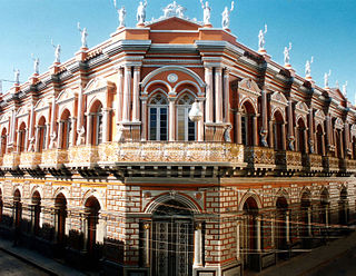
Tarija or San Bernardo de la Frontera de Tarixa is a city in southern Bolivia. Founded in 1574, Tarija is the largest city and capital and municipality within the Tarija Department, with an airport offering regular service to primary Bolivian cities, as well as a regional bus terminal with domestic and international connections. Its climate is semi-arid (BSh) with generally mild temperatures in contrast to the harsh cold of the Altiplano and the year-round humid heat of the Amazon Basin. Tarija has a population of 234,442.

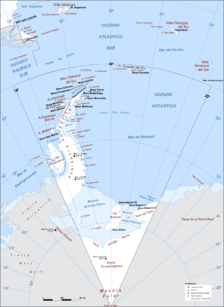
Argentine Antarctica is an area on Antarctica claimed by Argentina as part of its national territory. It consists of the Antarctic Peninsula and a triangular section extending to the South Pole, delimited by the 25° West and 74° West meridians and the 60° South parallel. This region overlaps with British and Chilean claims in Antarctica. None of these claims have widespread international recognition.

The Prince Gustav Channel is a strait about 80 nautical miles long and from 4 to 15 nautical miles wide, separating James Ross Island and Vega Island from the Trinity Peninsula, Antarctica.

Pedraza de Campos is a municipality located in the province of Palencia, Castile and León, Spain. According to the 2004 census (INE), the municipality had a population of 115 inhabitants.

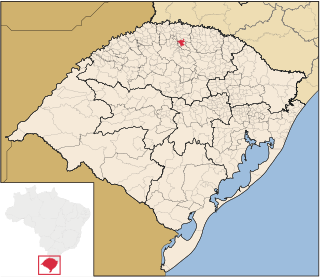
Constantina, Rio Grande do Sul is a municipality in the state of Rio Grande do Sul, Brazil. Founded April 14, 1959. The municipality's motto is "Celeiro da Hospitalidade", meaning "Barn Hospitality".
Little Rapids is a local service district and designated place in the Canadian province of Newfoundland and Labrador. It is east of Corner Brook.

Tianguá is a municipality in the state of Ceará in the Northeast region of Brazil.
Zongozotla Municipality is a municipality in the Mexican state of Puebla in south-eastern Mexico.

Aguas Blancas (Salta) is a village and rural municipality in Salta Province in northwestern Argentina. It is a city in the Oran department, located northeast of the province of Salta, Argentina. Aguas Blancas is located on the right bank of the Bermejo River, which forms a natural boundary between Argentina and Bolivia. The city Bermejo, Bolivia is on the opposite bank of the river.
El Barrial is a village and rural municipality in Salta Province in northwestern Argentina.
San Agustín is a village and rural municipality in Salta Province which is located in northwestern Argentina.
Santa Rosa (Salta) is a village and rural municipality in Salta Province in northwestern Argentina.

El Galpón (Salta) is a town and municipality in Salta Province in northwestern Argentina.

The Du Toit Nunataks are a group of nunataks between Cornwall Glacier and Glen Glacier, marking the western end of the Read Mountains in the Shackleton Range of Antarctica.

Fredriksen Island is an island 5 km (3.1 mi) long and 1 km (0.62 mi) wide, lying 1 km south-east of Powell Island in the South Orkney Islands of Antarctica. It was discovered by Captains Nathaniel Palmer and George Powell in the course of their joint cruise in December 1821. It was named by Norwegian whaling captain Petter Sorlle, who made a running survey of the island in the 1912–13 summer.
Hazard Rock is a small isolated rock, 1 metre (3 ft) high, lying on the east side of Butler Passage, 2.5 nautical miles (5 km) northeast of Cape Renard, off the west coast of Graham Land, on the Antarctic Peninsula. It was named by Lieutenant Commander F.W. Hunt, Royal Navy, following his survey in 1952. This feature is a hazard to navigation in the low visibility which is frequent in this vicinity.
Huitfeldt Point is a point southeast of Vorweg Point on the southwest side of Barilari Bay, on the west coast of Graham Land, Antarctica. It was charted by the British Graham Land Expedition under John Rymill, 1934–37, and was named by the UK Antarctic Place-Names Committee in 1959 for Fritz R. Huitfeldt, a Norwegian pioneer ski exponent, the author of one of the earliest skiing manuals, and the designer of the Huitfeldt ski binding, for long the standard binding.
Hooper Glacier is a glacier 3 nautical miles (6 km) long, flowing from the col north of Mount William into the west side of Börgen Bay, Anvers Island, in the Palmer Archipelago, Antarctica. It was surveyed by the Falkland Islands Dependencies Survey (FIDS) in 1955, and named by the UK Antarctic Place-Names Committee for Peter R. Hooper of FIDS, leader and geologist at the Arthur Harbour station in 1955 and 1956. Gateway Ridge separates Hooper Glacier from William Glacier.
Vapour Col is a col lying south of Stonethrow Ridge on the west side of Deception Island in the South Shetland Islands of Antarctica. The name given by the United Kingdom Antarctic Place-Names Committee (UK-APC) in 1959 originates from the fumaroles in the col. This is the only locality on Deception Island where there is a complete cross section through the stratigraphy of volcanic succession. Having a similar name in the same island is the Fumarole Bay.


