
Zula is a small town in central Eritrea. It is situated near the head of Annesley Bay, on the Red Sea coast. Four kilometers away is the archeological site of Adulis, which was an emporium and the port of Axum.

Diébougou is a town in Burkina Faso, situated 136 kilometres (85 mi) south-east of Bobo-Dioulasso on the main highway to Ghana. It is located 74 kilometres north of Gaoua and 133 km west of Leo, Burkina Faso and is the capital of Bougouriba Province.

Al Ghubra is a suburb of Muscat, the capital city of the Sultanate of Oman. It is a developing town with a number of malls, hospitals, schools, hotels and many local businesses. There is a sizeable number of expatriates among the locals. The beach is a long expanse of sand dunes. There are many schools here which are owned by different communities. The town is well planned and known for its lake park designed especially with a walk-path and children's playground.Al-Ghubra is Oman's most popular shopping destination with Muscat Grand Mall (MGM) Oman Avenue Mall & Panorama Mall being some of them .Also in this area lot of hotels and restaurants coffee shops are available.Many cuisines like Indian,Chinese,Italian,Arabic,Continental & Latin are available here.

Serekunda is the largest urban centre in The Gambia.

In Ghana and neighboring countries tro tros are privately owned minibus share taxis that travel fixed routes leaving when filled to capacity. While there are tro tro stations, these vehicles for hire can also be boarded anywhere along the route.
Saham is a coastal town in the Al Batinah Region, in northeastern Oman. It is located at about 24°10′20″N56°53′19″E and has a population of 85,010. Saham is a fishing and a farming town between Al Khaboura and Sohar.

The Aroa River is a river in northwestern Venezuela. It runs parallel and west of the Yaracuy River. The Aroa River empties into the Caribbean Sea.

Bradt Travel Guides is a publisher of travel guides founded in 1974 by Hilary Bradt and her husband George, who co-wrote the first Bradt Guide on a river barge on a tributary of the Amazon,.

ʿAmrān is a small city in western central Yemen. It is the capital of the 'Amran Governorate, and was formerly in the Sana'a Governorate. It is located 52.9 kilometres (32.9 mi) by road northwest of the Yemeni capital of Sana'a. According to the 2004 census it had a population of 76,863, and an estimated population of 90,792 in 2012.
The National Library of Yemen is the national library of Yemen, located in central Sana'a. It is located near the Al-Tahrir Square and the Yemen Military Museum.It has an extensive collection of books in French and in English about Yemen.

The Katara is a spicy sauce typically made in the Venezuelan Amazon.It is made by the natives with chilli pepper and giant bottom. Very aphrodisiac and with a granulated texture, its spicy taste comes from the poison used by the ant to defend itself.
Los Aleros is a theme park located near Mérida, Venezuela. It depicts a typical Andean town in the 1930s. It was created by Alexis Montilla in 1984; he subsequently created the nearby "Venezuela de Antier" and "Montaña de los Sueños" themeparks.

Catedral de Nuestra Señora de La Asunción is the seat of the Roman Catholic Diocese of Margarita and is located in La Asunción, Nueva Esparta state, on Margarita Island, Venezuela. Completed in 1571, it is the oldest church in Venezuela.

The Palacio Municipal de Caracas, or Consejo Municipal de Caracas, is the city hall of Caracas, Venezuela. It is located on the corner of Gradillas a Monjas opposite the Plaza Bolívar, occupying half of the plaza's southern section. The building dates from the seventeenth century but now bears the mark of Alejandro Chataing's Neoclassical additions in 1906. It was the focal point for the Constitutional Convention, and signing of the Declaration of Independence in the nineteenth century. The present building is the result of the work undertaken by the Venezuelan architect Alejandro Chataing in 1906. The west wing of the building, the Capilla de Santa Rosa de Lima, the chapel where Venezuela's independence was declared in 1811, has been fully restored and furnished with authentic period pieces. The ground floor houses the Museo Caracas, which contains works by Venezuela's most celebrated painters and many other historic artifacts. It was declared a National Historic Landmark on 16 February 1979.
Santa Ana is a town on Isla Margarita, in the state of Nueva Esparta, Venezuela. It is the capital of the Gómez municipality. The town is located in the south of the municipality, in the northeast of Margarita.

The Queen's Head is a pub at 13 Brook Green, Hammersmith, London W6.

Bienmesabe is a sweet Venezuelan cuisine dessert prepared with honey, egg yolk and ground almonds as primary ingredients. Its consistency significantly varies depending upon preparation methods used. The dessert is also popular in the cuisine of the Canary Islands. It has been described as influenced by Moorish cuisine. Several variations of the dessert exist.

The St. Peter and St. Paul Cathedral or just Maracaibo Cathedral is the main church of Maracaibo in the Zulia state of Venezuela. It was built in the seventeenth century. Pope Leo XIII designated it as a cathedral on 25 July 1897 and together with the Archbishop's Palace, is the seat of the Roman Catholic Archdiocese of Maracaibo.

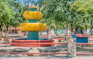
Aroa is the capital of the municipality of Bolívar in the state of Yaracuy, Venezuela. It grew up to serve the Aroa copper mines, now defunct.

The Yurubí National Park Is a protected area with the status of national park in the north of the South American country of Venezuela. It was founded on March 18, 1960 in Yaracuy State created to protect the Yurubí river basin, which is the source of fresh water for the city of San Felipe. The Yurubí National Park is located in the mountains of the Sierra de Aroa. The park includes cloud forests and low montane forests and is surrounded by cultivated areas. The park is crossed by small trails, which are used mainly by poachers or by a small number of visitors and researchers. The park is not inhabited; The former settlers of the area were relocated many years ago.


