
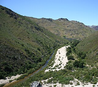
The Orange River is the longest river in South Africa and the Orange River Basin extends extensively into Namibia and Botswana to the north. It rises in the Drakensberg mountains in Lesotho, flowing westwards through South Africa to the Atlantic Ocean. The river forms part of the international borders between South Africa and Namibia and between South Africa and Lesotho, as well as several provincial borders within South Africa. Except for Upington, it does not pass through any major cities. The Orange River plays an important role in the South African economy by providing water for irrigation and hydroelectric power. The river was named the Orange River in honour of the Dutch ruling family, the House of Orange, by the Dutch explorer Robert Jacob Gordon. Other names include Gariep River, Groote River or Senqu River.

The Vaal River is the largest tributary of the Orange River in South Africa. The river has its source near Breyten in Mpumalanga province, east of Johannesburg and about 30 kilometres (19 mi) north of Ermelo and only about 240 kilometres (150 mi) from the Indian Ocean. It then flows westwards to its conjunction with the Orange River southwest of Kimberley in the Northern Cape. It is 1,120 kilometres (700 mi) long, and forms the border between Mpumalanga, Gauteng and North West Province on its north bank, and the Free State on its south.

The Umgeni River or Mgeni River, is a river in KwaZulu-Natal, South Africa. It rises in the "Dargle" in the KZN midlands, and its mouth is at Durban, some distance north of Durban's natural harbour. The name is taken to mean the river of entrance in Zulu, though other meanings have been proposed.
The Olifants River is a river in the northwestern area of the Western Cape Province of South Africa. The upper and main catchment area of the Olifants river is around Ceres and the Cederberg mountains. The Clanwilliam and Bulshoek dams are located on the river and provide water for the towns and farms along the watercourse. The river is approximately 285 km long with a catchment area of 46,220 km2 and flows into the Atlantic Ocean at Papendorp, 250 km north of Cape Town.

Gariep Dam located in South Africa, near the town of Norvalspont, bordering the Free State and Eastern Cape provinces. Its primary purpose is for irrigation, domestic and industrial use as well as for power generation.
The Sundays River or Nukakamma is a river in the Eastern Cape Province of South Africa. It is said to be the fastest flowing river in the country. The Khoisan people originally named this river Nukakamma because the river's banks are always green and grassy despite the arid terrain that it runs through.

The Steenbras Dam, now referred to as Steenbras Lower Dam, is a gravity concrete arch type dam located in the Hottentots-Holland mountains, above Gordons Bay, near Cape Town in South Africa. In 1916 a Board of Engineers was appointed to report on a water augmentation scheme for the city. Their proposal was the Steenbras scheme which would consist of a concrete gravity and arch dam on the Steenbras River. This dam would be connected to the Molteno reservoir through a tunnel in the Hottentots Holland mountains and a 64 kilometre long cast iron pipeline. Work began on the scheme in 1918 and was completed three years later. The Steenbras scheme could supply Cape Town with up to 42 million litres of water per day although the average consumption was in the region of 29 million litres per day. The consumption however grew rapidly and it was not long before Cape Town once again had a water supply problem. To solve the demand for additional water supplies the Steenbras dam wall was raised and an additional pipeline was laid into the city. This work was completed in 1928. For much of the first half of the twentieth century it was the main reservoir for Cape Town but is now only one of many dams that supply the city. The hazard potential of Steenbras has been ranked high (3).

The Western Cape Water Supply System (WCWSS) is a complex water supply system in the Western Cape region of South Africa, comprising an inter-linked system of six main dams, pipelines, tunnels and distribution networks, and a number of minor dams, some owned and operated by the Department of Water and Sanitation and some by the City of Cape Town.

The Berg River Dam is a 68-metre (223 ft) high dam on the Berg River in South Africa. It is the centerpiece of the Berg Water Project (BWP) which is designed to capture the winter rainfall and store it for supply to Cape Town during the dry summer months. The project in turn forms an important part of the Western Cape Water Supply System (WCWSS), an intricate system of dams and bulk water infrastructure that provides water to more than 3 million people. At the inauguration of the dam in 2009, then President of South Africa Kgalema Motlanthe called the project "a good example of how public infrastructure projects can be used to contribute meaningfully to poverty eradication and to foster social empowerment of the people." The Berg River Dam was the first dam in South Africa to be designed and constructed, and is due to be operated, in accordance with the guidelines of the World Commission on Dams. It has been completed on time and within budget. The Berg River basin and the adjacent metropolitan area of Cape Town are of particular importance to the Western Cape region because, although the basin generates only about 3% of the country's water resources, it is home to about 8% of South Africa's population, and produces about 12% of GDP.
Driekloof Dam is dam on the Klip River, Western Cape, South Africa. It was established in 1989.
Ncora Dam is a gravity type dam located on the Tsomo River, near Tsomo, Eastern Cape, South Africa. It was established in 1972 and serves mainly for irrigation purposes. The hazard potential of the dam has been ranked high (3).

Wemmershoek Dam is an earth-fill type dam located on the Wemmershoek River near Franschhoek and Paarl in South Africa. The dam was established in 1957 with a capacity of 58 644 000 m3 behind a 55 m high wall. The dam serves mainly for municipal and industrial use as part of the Western Cape Water Supply System which supplies the city of Cape Town and surrounding areas. Its hazard potential has been ranked high (3).

Woodhead Dam is a dam on Table Mountain, Western Cape, South Africa. It was built in 1897 and supplies water to Cape Town. The dam, which was the first large masonry dam in South Africa, was designated as an International Historic Civil Engineering Landmark by the American Society of Civil Engineers in 2008.
Duiwenhoks River, located in Western Cape, South Africa, drains the Langeberg Mountains and flows south to the coast, entering the sea west of Mossel Bay in the Southern Cape. The river is approximately 83 km long with a catchment area of 1 340 km2. The Noukrans River is a tributary.
Mthatha Dam is an earth-fill type dam located on the Mthatha River, near Mthatha, Eastern Cape, South Africa. It was established in 1977 and serves mainly for municipal and industrial purposes. Its hazard potential has been ranked high (3).

Palmiet River is a river located in the Western Cape province of South Africa. The Palmiet River is a typical Western Cape river, experiencing winter rainfall and it is important for the Western Cape Water Supply System. It has a small catchment area of 500 km2, flows through the expanse of the Elgin Valley, and reaches the ocean through an estuary.

The Keiskamma River is a river in the Eastern Cape Province in South Africa. The river flows into the Indian Ocean in the Keiskamma Estuary, located by Hamburg Nature Reserve, near Hamburg, midway between East London and Port Alfred. The Keiskamma flows first in a southwestern and then in a southeastern direction after meeting its main tributary, the Tyhume River.

Krom River or Kromme River is a river in the Eastern Cape Province in South Africa. The river flows into the Indian Ocean through an estuary on the north side of St Francis Bay, west of Port Elizabeth. The Krom river flows in an ESE direction and is approximately 109 km long with a catchment area of 1,085 km².
The Tyhume River is a river in Amathole District Municipality in the central part of the Eastern Cape province of South Africa. It springs in the forested mountains of Hogsback, part of the Amatola Mountains, and runs down the Tyhume River Valley and through the eastern verge of the small town of Alice, Eastern Cape, bordering most of the Fort Hare University grounds.


