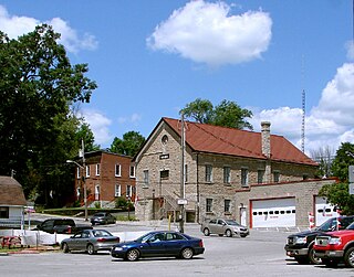
Eldorado is a community in Madoc Township, in Ontario, Canada, with a 2019 population of 50.
Contents
In 1866, it was the location of Ontario's first gold rush after Marcus Herbert Powell found gold on John Richardson's farm. [1]

Eldorado is a community in Madoc Township, in Ontario, Canada, with a 2019 population of 50.
In 1866, it was the location of Ontario's first gold rush after Marcus Herbert Powell found gold on John Richardson's farm. [1]
Eldorado is located six miles away from the centre of Madoc. [2]
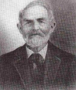
Municipal employee and part-time prospector Marcus Herbert Powell found gold on August 15, 1866, on a farm owned by John Richardson's. [1] [3]
The town of Eldorado was founded in 1867. [1] The same year the Richardson Mine went into operation. [1] Despite higher expectations, Powell extracted about 100 ounces of gold, worth $1,500 to $2,000 at the time, but no further gold was found. [3] Various other mines that had quickly opened, quickly closed. [3] [1]
In 2019 the population of Eldorado was 50, down from 4,000 during the gold rush. [3] In contemporary times, it is considered to be a ghost town. [4]

A gold rush or gold fever is a discovery of gold—sometimes accompanied by other precious metals and rare-earth minerals—that brings an onrush of miners seeking their fortune. Major gold rushes took place in the 19th century in Australia, Greece, New Zealand, Brazil, Chile, South Africa, the United States, and Canada while smaller gold rushes took place elsewhere.

Hastings County is located in the province of Ontario, Canada. Geographically, it is located on the border of Eastern Ontario and Central Ontario. Hastings County is the second-largest county in Ontario, after Renfrew County, and its county seat is Belleville, which is independent of Hastings County. Hastings County has trademarked the moniker "Cheese Capital of Canada".

Madoc is a township in Hastings County in Eastern Ontario, Canada.

Marmora is the largest community in the Municipality of Marmora and Lake in Hastings County, Ontario, Canada. It is located on the Crowe River and along Highway 7 between Havelock to the west and Madoc to the east, about the halfway point between Ottawa and Toronto.

Madoc is a community in the municipality of Centre Hastings, Hastings County, Ontario, Canada. It is located at the junction of Highway 7 and Highway 62, southeast of Bancroft, halfway between Toronto and Ottawa.
King's Highway 62, commonly referred to as Highway 62, is a provincially maintained highway in the Canadian province of Ontario. The highway travels south–north from Highway 33 at Bloomfield in Prince Edward County, through Belleville, Madoc and Bancroft, to Maynooth, where it ends at a junction with Highway 127. Prior to 1997, the route continued north and east of Maynooth through Combermere, Barry's Bay, Killaloe, Round Lake and Bonnechere to Highway 17 in Pembroke. This section of highway was redesignated Hastings Highlands Municipal Road 62, Renfrew County Road 62, and Renfrew County Road 58.

Matachewan is a township in Timiskaming, Northeastern Ontario, Canada, located at the end of Ontario Highway 66 along the Montreal River. The name is derived from the Cree word for "meeting of the currents".

Stone Mills is a lower-tier township north of Greater Napanee in Lennox and Addington County, Ontario, Canada. According to the 2016 census, the township has a population of 7,702.

Faraday is a township in the Canadian province of Ontario, located within Hastings County adjacent to the town of Bancroft.
Deloro is a community in geographic Marmora Township in the Municipality of Marmora and Lake, Hastings County in Central Ontario, Canada. Deloro is about 200 kilometres (120 mi) southwest of Ottawa and 65 kilometres (40 mi) east of Peterborough. The Deloro Mine site sits along the banks of the Moira River, along the east side of the community. During the gold rush days, after striking gold in Eldorado in 1866, prospectors built at least 25 shafts on the area now known as the Deloro Mine Site.

Moira Lake is a lake in Hastings County in Ontario, Canada. Located on Highway 62 south of Madoc and Highway 7, it is a recreational lake with cottage development along much of the shoreline. The lake is fed by the Moira River. There is a boat launch and a trail that runs past the lake following the abandoned Belleville and North Hastings Railway.
The Cobalt silver rush was a silver rush in Ontario, Canada that began in 1903 when huge veins of silver were discovered by workers on the Temiskaming and Northern Ontario Railway (T&NO) near the Mile 103 post. By 1905 a full-scale silver rush was underway, and the town of Cobalt, Ontario sprang up to serve as its hub. By 1908 Cobalt produced 9% of the world's silver, and in 1911 produced 31,507,791 ounces of silver. However, the good ore ran out fairly rapidly, and most of the mines were closed by the 1930s. There were several small revivals over the years, notably in World War II and again in the 1950s, but both petered out and today there is no active mining in the area. In total, the Cobalt area mines produced 460 million ounces of silver.

Canada is the world's second-largest producer of uranium, behind Kazakhstan. In 2009, 20% of the world's primary uranium production came from mines in Canada. 14.5% of the world production came from one mine, McArthur River. Currently, the only producing area in Canada is northern Saskatchewan, although other areas have had active mines in the past.

Henry Wickenburg was a Prussian prospector who discovered the Vulture Mine and founded the town of Wickenburg in the U.S. state of Arizona. Wickenburg never married. Mrs. Helene Holland inherited Wickenburg’s personal property in 1903, while he was still alive, and the remainder of his estate in 1905 after Henry Wickenburg died from a gunshot wound in the head. His death was deemed a suicide, but many questioned this ruling. The mine that he discovered produced as much as $70 million worth of gold during its course of operation, making it the most important gold mine in Arizona.
El Dorado is a mythical city of gold.

The Central Ontario Railway (COR) was a former railway that ran north from Trenton, Ontario to service a number of towns, mines, and sawmills. Originally formed as the Prince Edward County Railway in 1879, it ran between Picton and Trenton, where it connected with the Grand Trunk Railway that ran between Montreal and Toronto. After being purchased by a group of investors and receiving a new charter to build northward, the company was renamed the Central Ontario Railway in 1882, and it started building towards the gold fields at Eldorado and newly discovered iron fields in Coe Hill.
The Belleville and North Hastings Railway (B&NHR) was a short-line railway in Hastings County, Ontario, Canada. It branched off the Grand Junction Railway (GJR) north of Belleville and ended on the Central Ontario Railway (COR) outside Eldorado for a total distance of 33 kilometres (21 mi). In spite of its name, the line did not reach either Belleville or the northern part of Hastings County.

Uranium mining around Bancroft, Ontario, was conducted at four sites, beginning in the early 1950s and concluding by 1982. Bancroft was one of two major uranium-producing areas in Ontario, and one of seven in Canada, all located along the edge of the Canadian Shield. In the context of mining, the "Bancroft area" includes Haliburton, Hastings, and Renfrew counties, and all areas between Minden and Lake Clear. Activity in the mid-1950s was described by engineer A. S. Bayne in a 1977 report as the "greatest uranium prospecting rush in the world".
The Richardson Mine was Ontario's first gold mine, opened by Marcus Herbert Powell in 1867. The mine's opening caused Ontario's first gold rush, prompting the founding of Eldorado, Ontario the same year.
Gold mining in Canada refers to the extraction and harvesting of gold by mining in Canada.