
Corrientes, officially the Province of Corrientes is a province in northeast Argentina, in the Mesopotamia region. It is surrounded by : Paraguay, the province of Misiones, Brazil, Uruguay, and the provinces of Entre Rios, Santa Fe and Chaco.
Zárate is a port city in the northeast of the province of Buenos Aires, Argentina. It lies on the western shore of the Paraná River, 90 km (56 mi) from Buenos Aires. Its population as per the 2001 census [INDEC] is 101,271 inhabitants. It is the headquarters for and the only city in the partido of the same name.

San Fernando de la Buena Vista is a city in the Gran Buenos Aires area, in Argentina, and capital of the San Fernando Partido, 20 km (12 mi) north of the city of Buenos Aires.
Santos Lugares is a town in the southeast of the partido of Tres de Febrero. It is part of the urban agglomeration of Greater Buenos Aires in Buenos Aires Province, northeast of the Buenos Aires city proper. According to the 2001 census [INDEC], Santos Lugares had 17,023 inhabitants.
Tinogasta is a city in the west of the province of Catamarca, Argentina, on the right-hand shore of the Abaucán River, about 280 km from the provincial capital San Fernando del Valle de Catamarca. It had about 11,500 inhabitants at the 2010 census [INDEC]. It is the head town of the department of the same name. The name of the city comes from the Kakana words tino ("meeting") and gasta ("town").

Olavarría is a city in the province of Buenos Aires, Argentina. It is the administrative seat of the Olavarría Partido and has over 111,320 inhabitants, per the 2010 census [INDEC].

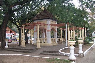
Burzaco is a city in Almirante Brown Partido, Buenos Aires Province, Argentina. It has an area of 22.77 km2, holds a population of 98,859. It is 27 kilometres from Buenos Aires city, to which it is linked by the Ferrocarril General Roca South. Although there were some farms in the area since at least since the end of the 18th century, Burzaco was first established as a town soon after the arrival of the railway in 1865. The current city is the site of the country's first ever National Flag monument, in Burzaco's main square.
José C. Paz is a city, the capital of José C. Paz Partido, Buenos Aires Province, Argentina. It forms part of the Greater Buenos Aires urban area and is located around 35 km north-west of the Capital federal. It was named after José C. Paz, an Argentine journalist and diplomat.

Santa María is a city in the province of Catamarca, Argentina. It has about 17,030 inhabitants per the 2010 census [INDEC], and is the head town of the department of the same name.
Empedrado is a town and commune in the Talca Province of Chile's Maule Region.

Vicente López is a neighborhood in Vicente López Partido, Buenos Aires Province, Argentina. It is a suburb in the Buenos Aires metropolitan area.
Berazategui is a city in Buenos Aires Province, Argentina, located to the south-east of Quilmes. It is the head town of the Berazategui Partido. It is part of the Gran Buenos Aires metropolitan area.

Dock Sud is a town of Avellaneda Partido in Buenos Aires Province, Argentina. It forms part of the urban agglomeration of Greater Buenos Aires.
Ciudad del Libertador General Don José de San Martín, more commonly known as San Martín, is the administrative seat of General San Martín Partido in the urban agglomeration of Greater Buenos Aires.

Empedrado Department is a department of Corrientes Province in Argentina.

Florencio Varela is a city in Buenos Aires Province, Argentina. It is the administrative centre for Florencio Varela Partido. It forms part of the urban agglomeration of Greater Buenos Aires.

Los Polvorines is a district (localidad) in the urban conurbation of Greater Buenos Aires, Argentina. It is the county seat of Malvinas Argentinas Partido of Buenos Aires Province.

Villa de Mayo is a town in the Malvinas Argentinas Partido of Buenos Aires Province, Argentina. It is located in the north west of Greater Buenos Aires urban conurbation around 39 km from Buenos Aires.
Ingeniero Pablo Nogués is a town in Malvinas Argentinas Partido of Buenos Aires Province, Argentina. It is located in the north west of the Greater Buenos Aires urban agglomeration.
