Related Research Articles

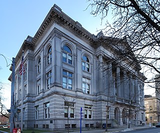
Albany County is a county in the state of New York, United States. Its northern border is formed by the Mohawk River, at its confluence with the Hudson River, which is to the east. As of the 2020 United States Census, the population was 314,848. The county seat and largest city is Albany, which is also the state capital of New York. As originally established by the English government in the colonial era, Albany County had an indefinite amount of land, but has had an area of 530 square miles (1,400 km2) since March 3, 1888. The county is named for the Duke of York and of Albany, who became James II of England.
Rensselaer County is a county in the U.S. state of New York. As of the 2020 census, the population was 161,130. Its county seat is Troy. The county is named in honor of the family of Kiliaen van Rensselaer, the original Dutch owner of the land in the area.
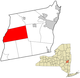
Berne is a town in Albany County, New York, United States. The population was 2,689 at the 2020 census. The town is at the western border of Albany County.

Grafton is a town in Rensselaer County, New York, United States. The population was 2,130 at the 2010 census. It is believed that the town received its name from Grafton, Vermont, where the first town supervisor, Nathaniel Dumbleton, was originally from. The town is an interior town near the north-central part of the county. NY Route 2 passes across the town.
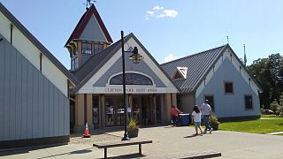
Clifton Park is a suburban town in Saratoga County, New York, United States. According to the United States Census Bureau, the 2020 population was 38,029. The name is derived from an early land patent. The town is in the southern part of Saratoga County, approximately 12 miles (19 km) north of Albany, 7 miles (11 km) northeast of Schenectady, and 10 miles (16 km) south of Saratoga Springs.

Moreau is a town in Saratoga County, New York, United States. The population was 13,826 at the 2000 census. The town is located in the northeast part of the county, north of Saratoga Springs. Moreau is named after Jean Victor Moreau, a French general, who visited the area just before the town was formed. The town contains a village called South Glens Falls.

The Capital District, also known as the Capital Region, is the metropolitan area surrounding Albany, the capital of the U.S. state of New York. The Capital District was first settled by the Dutch in the early 17th century and came under English control in 1664. Albany has been the permanent capital of the state of New York since 1797. The Capital District is notable for many historical events that predate the independence of the United States, including the Albany Plan of Union and the Battles of Saratoga.

Grafton Lakes State Park is a 2,545-acre (10.30 km2) state park located in Rensselaer County, New York, United States. The park is in the central part of the Town of Grafton and north of the hamlet of Grafton on NY Route 2, northeast of Albany. The park contains the Shaver Pond Nature Center.

The Long Path is a 357-mile (575 km) long-distance hiking trail beginning in New York City, at the West 175th Street subway station near the George Washington Bridge and ending at Altamont, New York, in the Albany area. While not yet a continuous trail, relying on road walks in some areas, it nevertheless takes in many of the popular hiking attractions west of the Hudson River, such as the New Jersey Palisades, Harriman State Park, the Shawangunk Ridge and the Catskill Mountains. It offers hikers a diversity of environments to pass through, from suburbia and sea-level salt marshes along the Hudson to wilderness and boreal forest on Catskill summits 4,000 feet (1,220 m) in elevation.

Area codes 518 and 838 are telephone area codes serving the northeasternmost part of Upstate New York in the United States. 518 was established as one of the original area codes during 1947. Area code 838 was added as an overlay during 2017. The two area codes cover 24 counties and 1,200 ZIP Codes. There are 493 landline exchanges and 100 wireless exchanges served by 47 carriers. The numbering plan area (NPA) it covers in New York State extends from the eastern Mohawk Valley to the Vermont border, and from the Canada–US border to south of Albany. The bulk of this NPA population is in the Capital District. Other cities in the NPA are Glens Falls, Plattsburgh, and Saratoga Springs.

Moreau Lake State Park is a 6,250-acre (2,530 ha) state park in Saratoga County, New York, United States.
Thompson's Lake State Park is a 308-acre (1.25 km2) state park located near East Berne in Albany County, New York.

New York State Route 85 (NY 85) is a state highway in Albany County, New York, in the United States. It is 26.49 miles (42.63 km) in length and runs from CR 353 in Rensselaerville to Interstate 90 (I-90) exit 4 in Albany. It also has a loop route, NY 85A, which connects NY 85 to the village of Voorheesville. The portion of NY 85 north of NY 140 to the Bethlehem–Albany town/city line is known as the Slingerlands Bypass. From there north to I-90, the road is a limited-access, four-lane highway named the Crosstown Arterial.

New York State Route 443 (NY 443) is an east–west state highway in the Capital District of New York in the United States. The route begins at an intersection with NY 30 in the town of Schoharie and ends 33.44 miles (53.82 km) later at a junction with U.S. Route 9W (US 9W) and US 20 in the city of Albany. It ascends the Helderberg Escarpment in the towns of Berne and New Scotland. Within the town of Bethlehem and the city of Albany, NY 443 is known as Delaware Avenue.

New York State Route 146 (NY 146) is a state highway in the Capital District of New York in the United States. It extends for 43 miles (69 km) from Gallupville at NY 443 to near Mechanicville at U.S. Route 4 (US 4) and NY 32. NY 146 is a major thoroughfare in the city of Schenectady, just outside Albany. Most of the route follows an east–west alignment; however, the middle third of the route between Guilderland and Clifton Park runs in a more north–south manner in order to serve Schenectady. At one time, NY 146 had three spur routes; only one—NY 146A—still exists.

New York State Route 157 (NY 157) is a state highway in Albany County, New York, in the United States. It runs from an intersection with NY 156 near the hamlet of Berne to a junction with NY 85 in the hamlet of New Salem. NY 157 is a two-lane, narrow, winding route that runs along an escarpment overlooking the Capital District. The route provides access to John Boyd Thacher State Park and Thompson's Lake State Park. NY 157 was assigned to its current alignment as part of the 1930 renumbering of state highways in New York.
New York State Route 157A (NY 157A) is an east–west state highway located in Albany County, New York, in the United States. It serves as a 5.88-mile-long (9.46 km) loop route of NY 157 through the towns of Knox and Berne, veering a considerable distance to the south to serve the hamlet of East Berne and indirectly connect NY 157 to NY 443. NY 157A rejoins NY 157 near the access road to Thompson's Lake State Park, which is along NY 157. It is a two-lane highway its entire length. NY 157A, like its parent route, was assigned in 1930 to its current routing.

The Mohawk Towpath Scenic Byway is a National Scenic Byway in the Capital District region of New York in the United States. It extends from Schenectady to Waterford by way of a series of local, county, and state highways along the Mohawk River and the Erie Canal. The byway is intended to showcase the history of the waterway, from Native American times through the creation of the Erie Canal and the role the waterside communities played in the Industrial Revolution and the westward expansion of the United States. At its east end, the byway connects to the Lakes to Locks Passage, an All-American Road.
Brunswick (Brittonkill) Central School District (BCSD) is a rural fringe central school district located east of the city of Troy whose main campus resides in the town of Brunswick in Rensselaer County, New York, United States. The district has two operating school buildings: Tamarac Elementary School and Tamarac Secondary School. The district is a member of the Rensselaer-Columbia-Greene Boards of Cooperative Educational Services (BOCES), known as Questar III.
References
- "Getting their bearings", Times Union, October 14, 2009
- "Orienteering is where it's at", The Spotlight, October 7, 2009
- "Finding Their Way", Gloversville-Johnstown Leader-Herald, November 2, 2003
- "BKW Finds Way to Championship", Altamont Enterprise, April 12, 2001
- "Details of a January Ski-O", ONA, January 2001
- "Course Data", http://www.billygoat.org/statistics/courses.html
- "No Path, No Rules: The Wildest New Race", Men's Journal, June 2012