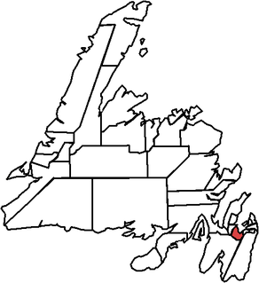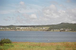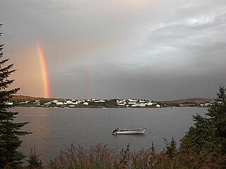
Harbour Main, formerly Harbour Main-Whitbourne and Harbour Main-Bell Island, is a provincial electoral district for the House of Assembly of Newfoundland and Labrador, Canada. Prior to 1975, the district elected two MHAs.

Carbonear-Trinity-Bay de Verde is a provincial electoral district of the House of Assembly of Newfoundland and Labrador, Canada. The district covers the eastern edge of Trinity Bay and the tip of Conception Bay. As of 2011, there are 6,968 eligible voters living within the district.

Fortune Bay—Cape La Hune is a provincial electoral district for the House of Assembly of Newfoundland and Labrador, Canada. When created in 1975 it was called Fortune-Hermitage. As of 2011, there are 6,053 eligible voters living within the district.

Placentia—St. Mary's is a provincial electoral district for the House of Assembly of Newfoundland and Labrador, Canada. As of 2011, there were 7,361 eligible voters living within the district.

The Isles of Notre Dame, formerly called Twillingate and Fogo, is a defunct provincial electoral district for the House of Assembly of Newfoundland and Labrador, Canada. As of 2011 the district had 6,990 eligible voters. The district was abolished in 2015 and largely replaced by Lewisporte-Twillingate.

Trinity North is a provincial electoral district for the House of Assembly of Newfoundland and Labrador, Canada. As of 2011, there were 8,278 eligible voters living within the district.

Old Perlican is a fishing village on the Avalon Peninsula, Newfoundland and Labrador in Canada. Incorporated in 1971, it is one of the oldest fishing communities in Newfoundland, serving as the major fishing station in Trinity Bay for migratory fisherman from England in the 17th century.

Battle Harbour is a summer fishing station, formerly a permanent settlement, located on the Labrador coast in the province of Newfoundland and Labrador, Canada. Battle Harbour was for two centuries the economic and social centre of the southeastern Labrador coast. Mercantile saltfish premises first established there in the 1770s developed into a thriving community that was known as the Capital of Labrador. It fell into decline following reductions in the cod fishery and a major fire in 1930, and was abandoned as a permanent settlement following government resettlement activity in the 1960s.

Port Kirwan is a small incorporated fishing community located on the southern shore of the Avalon Peninsula, Newfoundland, Canada. The community so named after a Reverend Mother Mary Bernard Kirwan, foundress of Presentation Sisters of Newfoundland and Labrador in 1853. The community is located on the area known as The Irish Loop. The Irish Loop comprises many unique and culturally rich communities that show vast dialect, culture, and the way of life of their ancestors from Ireland showed them.

Area code 709 is the telephone area code in the Canadian province of Newfoundland and Labrador, encompassing the whole province.

Rocky Harbour is a town located on the western edge of Newfoundland, near the entrance to Bonne Bay. The harbour was previously known as Small Bay or Little Harbour. This town is home to Gros Morne National Park, a World Heritage Site.
This is a list of elections in Canada in 2007. Included are provincial, municipal and federal elections, by-elections on any level, referendums and party leadership races at any level.

Crow Head is a small town located on the north island of Twillingate in Newfoundland and Labrador, Canada. It is home to the Long Point Lighthouse and Twillingate Dinner Theatre. Its only land border is with the Town of Twillingate, to the southeast.

SS Kyle is a 220 feet (67 m) steam ship that is aground in the harbour of the Town of Harbour Grace, Newfoundland and Labrador, Canada. She ran ashore in February 1967. Intended to transport supplies and provide transportation from Carbonear to Labrador, she was also used to transport infantry to Canada during World War II. After her grounding on the shores of Riverhead, Harbour Grace, she has had several owners, from the Earle Brothers Freighting Company, Dominion Metals, and the Government of Newfoundland. Plans to have the vessel moved to the town of Salmon Cove, Newfoundland, and turned into a museum were later aborted due to financial implications.

NunatuKavut is an unrecognized Inuit territory in Labrador. The NunatuKavut people are the direct descendants of the Inuit that lived south of the Churchill or Grand River prior to European contact, with European influence from Basque and French whalers.
Division No. 2, Newfoundland and Labrador is a census division in the Canadian province of Newfoundland and Labrador, primarily comprising the Burin Peninsula. Like all census divisions in Newfoundland and Labrador, but unlike the census divisions of some other provinces, the division exists only as a statistical division for census data, and is not a political entity.


