
Interstate 5 (I-5) is the main north–south Interstate Highway on the West Coast of the United States, running largely parallel to the Pacific Coast of the contiguous U.S. from Mexico to Canada. It travels through the states of California, Oregon, and Washington, serving several large cities on the West Coast, including San Diego, Los Angeles, Sacramento, Portland, and Seattle. It is the only continuous Interstate highway to touch both the Mexican and Canadian borders. Upon crossing the Mexican border at its southern terminus, I-5 continues to Tijuana, Baja California, as Mexican Federal Highway 1 (Fed. 1). Upon crossing the Canadian border at its northern terminus, it continues to Vancouver as British Columbia Highway 99 (BC 99).
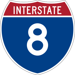
Interstate 8 (I-8) is an Interstate Highway in the southwestern United States. It runs from the southern edge of Mission Bay at Sunset Cliffs Boulevard in San Diego, California, almost at the Pacific Ocean, to the junction with I-10, just southeast of Casa Grande, Arizona. In California, the freeway travels through the San Diego metropolitan area as the Ocean Beach Freeway and the Mission Valley Freeway before traversing the Cuyamaca Mountains and providing access through the Imperial Valley, including the city of El Centro. Crossing the Colorado River into Arizona, I-8 continues through the city of Yuma across the Sonoran Desert to Casa Grande, in between the cities of Phoenix and Tucson.
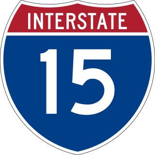
Interstate 15 (I-15) is a major Interstate Highway in the Western United States, running through Southern California and the Intermountain West. I-15 begins near the Mexican border in San Diego County and stretches north to Alberta, Canada, passing through the states of California, Nevada, Arizona, Utah, Idaho, and Montana. The Interstate serves the cities such as San Diego, San Bernardino, Las Vegas, Salt Lake City, Idaho Falls, and Great Falls. It also passes close to the urban areas of Los Angeles, Orange, and Riverside counties, California. The stretches of I-15 in Idaho, Utah, and Arizona have been designated as the "Veterans Memorial Highway". The southern end is at a junction with I-8 and State Route 15 (SR 15) in San Diego, and the northern end is at a connection with Alberta Highway 4 at the Sweetgrass–Coutts Border Crossing.

U.S. Route 395, also known as U.S. Highway 395, is a north–south United States Numbered Highway that traverses the western states of California, Nevada, Oregon, and Washington. It travels for over 1,300 miles (2,100 km) from a junction in the Mojave Desert at Interstate 15 (I-15) in Hesperia to the Canada–U.S. border near Laurier, Washington. Major cities along its route include Carson City and Reno in Nevada; Kennewick and Pasco in Washington's Tri-Cities region; and Spokane, Washington. US 395 is a auxiliary route of US 95 but never intersects its parent route, which runs further east.

Interstate 805 (I-805) is a major north–south auxiliary Interstate Highway in Southern California. It is a bypass auxiliary route of I-5, running roughly through the center of the Greater San Diego region from San Ysidro near the Mexico–U.S. border to near Del Mar. The southern terminus of I-805 at I-5 in San Ysidro is less than 1 mi (1.6 km) north of the Mexican border. I-805 then traverses the cities of Chula Vista and National City before reentering San Diego. The freeway passes through the San Diego neighborhoods of North Park, Mission Valley, Clairemont, and University City before terminating at I-5 in the Sorrento Valley neighborhood near the Del Mar city limit.
The Riverside Freeway is one of the named principal Southern California freeways. It consists of the following segments:

Interstate 215 (I-215) is a 54.5-mile-long (87.7 km) north–south auxiliary Interstate Highway in the Inland Empire region of the San Bernardino–Riverside urban area in Southern California. It has portions designated as the Barstow, Escondido, and Armed Forces Freeways. I-215 is a bypass auxiliary route of I-15, running from Murrieta to northern San Bernardino. While I-215 connects the city centers of both Riverside and San Bernardino, its parent I-15 runs to the west through Corona and Ontario.
The Barstow Freeway is one of the named principal Southern California freeways. It consists of the following segments:

State Route 163 (SR 163), or the Cabrillo Freeway, is a state highway in San Diego, California. The 11.088-mile (17.844 km) stretch of the former US 395 freeway runs from Downtown San Diego just south of an interchange with Interstate 5 (I-5), extending north through historic Balboa Park and various neighborhoods of San Diego to an interchange with I-15 in the neighborhood of Miramar. The freeway is named after Juan Rodríguez Cabrillo, the first European to navigate the coast of present-day California.

The Southern California freeways are a vast network of interconnected freeways in the megaregion of Southern California, serving a population of 23 million people. The Master Plan of Metropolitan Los Angeles Freeways was adopted by the Regional Planning Commission in 1947 and construction began in the early 1950s. The plan hit opposition and funding limitations in the 1970s, and by 2004, only some 61% of the original planned network had been completed.
The San Diego Freeway is one of the named principal Southern California freeways. It consists of the following two segments:

The Foothill Freeway is a freeway in the Los Angeles metropolitan area, California, United States, running from the Sylmar district of Los Angeles east to Redlands. The western segment is signed as Interstate 210 (I-210) from its western end at I-5 to SR 57 in Glendora, while the eastern segment is signed as State Route 210 (SR 210) to its eastern terminus at I-10. Under the California Streets and Highways Code, the entire Foothill Freeway is legally referred to as Route 210.
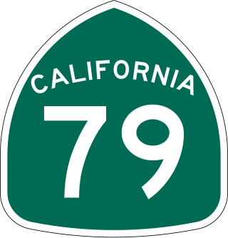
State Route 79 is a state highway in the U.S. state of California. The route begins at Interstate 8 (I-8) in San Diego County, continuing north through the town of Cuyamaca into Julian. After passing through Warner Springs, the route crosses into Riverside County, serving the cities of Temecula and Murrieta. SR 79 ends at I-10 in Beaumont.

Route 15, consisting of the contiguous segments of State Route 15 (SR 15) and Interstate 15 (I-15), is a major north–south state highway and Interstate Highway in the U.S. state of California, connecting San Bernardino, Riverside, and San Diego Counties. The route consists of the southernmost 289.24 miles (465.49 km) of I-15, which extends north through Nevada, Arizona, Utah, Idaho, and Montana to the Canada–US border. It is a major thoroughfare for traffic between San Diego and the Inland Empire, as well as between Southern California, Las Vegas, Nevada, and the Intermountain West.

California's transportation system is complex and dynamic. Although known for its car culture and extensive network of freeways and roads, the state also has a vast array of rail, sea, and air transport. Several subway, light rail, and commuter rail networks are found in many of the state's largest population centers. In addition, with the state's location on the West Coast of the United States, several important ports in California handle freight shipments from the Pacific Rim and beyond. A number of airports are also spread out across the state, ranging from small general aviation airports to large international hubs like Los Angeles International Airport and San Francisco International Airport.

Interstate 5 (I-5) is a major north–south route of the Interstate Highway System in the United States, stretching from the Mexican border at the San Ysidro crossing to the Canadian border near Blaine, Washington. The segment of I-5 in California runs 796.77 miles (1,282.28 km) across the length of the state from San Ysidro to the Oregon state line south of the Medford-Ashland metropolitan area. It is the longest interstate in California, and accounts for more than half of I-5's total length.

Greater Los Angeles has a complex multimodal transportation infrastructure, which serves as a regional, national and international hub for passenger and freight traffic. The transportation system of Greater Los Angeles includes the United States' largest port complex, seven commuter rail lines, Amtrak service, a subway system within the city of Los Angeles, and numerous highways. Los Angeles is integrated into the Interstate Highway System by Interstate 5, Interstate 10, and Interstate 15, along with numerous auxiliary highways and state routes. Bus service is also included locally within the area by numerous local government agencies. Subways and light commuter rail lines are present within Los Angeles proper, allowing mass transportation within the city. Commuter railroads are run by Metrolink. Amtrak has numerous railroad lines that connect Los Angeles to the rest of the country.

Many of the existing freeways in Southern California's Inland Empire were completed in the late 1970s. The only exception is the segment of the Foothill Freeway, State Route 210 between San Dimas and San Bernardino, completed in July 2007. In general, most of the higher paying jobs are located in Los Angeles and Orange County. Thus, workers must commute daily up to two hours in each direction on the existing network. As the population increases, traffic congestion is also projected to increase. In 2007, Forbes magazine ranked the area first in its list of America's most unhealthy commutes, beating every other major metropolitan area in the country, as Inland area drivers breathe the unhealthiest air and have the highest rate of fatal auto accidents per capita.
Transportation in San Diego–Tijuana occurs by various means. Though, in the four cities of San Diego, Tijuana, Tecate, and Rosarito Beach, the automobile serves as most important means of transportation. The international metropolitan region maintains an intricate highway infrastructure. As a large metropolitan area in Western North America, many roadways, including Interstates, State Routes, and Mexican Federal Highways, hold a terminus in the area. These roads have grown accustomed to support the masses of the commuting populace within the international region and are constantly being expanded and/or renovated. Transportation is a crucial issue in the metropolitan area. The streets and highways of the region affect environmental health and have influence over the degree of regional connectivity. Binational discussions about coordinating public transportation across the border are currently underway. San Diego–Tijuana is the site of two major international airports and numerous regional airports. It is also the site of the Port of San Diego and miles from the nearby Port of Ensenada.