Related Research Articles
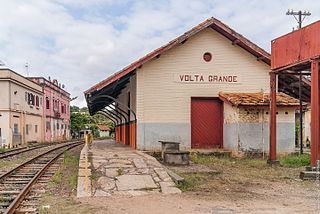
Volta Grande is a Brazilian municipality in the state of Minas Gerais. As of 2020 its population was estimated to be 5,261.

Arapuá is a Brazilian municipality located in the northwest of the state of Minas Gerais. Its population as of 2020 was 2,835 people living in a total area of 172 km². The city belongs to the mesoregion of Triângulo Mineiro e Alto Paranaiba and to the microregion of Patos de Minas. It became a municipality in 1962.
Felisburgo is a Brazilian municipality located in the northeast of the state of Minas Gerais.

Itinga is a Brazilian municipality located in the northeast of the state of Minas Gerais. As of 2020 the population was 15,022 in a total area of 1,641 km².
Miravânia is a municipality in the north of the state of Minas Gerais in Brazil. As of 2020 the population was 4,914 in an area of 603 km². It is located on the left bank of the São Francisco River. It is connected by dirt road to São João das Missões by paved BR-135. The distance is 112 km. Neighboring municipalities are: Montalvânia, Manga, Cônego Marinho, and São João das Missões.
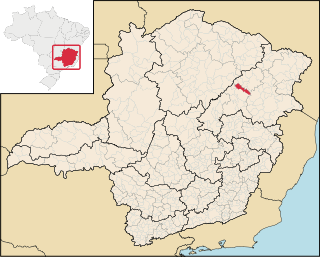
Presidente Olegário is a municipality in the north of the Brazilian state of Minas Gerais. Its population in 2020 was 19,627 inhabitants in a total area of 3,531 km2 (1,363 sq mi).

Jequitaí is a Brazilian municipality located in the north of the state of Minas Gerais. In 2020 the population was 7,468 in a total area of 1,268 km2. It became a municipality in 1948.
São Romão is a Brazilian municipality located in the north of the state of Minas Gerais. In 2020 the population was 12,529 in a total area of 2,432 km². It became a municipality in 1943.

Riachinho is a Brazilian municipality located in the north of the state of Minas Gerais. In 2020 the population was 8,134 in a total area of 1,775 km². It became a municipality in 1992.
Santa Rosa da Serra is a Brazilian municipality located in the northwest of the state of Minas Gerais. Its population as of 2020 was 3,357 people living in a total area of 296 km2. The city belongs to the mesoregion of Triângulo Mineiro e Alto Paranaiba and to the microregion of Patos de Minas. It became a municipality in 1962.

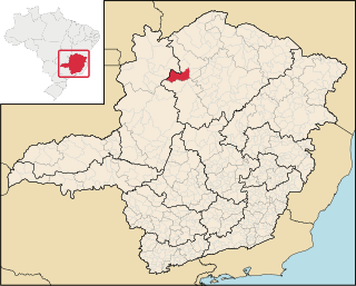
São Gotardo is a Brazilian municipality located in the northwest of the state of Minas Gerais. Its population as of 2020 was 35,782 people and its land area is 854 km2. The city belongs to the mesoregion of Triângulo Mineiro e Alto Paranaiba and to the microregion of Patos de Minas. It became a municipality in 1915.

Cruzeiro da Fortaleza is a Brazilian municipality located in the northwest of the state of Minas Gerais. Its population as of 2020 was 3,639 people living in a total area of 185 km2. The city belongs to the mesoregion of Triângulo Mineiro e Alto Paranaiba and to the microregion of Patrocínio. It became a municipality in 1963.
Chapada do Norte is a municipality in the northeast of the Brazilian state of Minas Gerais. As of 2020 the population was 15,345 in a total area of 828 km². The elevation of the town center is 751 meters. It is part of the IBGE statistical meso-region of Jequitinhonha and the micro-region of Capelinha. It became a municipality in 1963.

Senador Modestino Gonçalves is a Brazilian municipality in the state of Minas Gerais.

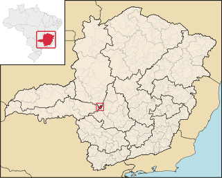
São Roque de Minas is a Brazilian municipality located in the west of the state of Minas Gerais. Its population as of 2020 was 7,076 people living in a total area of 2,100 km². The city belongs to the meso-region of Oeste de Minas and to the micro-region of Piumhi. It became a municipality in 1938.

Fortaleza de Minas is a Brazilian municipality located in the southwest of the state of Minas Gerais. Its population as of 2020 was 4,437 people living in a total area of 218 km2 (84 sq mi). The city belongs to the meso-region of Sul e Sudoeste de Minas and to the micro-region of Passos. It became a municipality in 1963.

São José da Barra is a Brazilian municipality located in the southwest of the state of Minas Gerais. Its population as of 2020 was 7,480 people living in a total area of 312 km2. The city belongs to the meso-region of Sul e Sudoeste de Minas and to the micro-region of Passos. It became a municipality in 1948. The important hydroelectric plant of Furnas is located here.

Divisa Nova is a municipality in the state of Minas Gerais in the Southeast region of Brazil.
Toledo, Minas Gerais is a municipality in the state of Minas Gerais in the Southeast region of Brazil.
Ipanema, Minas Gerais is a municipality in the state of Minas Gerais in the Southeast region of Brazil.
References
- Map from Ministry of Transport
- Rand McNally, The New International Atlas, 1993.
Coordinates: 17°31′37″S46°38′31″W / 17.52694°S 46.64194°W