
The Eskdalemuir Observatory is a UK national environmental observatory located near Eskdalemuir, Dumfries and Galloway, Scotland. Along with Lerwick and Hartland, Eskdalemuir is one of three permanent geomagnetic observatories in the United Kingdom.
This is a list of the extreme points of the United Kingdom: the points that are farther north, south, east or west than any other location. Traditionally the extent of the island of Great Britain has stretched "from Land's End to John o' Groats".

This is a list of the extreme points of Ireland – the points that are farthest north, south, east or west in Ireland. It includes the Republic of Ireland and Northern Ireland.

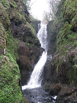
The River Esk, also known as the Border Esk, is a river that rises in the Scottish region of Dumfries and Galloway before crossing the border to the English county of Cumbria and flowing into the Solway Firth.

The Forest of Ae is located between Nithsdale and Annandale in Dumfries and Galloway in south-west Scotland.

Long Crag is a hill to the north of Rothbury in Northumberland, England. It lies within the Thrunton Woods, a Forestry Commission-owned area of forestry plantations.
Ed Bird – Estella Lakes Provincial Park is a provincial park in British Columbia, Canada.
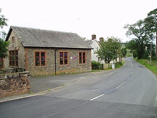
Eskdalemuir is a civil parish and small village in Dumfries and Galloway, Scotland, with a population of 265. It is around 10 miles (16 km) north-west of Langholm and 10 miles (16 km) north-east of Lockerbie.
Glenariff Forest Park is an 1185 hectare forest in County Antrim, Northern Ireland. It is part of Glenariff glen itself. The forest is managed by the Northern Ireland Forest Service, the state body responsible for forestry in the province, which is part of the Department of Agriculture, Environment and Rural Affairs.

Boreland is a village in Dumfries and Galloway, Scotland, which is located in Dryfesdale about 7 miles north of Lockerbie on the B723 road to Eskdalemuir. The village is bordered by the Dryfe Water to the north, whilst the Boreland Burn flows to the south of the village which is a tributary of the Dryfe Water. Next to the Dryfe are the remains of Gillesbie Tower which was home to one of the Border Reiver clans, the Grahams. This tower, dating back to the 15th century, was a stronghold of the Grahams of Gillesbie. The area surrounding Boreland has many other significant historical remains, with some dating back to the Iron Age.

Manor Water is a river in the parish of Manor, Peeblesshire in the Scottish Borders. It rises in the Ettrick Forest and flows down through the Maynor valley, passing the various farms and hamlets of Maynor as well as Kirkton Manynor, where the Maynor kirk and village hall are flowing into the River Tweed one mile south of Peebles at Olde Maynor Brig, which is closed to traffic for the foreseeable future.

Wauchope Forest is a forest on the Rule Water, in the Scottish Borders area of Scotland, south of Hawick, and including the A6088, the A68 and the B6357, as well as Newcastleton, Bonchester Bridge, Hobkirk, Southdean, Hyndlee, Carter Bar, Abbotrule, Chesters, Scottish Borders.

Craik is a hamlet in Craik Forest, by the Airhouse Burn in the Scottish Borders area of Scotland, close to Roberton, Scottish Borders.

Craik Forest is a forest near Hawick in the Scottish Borders area of Scotland, and managed by the Forestry Commission. It is adjoined to the south-west by Eskdalemuir Forest.

The Cardrona Forest is a forest in the Scottish Borders area of Scotland, on in Tweed Valley, near Peebles. A nearby forest is Glentress Forest. The forest contains 2,000 years of Scottish history, and is home to ruins. It is popular among cyclists and hikers, for it has a network of trails, many of which have names.

Bắc Kạn, sometimes misspelled as Bắc Cạn, is a province of Vietnam. It is located in the Northeast region, due north of the capital Hanoi.

The Field Elm cultivar Ulmus minor 'Dehesa de la Villa' was cloned by root cuttings from a tree growing in the eponymous park within the Moncloa-Aravaca district of north-west Madrid, by researchers at the Escuela Técnica Superior de Ingenieros de Montes, Universidad Politėcnica de Madrid in 1990.

Bentpath is a small village between Eskdalemuir and Langholm in Dumfries and Galloway, Scotland. It is located on the River Esk and has a church and a library. Westerkirk library was founded in 1791 and is the oldest library in Scotland which is still in use.
Castle O'er Forest is a forest south of Eskdalemuir, Dumfries and Galloway, in southern Scotland.

Harwood Forest is a 3,527-hectare (8,720-acre) conifer plantation located to the south of Rothbury in North Northumberland, England, and managed by Forestry England.
