| Estero Arrayán | |
|---|---|
 | |
| Location | |
| Country | Chile |
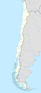
The Estero Arrayán is a river of Chile.
| Estero Arrayán | |
|---|---|
 | |
| Location | |
| Country | Chile |
The Estero Arrayán is a river of Chile.

The Arctic Archipelago, also known as the Canadian Arctic Archipelago, groups together all islands lying to the north of the Canadian continental mainland excluding Greenland.

Laja River is a river in Chile, along which can be found the Laja Falls. It is located in the Bío Bío Region. The source of the river is Laguna del Laja in the Andes, then flows westward through the Chilean Central Valley and terminates into the Bío Bío River, being an important tributary of it.

Penco (Mapudungun: "See Water, is a Chilean city and commune in Concepción Province, Bío Bío Region on the Bay of Concepción. Founded as the city of Concepción del Nuevo Extremo on February 12, 1550 by Pedro de Valdivia, it is the third oldest city in Chile, after capital Santiago founded first in 1541 and La Serena second in 1544.

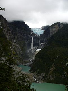
Queulat National Park is a national park of Chile located in the Aysén del General Carlos Ibáñez del Campo Region. The park is bordered by the Cisnes River on the south side and is neighbor to Lago Rosselot National Reserve. It contains 1,541 km2 (595 sq mi) of glacier-capped mountains and virgin evergreen forests.

San Pedro River is a river in Valdivia Province, southern Chile. It drains waters from the Riñihue Lake, the last of the Seven Lakes, to the Calle-Calle River, which in turn changes name to Valdivia River and at the end outflows in Corral Bay. San Pedro River is well known for being a good fishing area and a good place to practise rafting.

The Zona Sur is one of the five natural regions on which CORFO divided continental Chile in 1950. Its northern border is formed by the Bío-Bío River, the limit with the Central Chile Zone. By west with the Pacific Ocean, by the east with the Andean mountains and Argentina. Its southern border is the Chacao Channel, beyond it lies the Austral Zone. While Chiloé Archipelago belongs geographically to Zona Austral in terms of culture and history it lies closer to Zona Sur.
Santo Domingo de Silos is a municipality and town located in the province of Burgos, Castile and León, Spain. According to the 2004 census (INE), the municipality had a population of 292 inhabitants.
Antilhue is a village in Chile, South America. It is located in the commune of Los Lagos on the shores of Calle-Calle River just east of Valdivia. Two petroleum-fueled power plants, Antilhue I and Antilhue II, with a combined production capacity of 101.3 MW, are located near the village.
Espíritu Santo was a Spanish fortress that existed a little to the north of what is now the Nacimiento commune of Bío Bío Province, Bio-Bio Region of Chile. It was on the left bank of the Bio Bio River immediately below its confluence with the Tavolevo River. Built in 1585 by the Governor Alonso de Sotomayor for defense of the valley of Catiray and was in correspondence with fort Santísima Trinidad, on the opposite shore of the Bio Bio. It was abandoned and destroyed by the year of 1600.

Tavolevo River, a tributary of the Biobío River. in Chile. It has two tributaries the Culenco River flowing southeast from the Nahuelbuta Range in the Catirai region and the Nicodahue River that flows north from the La Araucanía Region and its two tributaries the Esperanza and Maitenrehue Rivers that all originate northwest of Angol. It is sometimes considered part of the Nicodahue River. The Tavolevo flows into the Bio Bio fifty kilometers beyond the confluence of the Nicodahue and Culenco Rivers and seven kilometers to the north of Nacimiento. Immediately downstream from its mouth was the location of the old fort of Espirito Santo and on its banks significant placer gold deposits. The river was navigable by flatboats up to nine kilometers above its confluence with the Bio Bio. Its Mapudungun name meant confluence.
Santa Cruz de Coya was a city established by the governor of Chile Martín García Oñez de Loyola on the site of the fort of Santa Cruz de Oñez, in 1595. It was named for his wife Beatriz Clara Coya, a member of the royal Incan house. The Mapuche called the city Millacoya, meaning gold princess from the mapudungun milla, gold and the quechua coya, princess.

The Chol Chol River is a river in Chile. It is situated in the Araucania Region of Chile in the village of Cholchol, just outside Temuco and with the Cautín River are tributaries of the Imperial River (Chile).
The Estero Zamorano is a river of Chile.

The Muco River is a river in the Araucanía Region in Chile. It is a tributary of the Cautín River.

The Yelcho River is a river in the Los Lagos Region of southern Chile.

Coulston Glacier is a small tributary glacier flowing south from the Cartographers Range into Trafalgar Glacier, 10 nautical miles (19 km) west of Bypass Hill, in the Victory Mountains of Victoria Land. It was mapped by the United States Geological Survey from surveys and from U.S. Navy air photos 1960–64, and named by the Advisory Committee on Antarctic Names for Peter W. Coulston, an aviation electronics technician with U.S. Navy Squadron VX-6 at McMurdo Station, 1967.
Rock Pile Point is the east point of Bermel Peninsula on the Bowman Coast, Graham Land. This feature was photographed from the air and roughly positioned by United States Antarctic Service (USAS), 1939–41, which applied the descriptive name Rock Pile Point to the peninsula; the name was subsequently reapplied by Advisory Committee on Antarctic Names (US-ACAN) to the east point as described.

German submarine U-1169 was a Type VIIC/41 U-boat of Nazi Germany's Kriegsmarine during World War II.
Central San Pedro is a controversial energy project that aims to build a hydroelectric power plant in San Pedro River, Los Ríos Region, Chile. The dam and the associated infrastructure of the project would generate total of 170 megawatts (230,000 hp). The project was first halted in 2009 due to problems associated with the geology of the area. As of 2019 the municipalities of Panguipulli and Los Lagos the two most directly affected communes have rejected the project. The mayor of Los Lagos, among other people, has expressed concerns over the projects impact on tourism and biodiversity. On September 7, 2019 three or more armed persons attacked the temporary installations of the project setting the storehouse ablaze. Within a week Colbún S.A. had responded by filling legal actions against the responsible.
Coordinates: 41°25′S72°58′W / 41.417°S 72.967°W
| This Los Lagos Region location article is a stub. You can help Wikipedia by expanding it. |
| This article related to a river in Chile is a stub. You can help Wikipedia by expanding it. |