
The Sonoran Desert is a hot desert and ecoregion in North America that covers the northwestern Mexican states of Sonora, Baja California, and Baja California Sur, as well as part of the Southwestern United States. It is the hottest desert in both Mexico and the United States. It has an area of 260,000 square kilometers (100,000 sq mi).
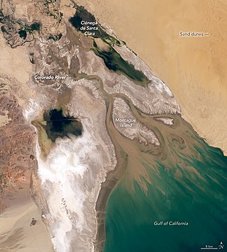
The Colorado River Delta is the region where the Colorado River once flowed into the Gulf of California in eastern Mexicali Municipality in the north of the state of Baja California, in northwestern Mexico. The delta is part of a larger geologic region called the Salton Trough. Historically, the interaction of the river's flow and the ocean's tide created a dynamic environment, supporting freshwater, brackish, and saltwater species. Within the delta region, the river split into multiple braided channels and formed a complex estuary and terrestrial ecosystems. The use of water upstream and the accompanying reduction of freshwater flow has resulted in the loss of most of the wetlands of the area, as well as drastic changes to the aquatic ecosystems - an ecosystem collapse.

The Gran Desierto de Altar is one of the major sub-ecoregions of the Sonoran Desert, located in the State of Sonora, in northwest Mexico. It includes the only active erg dune region in North America. The desert extends across much of the northern border of the Gulf of California, spanning more than 100 kilometres (62 mi) east to west and over 50 kilometres (31 mi) north to south. It constitutes the largest continuous wilderness area within the Sonoran Desert.

Desierto de los LeonesNational Park is located entirely within the limits of Mexico City; it stretches between Cuajimalpa and Álvaro Obregón boroughs. It is located in the Sierra de las Cruces mountain range west of the city center with an area of 1,867 hectares, representing fifteen percent of the entire Valley of Mexico. The term Desierto (‘desert’) is used in this context in the archaic sense of “wild, sparsely populated area” rather than in reference to an arid environment. Leones (‘Lions’) refers not to the big cats but rather to the original landlord's surname.

Heterotheca sessiliflora is a species of flowering plant in the family Asteraceae known by the common name sessileflower false goldenaster. It is native to California, Sonora, and Baja California.

The Pinacate Peaks are a group of volcanic peaks and cinder cones located mostly in the Mexican state of Sonora along the international border adjacent to the U.S. state of Arizona, surrounded by the vast sand dune field of the Gran Desierto de Altar, at the desert's southeast.
Eduardo Hugo Rapoport was an Argentine ecologist and emeritus professor at Universidad Nacional del Comahue. He is widely known for his fundamental work on soil biology, biological invasions, and urban ecology and, in particular, for his contributions to the biogeography.

Mapastepec is a town and municipality in the Mexican state of Chiapas in southern Mexico. Its name derives from the place name mapachtepec, "Hill of the Raccoon", a compound of the Nahuatl words mapachi ("raccoon") and tepetl ("mountain").

Puerto Peñasco Municipality is a municipality in the Mexican state of Sonora in north-western Mexico. As of 2015, the municipality had a total population of 62,177 inhabitants. The only locality with a significant population is the municipal seat, also named Puerto Peñasco, which contains almost 99% of the municipality's population.

A tinaja is a surface pocket (depression) formed in bedrock that occurs below waterfalls, that is carved out by spring flow or seepage, or that is caused by sand and gravel scouring in intermittent streams (arroyos). Tinajas are an important source of surface water storage in arid environments.
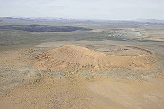
El Pinacate and Gran Desierto de Altar Biosphere Reserve is a biosphere reserve and UNESCO World Heritage Site managed by the federal government of Mexico, specifically by Secretariat of the Environment and Natural Resources, in collaboration with the state governments of Sonora and the Tohono O'odham.

El Tepeyac National Park is one of a number of federally recognized national parks in Mexico that are protected natural areas and administered by the federal National Commission of Protected Natural Areas (CONANP), a subsidiary of SEMARNAT. It is one of the few green areas located north of the Mexico City suburbs. 95% of its territory is located in Gustavo A. Madero, D.F. Borough and 5% in the municipality of Tlalnepantla de Baz.

Grimothea planipes, also known as the pelagic red crab, red crab, or tuna crab, is a species of squat lobster from the eastern Pacific Ocean.
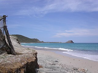
Cabo Pulmo National Park is a national marine park on the east coast of Mexico's Baja California Peninsula, spanning the distance between Pulmo Point and Los Frailes Cape, approximately 100 kilometres (62 mi) north of Cabo San Lucas in the Gulf of California. Bahía Pulmo is home to the oldest of only three coral reefs on the west coast of North America. Cabo Pulmo is estimated to be 20,000 years old. The 27 square mile national park is home to 11 different species of coral. It is the northernmost coral reef in the eastern Pacific Ocean.
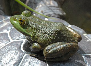
Invasive species in Mexico are a major cause of biodiversity loss, altering ecosystems, affecting native species, damaging environmental services and public health, and causing economic losses. An invasive species is one native to a particular area that has been introduced into a new habitat, adapting and altering to suit its new conditions.

Alto Golfo de California Biosphere Reserve is a UNESCO Biosphere Reserve located in the state of Sonora in extreme northwestern Mexico. Thee 1,652,110 hectares (6,378.8 sq mi) reserve comprises the El Pinacate y Gran Desierto reserve and the Bahia Adair on the Gulf of California border. Geological volcanic formations with craters, dunes, oasis and beaches, and the diversity of plant associations determine its special landscape. The reserve was established in 1993 by the President of Mexico as Reserva de la Biosfera del Alto Golfo de California y Delta del Río Colorado and extended in 1995.
Rodolfo Dirzo is a professor, conservationist, and tropical ecologist. He is a Bing Professor in environmental science at Stanford and a senior fellow at the Stanford Woods Institute for the Environment. His research interests mainly focus on plant-animal interactions, evolutionary ecology, and defaunation in the tropics of Latin America, Africa, and the Central Pacific. He was a member of the Committee on A Conceptual Framework for New K-12 Science Education Standards, co-authoring the framework in 2012, and continues to educate local communities and young people about science and environmental issues.

The Northern Mesoamerican Pacific Mangroves is a mangrove ecoregion of the southern Baja California Peninsula and coastal Sonora and northern Sinaloa states in northwestern Mexico. They are the northernmost mangroves on the Pacific Coast of North America and the region is transitional between tropical and temperate seas.

Edith Abigail Purer was a botanist, teacher, environmentalist, and artist. She was an early advocate for California State Parks, and the state's first female professional ecologist.
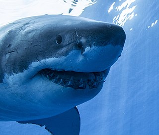
The Guadalupe Island Biosphere Reserve,, is in the Pacific Ocean and part of Baja California state of Mexico. The Reserve consists of Guadalupe Island and several small islands nearby plus a large expanse of surrounding ocean. The Reserve was created by the government of Mexico on 25 April 2005 and is located 250 kilometres from the mainland. The Reserve is 4,770 square kilometres (1,840 sq mi) in size of which 263 square kilometres (102 sq mi) is land and the remainder is water.


