The Arctic Archipelago, also known as the Canadian Arctic Archipelago, is a group of islands north of the Canadian mainland.

Bihor Mountains is a mountain range in western Romania. It is part of the Apuseni Mountains, which are part of the Carpathian Mountains. The massif has a length of 25 kilometres (16 mi) from the northwest to the southeast and a width of 14 kilometres (8.7 mi). It is located east of the town Ștei, and north of the town Brad.

The Battle of Flushing was a naval battle of the Eighty Years' War, fought on April 17, 1573 near the city of Flushing, Netherlands. The Spanish fleet was led by Sancho d'Avila, the Dutch fleet by Lieven Keersmaker.
Oleksandrivsk or Aleksandrovsk is a small city in Luhansk Municipality, Luhansk Oblast (region) of Ukraine. Population: 6,635 (2013 est.).
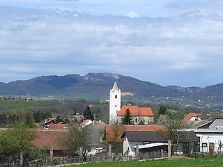
Sveti Petar Orehovec is a municipality in the Koprivnica-Križevci County in Croatia. According to the 2011 census, there are 4,583 inhabitants in the area. The municipality was formed in 1993.

Dekanovec is a village and municipality in Međimurje County, Croatia.
Prey Tralach is a khum (commune) of Moung Ruessei District in Battambang Province in north-western Cambodia.
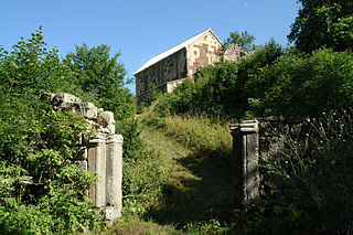
Gudarekhi is a village in Kvemo Kartli, Georgia, notable for a nearby monastic complex and archaeological site. It is located in the Algeti Valley, some 8 km of the town Tetritsqaro, south of Georgia’s capital Tbilisi.

The Zeppelin LZ 13 Hansa was a German civilian rigid airship first flown in 1912. It was built for DELAG to carry passengers and post and flew the first international passenger flight, visiting Denmark and Sweden in September 1912. In 1913 it was hired to the Imperial German Navy as a training craft, and at the outbreak of World War I it was requisitioned by the German military who used it for bombing, reconnaissance, and finally as a training airship.
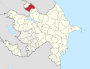
Mollaçibinə is a village in the municipality of Püştətala in the Balakan Rayon of Azerbaijan.
Sumaylı is a village in the municipality of Göyəm in the Zaqatala Rayon of Azerbaijan.

Quy Hóa is a commune (xã) and village in Minh Hóa District, Quảng Bình Province, in Vietnam.

Priekule Municipality is a municipality in Courland, Latvia. The municipality was formed in 2009 by merging Bunka parish, Virga parish, Gramzda parish, Kalēti parish, Priekule parish and Priekule town the administrative centre being Priekule.
Kerkateskánd is a village in Zala County, Hungary.
Murarátka is a village in Zala County, Hungary.
Aralikatti is a village in Belgaum district in the southern state of Karnataka, India.
German submarine U-828 was a Type VIIC/41 U-boat of Nazi Germany's Kriegsmarine during the Second World War. She saw no combat and was scuttled at the end of the war.
Vishnevka is the name of several rural localities in Russia.