
Akureyri Airport is a single-runway international airport in Akureyri, Iceland 3 kilometres (1.9 mi) south of the town center. Air Iceland and Norlandair link the airport with several domestic locations.
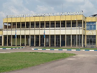
Bangoka International Airport is an airport serving Kisangani, Democratic Republic of the Congo. The airport is 12 kilometres (7.5 mi) east of the city.

Kindu Airport is an airport serving the Lualaba River port of Kindu, Democratic Republic of the Congo.
Kananga Airport is an airport serving Kananga, Democratic Republic of the Congo.
Muanda Airport or Moanda Airport is an airport serving Muanda, an Atlantic coastal city in the Democratic Republic of the Congo.

Gbadolite Airport is an airport serving Gbadolite, the capital of the Nord-Ubangi Province in the Democratic Republic of the Congo. The airport is at the village of Moanda, 6 kilometres (3.7 mi) southwest of Gbadolite.
Bunia Airport is an airport serving Bunia, a city in Orientale Province, Democratic Republic of the Congo.
Pichoy Airport is an airport 32 kilometres (20 mi) northeast of Valdivia, a city in the Los Ríos Region of Chile.
Andrés Sabella Gálvez International Airport is an airport serving Antofagasta, capital of the Antofagasta Region of Chile. It is 10 kilometres (6.2 mi) north of Antofagasta and 3 kilometres (1.9 mi) inland from the Pacific coastline.

Chacalluta International Airport is an airport serving the city of Arica, capital of the Arica Province in the northern Arica y Parinacota Region of Chile. It is 18.5 kilometres (11.5 mi) northwest of the city and 1 kilometre (0.62 mi) south of the border with Peru.

Cacique Aramare Airport is an airport serving Puerto Ayacucho, the capital of the Amazonas state in Venezuela. The airport and city are on the Orinoco River, locally the border between Venezuela and Colombia.
Gamboa Airport is an airport serving Castro, a city on Chiloé Island in the Los Lagos Region of Chile.
Mocopulli Airport is an airport serving Dalcahue, a port city on Chiloé Island in the Los Lagos Region of Chile. The airport is 6 kilometres (3.7 mi) northwest of Dalcahue.
Pupelde Airport is an airport serving Ancud, a Pacific port city in the Los Lagos Region of Chile. Ancud is on the northern shore of Chiloé Island.
Teniente Vidal Airport Spanish: Aeródromo Teniente Vidal, is an airport serving Coyhaique, capital of the Aysén Region of Chile. The airport is 3 kilometres (1.9 mi) southwest of Coyhaique.
General Freire Airport Spanish: Aeródromo General Freire, is an airport serving Curicó, a city in the Maule Region of Chile. The airport is within the northeast part of the city.
Frutillar Airport is an airport serving Frutillar, a town at the western end of Llanquihue Lake in the Los Lagos Region of Chile.
San Rafael Airport Spanish: Aeródromo de San Rafael de Los Andes, is an airport serving Los Andes, a city in the Valparaíso Region of Chile. The airport is 5 kilometres (3.1 mi) west-northwest of the city.
María Dolores Airport is an airport serving Los Ángeles, capital of Bío Bío Province in the Bío Bío Region of Chile.
El Mirador Airport, is an airport just southeast of Puerto Varas, a city in the Los Lagos Region of Chile. Puerto Varas is on the southwest shore of Llanquihue Lake.


