Newtown is a part of the Municipality of New-Wes-Valley, located at the North end of Bonavista Bay in the province of Newfoundland and Labrador, Canada. The approximate population is 400. Settlement in Newtown originated around 1850 when people relocated from nearby areas. Newtown is well known for being built on many small islands, and is the home of the Barbour Living Heritage Village.
Greenspond is a community in the province of Newfoundland and Labrador, Canada.
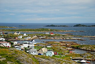
Clarke's Head, Newfoundland is the first community on the north side of the mouth of the Gander River. A small community, which joined with several other small communities, to form Gander Bay.
Baker's Tickle was a Canadian fishing settlement in the Burgeo, Newfoundland and Labrador District of the province of Newfoundland and Labrador.
Musgrave Harbour is a town in the Canadian province of Newfoundland and Labrador.
Bay de Verde is an incorporated town in Conception Bay on the northern tip of the Bay de Verde Peninsula of Newfoundland and Labrador, Canada. The first recorded inhabitants at Bay de Verde arrived in 1662. Bay de Verde became an incorporated town in 1950.
Cape Island is the name of both an island and a former community in the Canadian province of Newfoundland and Labrador.
Deadman's Bay is a local service district and designated place in the Canadian province of Newfoundland and Labrador. It is on the Straight Shore of Bonavista Bay near the community of Lumsden. The community is located near fishing grounds, contributing to its diversified and successful fishery despite its exposed, sandy coastline and harsh fall storms.
Indian Bay is located in Newfoundland, Canada.
Flowers Island was one of the communities in an area on the northeast coast of the Island of Newfoundland called Bonavista North. These communities have a shared history in that they were settled by people from England, predominantly from the West Country—Dorset, Devon Somerset and Hampshire.
Cape Freels is one of the communities that comprise an area on the northeast coast of the Island of Newfoundland, called Bonavista North, in the province of Newfoundland and Labrador, Canada. These communities have a shared history in that they were settled by people from England, predominantly from the West Country - Dorset, Devon, Somerset and Hampshire.
Pool's Island is an incorporated community of Badger's Quay-Valleyfield-Pool's Island in the province of Newfoundland and Labrador, Canada. It is now part of the town of New-Wes-Valley.
Swain's Island, Newfoundland, is actually a group of eight islands on the north side of Bonavista Bay, southeast of Wesleyville. All of these islands once had inhabitants but eventually all of them were resettled, mostly to Wesleyville.
Located on the northwest side of Bonavista Bay, Newfoundland at the mouth of the Indian Bay inlet is a small island named Silver Fox Island that was once inhabited. It is about 3 km in length and about 3 km from Fair Island. The first settling began at Warren's Harbour on the southern side of the island.
Pinchard's Island was one of the communities that comprise an area on the northeast coast of the Island of Newfoundland, called Bonavista North. These communities have a shared history in that they were settled by people from England, predominantly from the West Country - Dorset, Devon Somerset and Hampshire.

English Harbour East is a town in the Canadian province of Newfoundland and Labrador. It is located on the northeast side of Fortune Bay. Settled first by the Mi’kmaq of Newfoundland which used land on the "Neck" of the Harbour, they were joined in the early 1800s, by the English Dodge family and by Irishman Thomas Hynes Sr. European fishermen were first brought to the small community by English merchant family of Newman and Co. based in Harbour Breton, the firm of merchant John Gorman, and the Jersey firm of Nicholle and Co. The town had a population of 117 in the Canada 2021 Census.
Robert Dyer left the village of Heytesbury, in the county of Wiltshire, England, to voyage across the Atlantic Ocean to serve as a Newfoundland School Society teacher in the fishing community of Greenspond, Newfoundland. The Newfoundland School Society was established by the English merchant, Samuel Codner, who realised the need for educating the poor population of Newfoundland, and other poor colonies in British North America as well. Dyer first arrived in Newfoundland in 1839 and began his career as a teacher. He stayed in Greenspond for twenty years, earning the respect and admiration of the inhabitants and those who met or worked with him. Dyer was also ordained a Church of England Deacon in 1849; therefore, his work in Greenspond consisted of both teaching and ministerial duties. Dyer and his family later moved to Alberton, Prince Edward Island, where he was a minister in a Church of England Parish.
The Reverend Julian Moreton (1825–1900) was a Church of England (Anglican) clergyman and author who travelled from England to Newfoundland, Canada to be ordained as a missionary for the Society for the Propagation of the Gospel in Foreign Parts. He stayed for thirteen years, kept a detailed journal, and wrote a book, entitled "Life and work in Newfoundland: reminiscences of thirteen years spent there".

Samuel Blandford was a sealing captain and political figure in the Newfoundland Colony. He represented Bonavista Bay in the Newfoundland and Labrador House of Assembly from 1889 to 1893 as a Liberal.
Haystack was a former fishing settlement located on the northern portion of Long Island, Placentia Bay of the island of Newfoundland in the province of Newfoundland and Labrador, Canada. People from the community freely chose to move to other places in the province during the resettlement program of the 1950s and 60s. Unlike most communities, residents were not paid to leave the community.
