Related Research Articles

Cape Cod is a hook-shaped peninsula extending into the Atlantic Ocean from the southeastern corner of mainland Massachusetts, in the northeastern United States. Its historic, maritime character and ample beaches attract heavy tourism during the summer months. The name Cape Cod, coined in 1602 by Bartholomew Gosnold, is the ninth oldest English place-name in the U.S.

The Cape Cod Canal is an artificial waterway in the U.S. state of Massachusetts connecting Cape Cod Bay in the north to Buzzards Bay in the south, and is part of the Atlantic Intracoastal Waterway. The approximately seven-mile-long (11 km) canal traverses the neck of land joining Cape Cod to the state's mainland. It mostly follows tidal rivers widened to 480 feet (150 m) and deepened to 32 feet (9.8 m) at mean low water, shaving 135 miles (217 km) off the journey around the Cape for its approximately 14,000 annual users.

Fall River is a city in Bristol County, Massachusetts, United States. Fall River's population was 94,000 at the 2020 United States census, making it the tenth-largest city in the state.

Bourne is a town in Barnstable County, Massachusetts, United States. The population was 20,452 at the 2020 census.
The Charles River Dam Bridge, officially the Craigie Bridge, also called Craigie's Bridge or the Canal Bridge, is a six-lane bascule bridge across the Charles River in the West End neighborhood of Boston. The bridge, maintained by the Massachusetts Department of Conservation and Recreation, carries Massachusetts Route 28 next to the Green Line's Lechmere Viaduct. The Museum of Science is located on the dam and nearby piers. Charles River Dam Road connects Leverett Circle in the West End to East Cambridge, but most of the road is fixed, and the asymmetrically sited drawbridge is a short span entirely on the Boston side of the river.

Route 25 is a 10 mi (16 km)-long state highway located in Plymouth County and Barnstable County, Massachusetts, United States. The route is a nominally east–west freeway for its entire length, and less commonly known as the Blue Star Memorial Highway. An eastward continuation of Interstate 495, Route 25 provides freeway access to Cape Cod. The route's western terminus is at a trumpet interchange with I-495 and I-195 in West Wareham. The route has three numbered interchanges along its length before terminating at the northern end of the Bourne Bridge in Bourne; the mainline of Route 25 continues across the bridge and over the Cape Cod Canal as Massachusetts Route 28 south.

The Watuppa Branch is a roughly six-mile freight railroad line in southeastern Massachusetts. The track originates at Mount Pleasant Junction, where it diverges from the New Bedford Secondary, and runs through Dartmouth before terminating in north Westport. The line is owned by the Massachusetts Department of Transportation and is operated by Bay Colony Railroad, which interchanges with Massachusetts Coastal Railroad at the junction in New Bedford. The abandoned western portion of the right-of-way is used by the Quequechan River Rail Trail.

The Bourne Bridge in Bourne, Massachusetts, carries Route 28 across the Cape Cod Canal, connecting Cape Cod with the rest of Massachusetts. It won the American Institute of Steel Construction's Class "A" Award of Merit as the "Most Beautiful Steel Bridge" in 1934. Most traffic approaching from the west follows Route 25 which ends at the interchange with US 6 and Route 28 just north of the bridge. The highway provides freeway connections from Interstate 495 and Interstate 195.
The Sagamore Bridge in Sagamore, Massachusetts carries Route 6 and the Claire Saltonstall Bikeway across the Cape Cod Canal, connecting Cape Cod with the mainland of Massachusetts. It is the more northeastern of two automobile canal crossings, the other being the Bourne Bridge. Most traffic approaching from the north follows Massachusetts Route 3 which ends at Route 6 just north of the bridge, and the bridge provides direct expressway connections from Boston and Interstate 93.

The Cape Cod Canal Railroad Bridge, a vertical lift bridge in Bourne, Massachusetts near Buzzards Bay, carries railroad traffic across the Cape Cod Canal, connecting Cape Cod with the mainland.

The Charles M. Braga Jr. Memorial Bridge, also known as the Braga Bridge, is a through truss bridge that carries Interstate 195 over the Taunton River between the town of Somerset and the city of Fall River, near the mouth of the Quequechan River at the confluence with Mount Hope Bay. At just over a mile long, it is one of the longest bridges in Massachusetts. Opened to traffic on April 15, 1966, it provides an important link between Providence, Rhode Island, New Bedford, and Cape Cod.

WSP , is a multinational engineering and design firm. WSP stands for Williams Sale Partnership. The firm operates in the fields of strategic consulting, planning, engineering, construction management, energy, infrastructure and community planning.

The Quequechan River is a river in Fall River, Massachusetts, that flows in a northwesterly direction from the northwest corner of the South Watuppa Pond through the heart of the city of Fall River and into the end of the Taunton River at Mount Hope Bay at Heritage State Park/Battleship Cove. The word Quequechan means "Falling River" or "Leaping/Falling Waters" in Wampanoag, hence the city's name.

U.S. Route 6 (US 6) in Massachusetts is a 117.952-mile-long (189.825 km) portion of the cross-country route connecting Providence, Rhode Island, to Fall River, New Bedford, and Cape Cod. In the Fall River and New Bedford areas, US 6 parallels Interstate 195 (I-195). On Cape Cod, US 6 is a highway interconnecting the towns of the area. The expressway section in this area is also known as the Mid-Cape Highway. The highway is also alternatively signed as the "Grand Army of the Republic Highway".

The Hampden County Memorial Bridge is a reinforced-concrete arch bridge that spans the Connecticut River between Springfield, Massachusetts and West Springfield, Massachusetts, constructed in 1922. The bridge is owned by Massachusetts Highway Department and is located on Massachusetts Route 147. It spans 209 feet (64 m) and rises 29.71 feet (9.06 m) above the river.

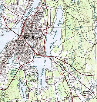
The Watuppa Ponds are two large, naturally occurring, spring-fed, glacially formed ponds located in Fall River and Westport, Massachusetts. Watuppa is a native word meaning "place of boats". The two ponds were originally one body of water, connected by a narrow rocky straight called "The Narrows" located on a thin strip of land between the two ponds which forms part boundary of between Fall River and Westport. The border between Fall River and Westport is also divided between the two ponds. Together, the ponds have an overall north–south length of about 7.5 miles, and have an average east–west width of about a mile. The ponds are drained by the Quequechan River, and flows in a westerly direction through the center of Fall River from South Watuppa Pond to Mount Hope Bay.

Buzzards Bay station is a train station located on Main Street in Buzzards Bay, Massachusetts. The site also contains an interlocking tower. The Cape Cod Canal Railroad Bridge is adjacent.

The CapeFlyer is a passenger rail service in Massachusetts between Boston and Cape Cod that began in 2013. It is operated by the Cape Cod Regional Transit Authority (CCRTA) in collaboration with the Massachusetts Bay Transportation Authority (MBTA) and the Massachusetts Department of Transportation (MassDOT). The service runs on the weekends, beginning Friday evenings and including holidays, between Memorial Day weekend and Labor Day weekend.

Bournedale station was a railroad station serving Bournedale, Massachusetts. Opened in 1848, it was relocated in 1911 during construction of the Cape Cod Canal and closed in the 1920s.
References
- ↑ "Cape & Plymouth Business Magazine". www.capeplymouthbusiness.com. Archived from the original on 2017-02-02. Retrieved 2017-01-26.
- ↑ "ACEC – Past Chairmen". www.acec.org. Retrieved 2017-01-26.
- ↑ Technology, Massachusetts Institute of (1911-01-01). Catalogue Issue. Massachusetts Institute of Technology.
- ↑ Hager, Willi H. (2015-12-23). Hydraulicians in the USA 1800–2000: A biographical dictionary of leaders in hydraulic engineering and fluid mechanics. CRC Press. ISBN 9781315680125.
- ↑ Fall River (Mass. ). Watuppa Ponds and Quequechan River Commission (1915-01-01). Report of the Watuppa Ponds and Quequechan River Commission to the city council, city of Fall River. : Together with the report of Fay, Spofford and Thorndike, consulting engineers. Fall River.
- ↑ Commission, Fall River (Mass ) Watuppa Ponds and Quequechan River; Commission, Watuppa Ponds and Quequechan River (1915). Report of the Watuppa Ponds and Quequechan River Commission to the City Council, City of Fall River: Together with the Report of Fay, Spofford and Thorndike, Consulting Engineers. Fort Hill Press.
- ↑ "New England District > Missions > Recreation > Cape Cod Canal > History". www.nae.usace.army.mil. Retrieved 2017-01-26.
- ↑ "Logan Int'l Builds Concrete Pier Over Boston Harbor to Support Runway Safety Area Extension | Airport Improvement Magazine". www.airportimprovement.com. Retrieved 2017-01-26.
- ↑ "Investors sought for a third bridge over Cape Cod Canal – The Boston Globe". BostonGlobe.com. Retrieved 2017-01-26.