
Mali is a landlocked nation in West Africa, located southwest of Algeria, extending south-west from the southern Sahara Desert through the Sahel to the Sudanian savanna zone. Mali's size is 1,240,192 square kilometers.

A dust storm, also called a sandstorm, is a meteorological phenomenon common in arid and semi-arid regions. Dust storms arise when a gust front or other strong wind blows loose sand and dirt from a dry surface. Fine particles are transported by saltation and suspension, a process that moves soil from one place and deposits it in another.

A radiosonde is a battery-powered telemetry instrument carried into the atmosphere usually by a weather balloon that measures various atmospheric parameters and transmits them by radio to a ground receiver. Modern radiosondes measure or calculate the following variables: altitude, pressure, temperature, relative humidity, wind, cosmic ray readings at high altitude and geographical position (latitude/longitude). Radiosondes measuring ozone concentration are known as ozonesondes.

The Sahara is a desert spanning North Africa. With an area of 9,200,000 square kilometres (3,600,000 sq mi), it is the largest hot desert in the world and the third-largest desert overall, smaller only than the deserts of Antarctica and the northern Arctic.

Tindouf, also written Tinduf, is the westernmost province of Algeria, having a population of 58,193 as of the 2008 census. Its population in reality could be as high as 160,000 because of the Sahrawi refugee camps. Despite the barren landscape, Tindouf is a resource-rich province, with important quantities of iron ore located in the Gara Djebilet area close to the border with Mauritania. Prior to Algerian independence, the area served as a strongpoint of several tribes of the nomadic Reguibat confederation.
Reggane is a town and commune, and the capital of Reggane District, in Adrar Province, central Algeria. Reggane lies in the Sahara Desert near an oasis. According to the 2008 census it has a population of 20,402, up from 14,179 in 1998, with an annual growth rate of 3.8%. Berber tribes and people live in and around Reggane.
Adrar is the administrative capital of Adrar Province, the second largest province in Algeria. The commune is sited around an oasis in the Touat region of the Sahara Desert. According to a 2008 census it has a population of 64,781, up from 43,903 in 1998, with an annual growth rate of 4.0%.

Bordj Badji Mokhtar is a town and commune in Bordj Badji Mokhtar District, Bordj Badji Mokhtar Province, in south-western Algeria. According to the 2008 census it has a population of 16,437, up from 9,323 in 1998, with an annual growth rate of 6.0%, the highest in the province. It was named after the Algerian independence activist Badji Mokhtar (1919–1954).

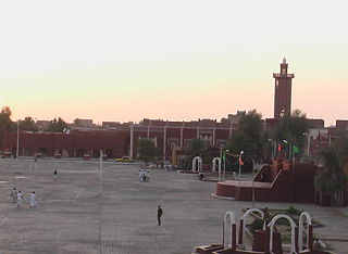
Tamanrasset, also known as Tamanghasset or Tamenghest, is an oasis city and capital of Tamanrasset Province in southern Algeria, in the Ahaggar Mountains. It is the chief city of the Algerian Tuareg. It is located an altitude of 1,320 metres (4,330 ft). As of the 2008 census, it has a population of 92,635, up from 72,741 in 1998, with an annual growth rate of 2.5%.
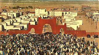
Tindouf is the main town, and a commune in Tindouf Province, Algeria, close to the Mauritanian, Western Saharan and Moroccan borders. The commune has a population of around 160,000, but the census and population estimates do not count the Sahrawi refugees, making the population as of the 2008 census 45,966, up from 25,266 in 1998, giving the town an annual population growth rate of 6.3%.
Opération Lamantin was a December 1977 – July 1978 military intervention by France on the behalf of the Mauritanian government, in its war against Sahrawi guerrilla fighters of the Polisario Front, seeking independence for Western Sahara. Airstrikes were launched in the provinces with the aim of stopping separatist raids in the rail route from the iron mines in Zouérat to the coast of Nouadhibou, and pushing them to release French hostages. France used Jaguar combat aircraft from Dakar Airbase. The bombings targeted areas around the railway, which was constantly raided by Polisario. With the release of the hostages and the halt of Polisario's attacks on ore cargo, the mission was deemed successful.

Meteorological instruments, including meteorological sensors, are the equipment used to find the state of the atmosphere at a given time. Each science has its own unique sets of laboratory equipment. Meteorology, however, is a science which does not use much laboratory equipment but relies more on on-site observation and remote sensing equipment. In science, an observation, or observable, is an abstract idea that can be measured and for which data can be taken. Rain was one of the first quantities to be measured historically. Two other accurately measured weather-related variables are wind and humidity. Many attempts had been made prior to the 15th century to construct adequate equipment to measure atmospheric variables.

The following outline is provided as an overview of and topical guide to the field of Meteorology.

The Atlantic coastal desert is the westernmost ecoregion in the Sahara Desert of North Africa. It occupies a narrow strip along the Atlantic coast, where the more frequent fog and haze generated offshore by the cool Canary Current provides sufficient moisture to sustain a variety of lichens, succulents, and shrubs.

Timiaouine is a town and commune in Bordj Badji Mokhtar District, Bordj Baji Mokhtar Province, in southwest Algeria near the border with Mali. According to the 2008 census it has a population of 4,493, up from 4,206 in 1998, with an annual growth rate of 0.7%, the lowest rate in the province.
During the late colonial period, Mauritania had few contacts with the other territories of French West Africa. At the time of the independence referendum in 1958, Mauritania's representatives on the Grand Council of the AOF remained neutral, while all other AOF members divided between the African Democratic Rally and the African Regroupment Party. Until Mauritania became independent and Morocco threatened its security, Mauritania did not participate in AOF intraterritorial political, labor, or cultural movements. Only when Mauritania's existence as a state became problematic did it seek international recognition and support.

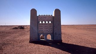
The Algeria–Mali border is 1,359 km in length and runs from the tripoint with Mauritania in the north-west to the tripoint with Niger in the south-east.
Richard Washington is a South African climate scientist and meteorologist. He is Professor of Climate Science at the School of Geography and the Environment at the University of Oxford, as well as being the Director of the Radcliffe Meteorological Station, which has the longest single-site weather records in the United Kingdom. He is a fellow of Keble College, Oxford.
Lahbib Sid Ahmed Aouba, known as Lahbib Ayoub was a Western Saharan militant and co-founder of the Polisario Front. He led many conflicts with the group before joining Morocco in 2002.
