Fenton and surrounds

Last updated

Fenton and surrounds
Entrance to Fenton and surrounds, 8 Albert Street, Edgecliff, NSW.jpg
Entrance to Fenton and surrounds, 8 Albert Street, Edgecliff, NSW
Location8 Albert Street, Edgecliff, Municipality of Woollahra, New South Wales, Australia
Coordinates 33°52′50″S151°14′19″E / 33.8806°S 151.2387°E / -33.8806; 151.2387
Official nameFenton and surrounds
TypeState heritage (built)
Designated2 April 1999
Reference no.249
TypeHouse
CategoryResidential buildings (private)
Location map Australia Sydney.png
Red pog.svg
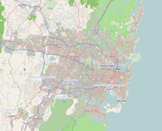
Location of Fenton and surrounds in Sydney

Fenton and surrounds is a heritage-listed house at 8 Albert Street, Edgecliff, Municipality of Woollahra, New South Wales, Australia. The house was designed by Robin Dods in 1919. It was added to the New South Wales State Heritage Register on 2 April 1999. [1] The property is privately owned.
Contents

History

The site was originally part of the Orielton Estate, [2] which had been built in Edgecliff in the 1860s. Following subdivision in 1918, Dods purchased the largest of the 4 allotments and built his most important house. It drew on his years of practice and, as his own house, it was presumably an opportunity to realise much more of his vision. Whether Dods knew Fenton would be his last house is uncertain, but during its construction he became progressively weaker and eventually, around the time of its completion, had ceased work altogether. [3] The home was passed down to Dod's son and pioneering Australian pediatrician, [4] Sir Lorimer Fenton Dods.

Heritage listing

Fenton and surrounds was listed on the New South Wales State Heritage Register on 2 April 1999. [1]

Description

Fenton is set on 1,410 square metres (15,177 sq ft). Situated down a long brick paved driveway planted with tall Cypress pines, the drive opens into a walled garden. The home sits modestly elevated on sandstone dressings, with a recessed entrance porch framed by simple columns. The main entrance door sits between elegant carved jambs with sidelights and an elaborate leaded fanlight of Georgian derivation above. [5]

Related Research Articles

<span class="mw-page-title-main">Redfern, New South Wales</span> Inner suburb of Sydney, Australia

Redfern is an inner southern suburb of Sydney located 3 kilometres (1.9 mi) south of the Sydney central business district and is part of the local government area of the City of Sydney. Strawberry Hills is a locality on the border with Surry Hills. The area experienced the process of gentrification and is subject to extensive redevelopment plans by the state government, to increase the population and reduce the concentration of poverty in the suburb and neighbouring Waterloo.

<span class="mw-page-title-main">Richmond, New South Wales</span> Town in New South Wales, Australia

Richmond is a town in New South Wales, in the local government area of the City of Hawkesbury. It is located 19 metres above sea level on the alluvial Hawkesbury River flats, at the foot of the Blue Mountains on the Cumberland Plain. It is about 65 km by road from Sydney and about 78 km by road from Lithgow.

<span class="mw-page-title-main">The Rocks, New South Wales</span> Suburb of Sydney, New South Wales, Australia


The Rocks is a suburb, tourist precinct and historic area of Sydney's city centre, in the state of New South Wales, Australia. It is located on the southern shore of Sydney Harbour, immediately north-west of the Sydney central business district.

<span class="mw-page-title-main">Surry Hills, New South Wales</span> Suburb of Sydney, New South Wales, Australia

Surry Hills is an inner-east suburb of Sydney, in the state of New South Wales, Australia. Surry Hills is immediately south-east of the Sydney central business district in the local government area of the City of Sydney. Surry Hills is surrounded by the suburbs of Darlinghurst to the north, Chippendale and Haymarket to the west, Moore Park and Paddington to the east and Redfern to the south. It is often colloquially referred to as "Surry".

<span class="mw-page-title-main">Windsor, New South Wales</span> Suburb of City of Hawkesbury, New South Wales, Australia

Windsor is a historic town north-west of Sydney, New South Wales, Australia. It is the council seat of the Hawkesbury local government area. The town sits on the Hawkesbury River, enveloped by farmland and Australian bush. Many of the oldest surviving European buildings in Australia are located at Windsor. It is 46 km (29 mi) north-west of metropolitan Sydney, on the fringes of urban sprawl.

<span class="mw-page-title-main">Francis Greenway</span> Architect

Francis Howard Greenway was an English-born architect who was transported to Australia as a convict for the crime of forgery. In New South Wales he worked for the Governor, Lachlan Macquarie, as Australia's first government architect. He became widely known and admired for his work displayed in buildings such as St Matthew's Church, St James' Church and Hyde Park Barracks.

<span class="mw-page-title-main">Double Bay, New South Wales</span> Suburb of Sydney, New South Wales, Australia

Double Bay is a harbourside eastern suburb of Sydney, in the state of New South Wales, Australia 4 kilometres east of the Sydney central business district. It is the administrative centre of the local government area of the Municipality of Woollahra.

<span class="mw-page-title-main">Watsons Bay, New South Wales</span> Suburb of Sydney, New South Wales, Australia

Watsons Bay is a harbourside, eastern suburb of Sydney, in the state of New South Wales, Australia. Watsons Bay is located 11 km north-east of the Sydney central business district, in the local government area of the Municipality of Woollahra.

John Verge (1782–1861) was an English architect, builder, pioneer settler in the Colony of New South Wales, who migrated to Australia and pursued his career there. Verge was one of the earliest and the most important architect of the Greek Revival in Australia. He also brought more comprehensive range of Regency style than any contemporary architects. His design indicates the increasing of sophistication compared to previous architect's design.

<span class="mw-page-title-main">Edgecliff, New South Wales</span> Suburb of Sydney, New South Wales, Australia

Edgecliff is a small suburb in the Eastern Suburbs of Sydney, in the state of New South Wales, Australia. Edgecliff is located 4 kilometres east of the Sydney central business district, in the local government area of the Municipality of Woollahra. The postcode is 2027.

<span class="mw-page-title-main">City of Campbelltown (New South Wales)</span> Local government area in New South Wales, Australia

The City of Campbelltown is a local government area in the Macarthur region of south-western Sydney, in New South Wales, Australia. The area is located about 55 kilometres (34 mi) south west of the Sydney central business district and comprises 312 square kilometres (120 sq mi).

<span class="mw-page-title-main">Municipality of Woollahra</span> Local government area in New South Wales, Australia

Woollahra Municipal Council is a local government area in the eastern suburbs of Sydney, in the state of New South Wales, Australia. Woollahra is bounded by Sydney Harbour in the north, Waverley Council in the east, Randwick City in the south and the City of Sydney in the west.

<span class="mw-page-title-main">Millers Point, New South Wales</span> Suburb of Sydney, New South Wales

Millers Point is an inner-city suburb of Sydney, in the state of New South Wales, Australia. It is on the north-western edge of the Sydney central business district, adjacent to The Rocks and is part of the local government area of the City of Sydney.

<span class="mw-page-title-main">Darling Point</span> Suburb of Sydney, New South Wales, Australia

Darling Point is a harbourside eastern suburb of Sydney, Australia. It is 4 kilometres east of the Sydney central business district and is part of the local government area of Woollahra Council.

<span class="mw-page-title-main">Walter Liberty Vernon</span>

Colonel Walter Liberty Vernon was an English architect who migrated to Australia and pursued his career as an architect in Sydney, New South Wales. In his role as the New South Wales Government Architect he is noted for designing multiple government buildings, many of which are extant with listings on national and state heritage registers.

<span class="mw-page-title-main">George McRae</span>

George McRae was a Scottish-Australian architect who migrated from his native Edinburgh to Sydney, where he became Government Architect of New South Wales and designed some of Sydney's best-known buildings, including completion of the Sydney Town Hall, the Queen Victoria Building, and the lower entrance to Taronga Zoo.

<span class="mw-page-title-main">Robin Dods</span> New Zealand-born Australian architect (1868 - 1920)

Robert Smith (Robin) Dods was a New Zealand-born Australian architect.

<span class="mw-page-title-main">Registrar-General's building</span> Government administration in New South Wales, Australia

The Registrar-General's building, also called the Land Titles Office, is a heritage-listed building located in the Sydney central business district, in New South Wales, Australia. The building is currently used by the Land and Property Information division of the Department of Finance, Services and Innovation, part of the Government of New South Wales. It was added to the New South Wales State Heritage Register on 2 April 1999.

<span class="mw-page-title-main">Ultimo Post Office</span> Historic site in New South Wales, Australia

The Ultimo Post Office is a heritage-listed former post office located at 494 Harris Street in the inner city Sydney suburb of Ultimo in the City of Sydney local government area of New South Wales, Australia. The property is owned by Trustees of the Museum of Applied Arts and Science, an agency of the Government of New South Wales. It was added to the New South Wales State Heritage Register on 2 April 1999.

References

  1. 1 2 "Fenton and surrounds". New South Wales State Heritage Register . Department of Planning & Environment. H00249. Retrieved 1 June 2018. CC BY icon.svg Text is licensed by State of New South Wales (Department of Planning and Environment) under CC-BY 4.0 licence .
  2. State Library, New South Wales. "Edgecliff subdivision plans". www2.sl.nsw.gov.au. Retrieved 10 October 2021.{{cite web}}: CS1 maint: url-status (link)
  3. Riddel, Robert (2012). Robin Dods, Selected Works. Uro Media. p. 181. ISBN   9780987228116.
  4. Yu, John (2007). "Dods, Sir Lorimer Fenton (1900–1981)". Australian Dictionary of Biography.{{cite web}}: CS1 maint: url-status (link)
  5. "Fenton - The Residence of Mr. R.S. Dods". The Home: An Australian Quarterly. 1 (1): 30–31. 1920 [1 February 1920].

Commons-logo.svg Media related to Fenton and surrounds at Wikimedia Commons

Attribution

CC BY icon-80x15.png This Wikipedia article was originally based on Fenton and surrounds , entry number 00249 in the New South Wales State Heritage Register published by the State of New South Wales (Department of Planning and Environment) 2018 under CC-BY 4.0 licence , accessed on 1 June 2018.