
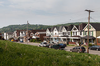
Elizabeth is a borough in Allegheny County, Pennsylvania, United States, on the east bank of the Monongahela River, where Pennsylvania Route 51 crosses, 15 miles (24 km) upstream (south) of Pittsburgh and close to the county line. The population was 1,398 at the 2020 census. The borough of Elizabeth is entirely contained within the 15037 USPS ZIP code. The local school district is the Elizabeth Forward School District. The borough is home to neighborhoods Walker Heights and Town Hill.
Glassport is a borough in Allegheny County, Pennsylvania, United States, approximately 10 miles (16 km) south of Pittsburgh and the confluence of the Monongahela and Allegheny rivers where they form the Ohio River. Glassport lies along the east side of the Monongahela River in the "Mon Valley", where many blue-collar municipalities have suffered severe economic decline in the wake of the loss of steel-making throughout the Greater Pittsburgh area. In 1910, the population of Glassport was 5,540. By 1940, it had risen to 8,748, but has since declined to 4,475 as of the 2020 census.

Liberty is a borough in Allegheny County, Pennsylvania, United States. The population was 2,355 at the 2020 census.

Lincoln is a borough in Allegheny County, Pennsylvania, United States. The population was 932 at the 2020 United States Census.
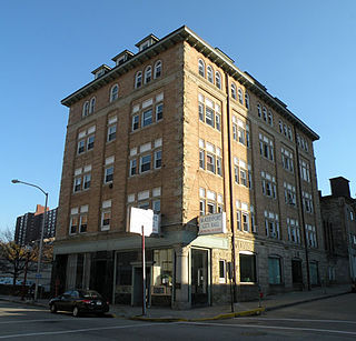
McKeesport is a city in Allegheny County, Pennsylvania, United States. A suburb of Pittsburgh, it is situated at the confluence of the Monongahela and Youghiogheny rivers. The population was 17,727 as of the 2020 census.
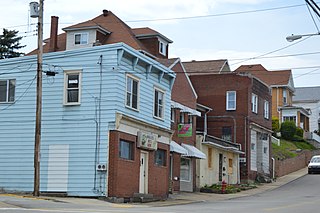
Port Vue is a borough in Allegheny County, Pennsylvania, United States. The population was 3,680 at the 2020 census.

White Oak is a borough in Allegheny County, Pennsylvania, United States. The population was 7,630 at the 2020 census. It is a suburb of the Pittsburgh metropolitan area. White Oak was named for a stand of white oak trees near the original town site.
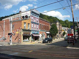
West Newton, located 24.5 miles (39.4 km) southeast of Pittsburgh, is a borough in Westmoreland County in the U.S. state of Pennsylvania. Formerly, the manufacture of radiators and boilers were the chief industries. The population was 2,633 at the 2010 census.
The Pittsburgh and Lake Erie Railroad, also known as the "Little Giant", was formed on May 11, 1875. Company headquarters were located in Pittsburgh, Pennsylvania. The line connected Pittsburgh in the east with Youngstown, Ohio, in the Haselton neighborhood in the west and Connellsville, Pennsylvania, to the east. It did not reach Lake Erie until the formation of Conrail in 1976. The P&LE was known as the "Little Giant" since the tonnage that it moved was out of proportion to its route mileage. While it operated around one tenth of one percent of the nation's railroad miles, it hauled around one percent of its tonnage. This was largely because the P&LE served the steel mills of the greater Pittsburgh area, which consumed and shipped vast amounts of materials. It was a specialized railroad, deriving much of its revenue from coal, coke, iron ore, limestone, and steel. The eventual closure of the steel mills led to the end of the P&LE as an independent line in 1992.
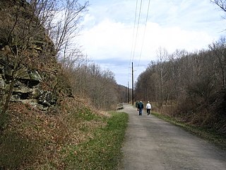
The Montour Trail is a multi-use recreational rail trail near Pittsburgh, Pennsylvania. It was formerly the Montour Railroad.

The Pinkerton's Surrender Bridge is a truss bridge that carries CSX Transportation's Pittsburgh Subdivision across the Monongahela River between Munhall, Pennsylvania and Rankin, Pennsylvania, United States. The structure's nickname references the 1892 Homestead strike, in which Pinkerton forces surrendered to striking union steelworkers.
The Keystone Subdivision is a railroad line owned and operated by CSX Transportation in the U.S. states of Maryland and Pennsylvania. The line runs from Cumberland, Maryland, west to McKeesport, Pennsylvania, along a former Baltimore and Ohio Railroad (B&O) line. The line includes the well-known Sand Patch Grade over the Allegheny Mountains.

The Pittsburgh Subdivision is an American railroad line that is owned and operated by CSX Transportation in the Commonwealth of Pennsylvania.
The Memorial Bridge is a structure that crosses the Youghiogheny River, connecting the eastern and western shores of Connellsville, Pennsylvania, US.
The P&LE McKeesport Bridge is an American truss bridge which spans the Youghiogheny River and connects the east and west banks of the Pittsburgh industrial suburb of McKeesport, Pennsylvania.

The Jerome Street Bridge is an arch bridge across the Youghiogheny River connecting the east and west banks of the Pittsburgh industrial suburb of McKeesport, Pennsylvania. The bridge is a rare steel crescent arch bridge. A crescent arch is formed when the intrados and extrados of the arch are not parallel, but instead form two different curves beginning and ending together. The ribs form a truss at the top of the arch and join together in a solid rib at each end. A crescent arch is a two-hinged arch, the ribs are further apart where the bending moment is greatest and close together at each hinge where it is minimized.
The P&LE Liberty Boro Bridge is a girder bridge across the Youghiogheny River connecting the Pittsburgh industrial suburbs of Liberty and McKeesport, Pennsylvania. In 1968, the Pittsburgh & Lake Erie Railroad undertook a major construction project in conjunction with the B&O Railroad to clear tracks from downtown McKeesport. These tracks caused traffic congestion and posed a safety hazard. As a result, both this bridge and the nearby P&LE McKeesport Bridge were created to direct rail traffic to the west bank of the river, which featured a less confusing street grid.
The Sutersville Bridge is a structure that crosses the Youghiogheny River between Sutersville and Elizabeth Township, Pennsylvania. It connects a rural southeastern corner of Allegheny County with a small Westmoreland County town.

The PATrain, also known as Mon Valley Commuter Rail, was a commuter rail service owned by the Port Authority of Allegheny County in the Monongahela Valley in the US state of Pennsylvania. Service began in 1975 when the Port Authority assumed ownership of the Pittsburgh–McKeesport–Versailles commuter trains operated by the Baltimore and Ohio Railroad (B&O) with the support of PennDOT. The Port Authority discontinued the service in 1989.
The Township of Versailles was one of the seven original townships of Allegheny County, Pennsylvania created during the first meeting of the Allegheny County Court in 1788. The other townships were Pitt, Plum, St. Clair, Moon, Mifflin, and Elizabeth. Versailles was named for Versailles, France, in honor of the United States' French allies during the American Revolution.
