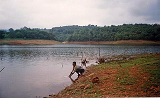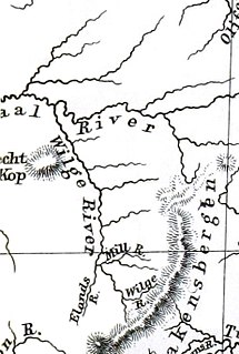
Bon Accord Dam is an earth-fill type dam located on the Apies River, some 15 km north of Pretoria. The dam comprises an earth embankment with a side spillway. The catchment area of the dam is 315 km² and comprises primarily the City of Tshwane Metropolitan Municipal area in Gauteng, South Africa. It was established in 1923 and its main purpose is irrigation.
Bospoort Dam is a gravity/earth-fill type dam on the Hex River, a tributary of the Elands River, part of the Crocodile River (Limpopo) basin. It is located near Rustenburg, North West, South Africa. Its primary purpose is for irrigation.
Craigie Burn Dam is an arch/earth-fill type dam located on the Mnyamvubu River, near Greytown, KwaZulu-Natal, South Africa. It was established in 1963 and its primary purpose is for irrigation usage. Recent assessments however, assign a significant hazard potential to the dam/reservoir which in turn makes the intended use questionable.
Glen Alpine Dam is a combined gravity and earth-fill type dam located on the Mogalakwena River, near Ga-Mankgodi, Bochum Limpopo, South Africa. It was established in 1968 and its main purpose is for irrigation use. The hazard potential of the dam has been ranked as high (3).
Grootdraai Dam is a combined gravity and earth-fill type dam located on the Vaal River, near Standerton, Mpumalanga, South Africa. It was established in 1981.
Heyshope Dam is a zoned earth-fill type dam located on the Assegaai River, Mpumalanga, South Africa. It was established in 1986. Its main purpose is to serve for municipal and industrial use. The hazard potential of the dam construction has been ranked high (3).
Impofu Dam is a combined rock-fill/earth-fill type dam located on the Kromme River, near Humansdorp, Eastern Cape, South Africa. It was established in 1983 and its primary purpose is to serve for municipal and industrial use. The hazard potential of the dam construction has been ranked high (3).

Inanda Dam is an earth-fill type dam located on the Mgeni River, near Hillcrest, KwaZulu-Natal, South Africa. It was established in 1989 and its primary purpose is to serve for domestic and industrial use.
Mokolo Dam is a rock-fill type dam located on the Mokolo River, near Lephalale, Limpopo, South Africa. It was established in 1980. The Malmanies River and the Bulspruit River, two tributaries of the Mokolo, also enter the dam from its left side. The dam supplies water to Lephalale town. The dam mainly serves for municipal and industrial purposes and its hazard potentials has been ranked high (3).
Molatedi Dam is an earth-fill type dam located on the Marico River, near Zeerust, North West, South Africa. It was established in 1986 and serves mainly for irrigation purposes and domestic supply. The hazard potential of the dam has been ranked high (3).
Injaka Dam, also spelled Inyaka Dam is an earth-fill type dam located on the Ngwaritsane River, near Bushbuckridge, Mpumalanga, South Africa. It was established in 2001 and its primary purpose is to store water for irrigation use. The hazard potential of the dam has been ranked as high (3).

The Crocodile River is a river in South Africa. After its confluence with the Marico River, both rivers form the Limpopo River.
Makuleke Dam is an earth-fill type dam located on the Mphongolo River, a tributary of the Shingwedzi River. It is located near Giyani, Limpopo, South Africa. The dam was established in 1990 and serves mainly for irrigation purposes. The hazard potential of the dam has been ranked significant (2).
Mthatha Dam is an earth-fill type dam located on the Mthatha River, near Mthatha, Eastern Cape, South Africa. It was established in 1977 and serves mainly for municipal and industrial purposes. Its hazard potential has been ranked high (3).
Ngotwane Dam is an earth-fill type dam located on the Ngotwane River, near Lobathleng, North West, South Africa. It was established in 1982 and serves primarily for irrigation purposes. The hazard potential of the dam has been ranked significant (2).
Rockview Dam is a zoned earth-fill/rock-fill type dam located on the Palmiet River near Grabouw, Western Cape, South Africa. It was established in 1986 and serves mainly for pumping purposes (storage). The hazard potential of the dam has been ranked high (3).
Setumo Dam is an earth-fill type dam located on the Molopo River near Mmabatho, North West, South Africa. It was established in 1997 and serves mainly for water storage/regulation purposes. The hazard potential of the dam has been ranked significant.
Vondo Dam is an earth-fill type dam located on the Mutshindudi River near Sibasa, Limpopo, South Africa. It was established in 1985 and has been renovated in 1994. The dam serves mainly for irrigation purposes and its hazard potential has been ranked high (3).
Waterdown Dam is an earth-fill type dam (reservoir) located on the Klipplaat River near Whittlesea, Eastern Cape, South Africa. It supplies Queenstown with drinking water and was established in 1958. The hazard potential of the dam has been ranked high (3).

Tzaneen Dam is an earth-fill type dam located on the Groot Letaba River, near Tzaneen, Limpopo, South Africa. The dam supplies domestic water to Polokwane and Tzaneen, and irrigation water to the Letaba valley. The hazard potential of the dam has been ranked high (3).


