Fire Prairie Creek

Last updated

Fire Prairie Creek is a stream in the U.S. state of Missouri. [1]

Stream A body of surface water flowing down a channel

A stream is a body of water with surface water flowing within the bed and banks of a channel. The stream encompasses surface and groundwater fluxes that respond to geological, geomorphological, hydrological and biotic controls.

U.S. state constituent political entity of the United States

In the United States, a state is a constituent political entity, of which there are currently 50. Bound together in a political union, each state holds governmental jurisdiction over a separate and defined geographic territory and shares its sovereignty with the federal government. Due to this shared sovereignty, Americans are citizens both of the federal republic and of the state in which they reside. State citizenship and residency are flexible, and no government approval is required to move between states, except for persons restricted by certain types of court orders.

Missouri U.S. state in the United States

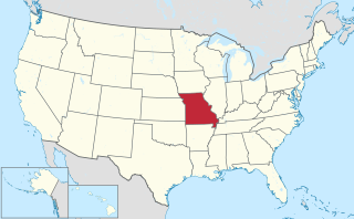
Missouri is a state in the Midwestern United States. With over six million residents, it is the 18th-most populous state of the Union. The largest urban areas are St. Louis, Kansas City, Springfield and Columbia; the capital is Jefferson City. The state is the 21st-most extensive in area. Missouri is bordered by eight states : Iowa to the north, Illinois, Kentucky and Tennessee to the east, Arkansas to the south and Oklahoma, Kansas and Nebraska to the west. In the South are the Ozarks, a forested highland, providing timber, minerals and recreation. The Missouri River, after which the state is named, flows through the center of the state into the Mississippi River, which makes up Missouri's eastern border.

Fire Prairie Creek was named for a prairie fire during pioneer days. [2]

See also

Related Research Articles

Lone Oak Township, Bates County, Missouri Township in Missouri, United States

Lone Oak Township is one of twenty-four townships in Bates County, Missouri, USA. As of the 2000 census, its population was 293.

Holmes Creek is a stream in Clay County in the U.S. state of Missouri.

Shoal Township is an inactive township in Clinton County, in the U.S. state of Missouri.

Alta Vista is an unincorporated community in Daviess and DeKalb counties, in the U.S. state of Missouri.

Lost Creek is a stream in DeKalb and Gentry counties in the U.S. state of Missouri.It is a tributary of Grindstone Creek.

Wamsley Creek is a stream in Daviess and DeKalb Counties in the U.S. state of Missouri.

Horseshoe Creek is a stream in Jackson and Lafayette counties in the U.S. state of Missouri. It is a tributary of Sni-A-Bar Creek.

Rock Creek is a stream in Jackson County in the U.S. state of Missouri. It is a tributary of the Missouri River.

Round Grove Creek is a stream in Jackson County in the U.S. state of Missouri.

Sni-A-Bar Creek is a stream in Jackson and Lafayette counties in the U.S. state of Missouri. It is a tributary of the Missouri River.

Sugar Creek is a stream in Jackson County in the U.S. state of Missouri. It is a tributary of the Missouri River.

Blue Township is an inactive township in Jackson County, in the U.S. state of Missouri.

Prairie Township is an inactive township in Jackson County, in the U.S. state of Missouri.

Sni-A-Bar Township is an inactive township in Jackson County, in the U.S. state of Missouri.

New Market is an unincorporated community in northern Platte County, in the U.S. state of Missouri. The community is located on Missouri Route 371 about 1.5 miles south of the Platte-Buchanan county line. Dearborn is two miles to the northeast across U.S. Route 71 and Bee Creek flows past the west side of the community.

Prairie Branch is a stream in Pike County in the U.S. state of Missouri. It is a tributary of Indian Creek.

Bee Creek is a stream in Buchanan and Platte counties of the U.S. state of Missouri. It is a tributary of the Missouri River.

Prairie Creek is a stream in Platte County in the U.S. state of Missouri. It is a tributary of the Platte River.

Sand Branch is a stream in Platte County in the U.S. state of Missouri. It is a tributary of Prairie Creek.

Lick Creek is a stream in Ray County in the U.S. state of Missouri. It is a tributary of the Fishing River.

References

  1. U.S. Geological Survey Geographic Names Information System: Fire Prairie Creek
  2. "Jackson County Place Names, 1928–1945 (archived)". The State Historical Society of Missouri. Archived from the original on 24 June 2016. Retrieved 16 October 2016.CS1 maint: BOT: original-url status unknown (link)

Coordinates: 39°08′16″N94°05′57″W / 39.1377854°N 94.0991122°W / 39.1377854; -94.0991122

Geographic coordinate system Coordinate system

A geographic coordinate system is a coordinate system that enables every location on Earth to be specified by a set of numbers, letters or symbols. The coordinates are often chosen such that one of the numbers represents a vertical position and two or three of the numbers represent a horizontal position; alternatively, a geographic position may be expressed in a combined three-dimensional Cartesian vector. A common choice of coordinates is latitude, longitude and elevation. To specify a location on a plane requires a map projection.