Related Research Articles
Canadian Forces Base Summerside was an air force base located in St. Eleanors, Prince Edward Island, Canada, now part of the city of Summerside.

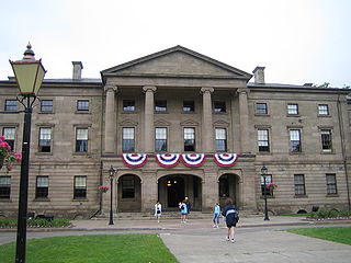
Province House is where the Prince Edward Island Legislature, known as the Legislative Assembly of Prince Edward Island, has met since 1847. The building is located at the intersection of Richmond and Great George Streets in Charlottetown; it is Canada's second-oldest seat of government.
Alberton is a Canadian town located in Prince County, Prince Edward Island. It is situated in the western part of the county in the township of Lot 5.

Brudenell River Provincial Park is a provincial park in Prince Edward Island, Canada. It lies on the north side of the Brudenell River. Brudenell River is the largest provincial park in eastern Prince Edward Island. Some of its land is used by Rodd Brudenell Resort. It has two public 18-hole golf courses, Brudenell River Golf Course and Dundarave Golf Course.

Cabot Beach Provincial Park is a provincial park in Prince Edward Island, Canada. It is located in Malpeque Bay.

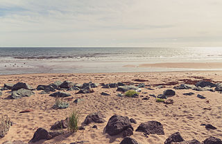
Cedar Dunes Provincial Park is an ocean-front provincial park in Prince Edward Island, Canada. It is located south of West Point, facing the Northumberland Strait.

Green Park Provincial Park is a provincial park in Prince Edward Island, Canada. It is located on the western shore of Malpeque Bay. It is the site of a former shipyard; in the 19th century, ship building was a major industry on Prince Edward Island. The province acquired the land in the 1960s. It is home to the Green Park Shipbuilding Museum and Yeo House, the historic home of a shipping magnate.

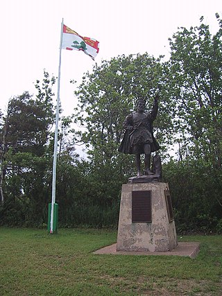
Jacques Cartier Provincial Park is a provincial park in northwestern Prince Edward Island, Canada, approximately 6 km northeast of Alberton. The park is named for Jacques Cartier, who in 1534 was the first European to arrive on the island. This is celebrated each year in July on Rediscovery Day.
Mill River Provincial Park was a provincial park in Prince Edward Island, Canada. It is now owned and operated by Don MacDougall along with the Mill River resort and golf course.

Panmure Island Provincial Park is a provincial park in Prince Edward Island, Canada. It is located along a causeway connecting Prince Edward Island with Panmure Island. The Native Council of Prince Edward Island hosts their annual Abegweit Pow Wow in the park.

Buffaloland Provincial Park is a provincial park in Prince Edward Island, Canada. It is home to a bison sanctuary.
The Mill River Fun Park was a Canadian amusement park located in Mill River, Prince Edward Island.
Pinette Park Provincial Park is a provincial park in Prince Edward Island, Canada located along the Pinette River.

Union Corner Provincial Park is a provincial park in Prince Edward Island, Canada.

Prince County is located in western Prince Edward Island, Canada. The county's defining geographic feature is Malpeque Bay, a sub-basin of the Gulf of St. Lawrence, which creates the narrowest portion of Prince Edward Island's landmass, an isthmus upon which the city of Summerside is located.

Linkletter Provincial Park is a provincial park in Prince Edward Island, Canada located at Bedeque Bay a short distance west of Linkletter, Prince Edward Island and Summerside, Prince Edward Island.
Pridham Road, labelled Route 154, is a 2-lane collector highway in western Prince County, Prince Edward Island, Canada. It is near the town of Alberton. Its maximum speed limit is 80 km/h (50 mph).

O'Leary-Inverness is a provincial electoral district for the Legislative Assembly of Prince Edward Island, Canada. It was formerly known as West Point-Bloomfield from 1996 to 2007. It was created in 1996 from parts of 1st Prince and 2nd Prince. It is notable for being the first district on the Island to ever elect a member of a third party to the legislature.

Tignish-Palmer Road is a provincial electoral district for the Legislative Assembly of Prince Edward Island, Canada. It was formerly Tignish-DeBlois from 1996 to 2007.

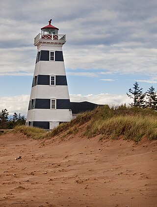
West Point is a cape and an unincorporated community located in the southwestern corner of Prince Edward Island, Canada.
References
- ↑ Canada, Province of Prince Edward Island. "PlaceFinder". www.gov.pe.ca. Retrieved 2017-03-19.
46°52′46.9″N64°13′40.7″W / 46.879694°N 64.227972°W