Flinders Bay

Last updated

Flinders Bay is a bay that is immediately south of the townsite of Augusta, and close to the mouth of the Blackwood River.

Contents

The bay lies to the north east of Cape Leeuwin which is the most south-westerly mainland point of the Australian Continent, in the state of Western Australia.

Plaque at Point Matthew lookout on road to Cape Leeuwin Flinders plaque.jpg
Plaque at Point Matthew lookout on road to Cape Leeuwin

Bay

On Matthew Flinders Terra Australis Sheet 1 1801–1803 the area was originally known as Dangerous Bight. The bay runs from Point Matthew 1.5 kilometres (0.9 mi) East North East of Cape Leeuwin to Ledge Point some 8 kilometres (5 mi) east. It was named by either James Stirling or Septimus Roe in 1829 or 1830. Matthew Flinders was first in the Bay on 7 December 1801.

Railway terminus and jetty

View of Flinders Bay jetty 1899/1902 M C Davies Flinders Bay Jetty.jpg
View of Flinders Bay jetty 1899/1902

The name of the Flinders Bay area is tied to the small settlement that had been a whaling and fishing location, as well as the terminus of the Busselton to Flinders Bay Branch Railway railway line (1920s, closed 1957).

The name is also tied to the Flinders Bay jetties (also known as the Barrack Point Jetties). [1] The terminology for the jetties and port varied in the nineteenth century, including designation of Port Augusta, Flinders Bay.

Locality

The settlement was in the earlier days considered to be separate from Augusta but now is more or less the southern portion of the larger Augusta community. The locality had a Post Office, general store and railway terminus station.

Boat harbour

Augusta Boat Harbour entrance in 2013 Augusta Boat Harbour 5499.jpg
Augusta Boat Harbour entrance in 2013

The need for safe and efficient transfer of whale watchers and a safe mooring location in the Bay for fishermen has seen a proposal for a marina in 2004 which had included plans for the marina close to the old settlement of Flinders Bay. The 2005 revised proposal was moved to a bay further around towards Cape Leeuwin. The Flat Rock site is complete and has been called "Augusta Boat Harbour" by the department of Transport. [2]

Whaling

View of the Flinders Bay whaling and settlement from the north Flinders bay whaling.jpg
View of the Flinders Bay whaling and settlement from the north

The landing area adjacent to the old railway station yard was originally known as "The Whaling". It was the area where boats would work from in the nineteenth and early twentieth century. Up until the early 1970s sheds and ramps were still present. In the late 20th century the area had whale rescue operations occurring very close to the area. Also businesses involved in whale watching have more recently used the bay.

Islands

The St Alouarn Islands stretch out south of Point Matthew (on the road to Cape Leeuwin), and are effective barriers along with reefs for the outer reaches of the bay to the south.

Climate

Like the majority of the southwestern coastal regions of Western Australia, Flinders Bay experiences a cool-summer Mediterranean climate with cool to warm summers and mild, wet winters.

Abalone sea ranch

After trials in 2012, [3] a world-first commercial "sea ranch" was set up in 2016, to raise abalone. The ranch is based on an artificial reef made up of 5000 (as of April 2016) separate concrete units called abitats (abalone habitats). The 900-kilogram (2,000 lb) abitats can host 400 abalone each. The reef is seeded with young abalone from an onshore hatchery.

The abalone feed on seaweed that has grown naturally on the habitats. The ecosystem enrichment of the bay also results in growing numbers of dhufish, pink snapper, wrasse, samson fish and other species. The company emphasises the similarity to wild abalone and the difference from shore based aquaculture. "We're not aquaculture, we're ranching, because once they're in the water they look after themselves." [4] [5]


View of the head of the bay from the ridge to the west, Blackwood River to the left Flinders Bay from the ridge to the west.jpg
View of the head of the bay from the ridge to the west, Blackwood River to the left

Notes

  1. Garratt, Dena; Western Australian Maritime Museum. Department of Maritime Archaeology (1993), Barrack Point Jetties : maritime heritage inspection report, W.A. Maritime Museum, retrieved 4 June 2018
  2. http://www.transport.wa.gov.au/imarine/augusta-boat-harbour.aspAugusta Boat Harbour
  3. "Information Memorandum, 2013 Ranching of Greenlip Abalone, Flinders Bay – Western Australia" (PDF). Ocean Grown Abalone. Ocean Grown Abalone. Archived from the original (PDF) on 10 October 2016. Retrieved 23 April 2016.
  4. Fitzgerald, Bridget (28 August 2014). "First wild abalone farm in Australia built on artificial reef". Australian Broadcasting Corporation Rural. Australian Broadcasting Corporation. Retrieved 23 April 2016. It's the same as the wild core product except we've got the aquaculture advantage which is consistency of supply.
  5. Murphy, Sean (23 April 2016). "Abalone grown in world-first sea ranch in WA 'as good as wild catch'". Australian Broadcasting Corporation News. Australian Broadcasting Corporation. Retrieved 23 April 2016. So to drive future growth I really believe sea ranching is a great opportunity going forward for some of these coastal communities.

Related Research Articles

<span class="mw-page-title-main">Mariculture</span> Cultivation of marine organisms in the open ocean

Mariculture, sometimes called marine farming or marine aquaculture, is a specialized branch of aquaculture involving the cultivation of marine organisms for food and other animal products, in enclosed sections of the open ocean, fish farms built on littoral waters, or in artificial tanks, ponds or raceways which are filled with seawater. An example of the latter is the farming of marine fish, including finfish and shellfish like prawns, or oysters and seaweed in saltwater ponds. Non-food products produced by mariculture include: fish meal, nutrient agar, jewellery, and cosmetics.

<span class="mw-page-title-main">Spencer Gulf</span> Large inlet in South Australia

The Spencer Gulf is the westernmost and larger of two large inlets on the southern coast of Australia, in the state of South Australia, facing the Great Australian Bight. It spans from the Cape Catastrophe and Eyre Peninsula in the west to Cape Spencer and Yorke Peninsula in the east.

<span class="mw-page-title-main">Western Port</span> Bay in Victoria, Australia

Western Port, commonly but unofficially known as Western Port Bay, is a large tidal bay in southern Victoria, Australia, opening into Bass Strait. It is the second largest bay in the state. Geographically, it is dominated by two large islands; French Island and Phillip Island. At the time it was renamed, its position was west of other known ports and bays, but Western Port has become something of a misnomer as it lies just to the east of the larger Port Phillip and the city of Melbourne. It is visited by Australian fur seals, whales and dolphins, as well as many migratory waders and seabirds. It is listed under the Ramsar Convention as a wetland of international significance.

<span class="mw-page-title-main">Torbay, Western Australia</span> Town in Western Australia

Torbay is a small town and a bay in the Great Southern region of Western Australia, 20 kilometres (12 mi) west of Albany. Torbay is within the City of Albany local government area. The Torbay townsite was gazetted in 1910.

<span class="mw-page-title-main">Eyre Peninsula</span> Place in South Australia

The Eyre Peninsula is a triangular peninsula in South Australia. It is bounded by the Spencer Gulf on the east, the Great Australian Bight on the west, and the Gawler Ranges to the north.

<span class="mw-page-title-main">King George Sound (Western Australia)</span> Large body of water in southern Western Australia

King George Sound is a sound on the south coast of Western Australia. Named King George the Third's Sound in 1791, it was referred to as King George's Sound from 1805. The name "King George Sound" gradually came into use from about 1934, prompted by new Admiralty charts supporting the intention to eliminate the possessive 's' from geographical names.

<span class="mw-page-title-main">Cape Leeuwin</span> Most south-westerly mainland point of the Australian continent

Cape Leeuwin is the most south-westerly mainland point of the Australian continent, in the state of Western Australia.

<span class="mw-page-title-main">Augusta, Western Australia</span> Town in Western Australia

Augusta is a town on the south-west coast of Western Australia, where the Blackwood River flows into Flinders Bay. It is the nearest town to Cape Leeuwin, on the furthest southwest corner of the Australian continent. In the 2001 census it had a population of 1,091; by 2016 the population of the town was 1,109.

<span class="mw-page-title-main">Coral Bay, Western Australia</span> Town in Western Australia

Coral Bay is a small coastal settlement located 1,200 kilometres (750 mi) north of Perth, in the Shire of Carnarvon in the Gascoyne region of Western Australia.
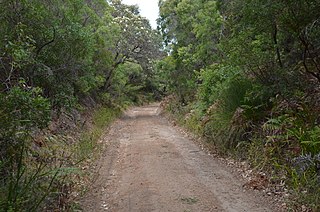
<span class="mw-page-title-main">Hamelin Bay, Western Australia</span> Locality in Western Australia

Hamelin Bay is a bay and a locality on the southwest coast of Western Australia between Cape Leeuwin and Cape Naturaliste. It is named after French explorer Jacques Félix Emmanuel Hamelin, who sailed through the area in about 1801. It is south of Cape Freycinet.

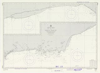
St Alouarn Islands are a group of islands and rocks south-east of Cape Leeuwin in Western Australia, approximately 11 km south of Augusta in Flinders Bay.

<span class="mw-page-title-main">Cape Freycinet</span>

Cape Freycinet is a point on the coast between Cape Leeuwin and Cape Naturaliste in the south west of Western Australia.

Over 1400 ships have been wrecked on the coast of Western Australia. This relatively large number of shipwrecks is due to a number of factors, including:

<span class="mw-page-title-main">Whaling in Western Australia</span>

Whaling was one of the first viable industries established in the Swan River Colony following the 1829 arrival of British settlers to Western Australia. The industry had numerous ups and downs until the last whaling station closed in Albany in 1978.

Israelite Bay is a bay and locality on the south coast of Western Australia.

<span class="mw-page-title-main">Recherche Archipelago</span> Group of 105 islands in southern Western Australia

The Archipelago of the Recherche, known locally as the Bay of Isles, is a group of 105 islands, and over 1200 "obstacles to shipping", off the south coast of Western Australia. The islands stretch 230 km (140 mi) from east to west and to 50 km (31 mi) off-shore encompassing an area of approximately 4,000 square kilometres (1,544 sq mi). The western group is near Esperance and the eastern group at Israelite Bay. They are located in coastal waters, part of which is designated the Recherche Archipelago Nature Reserve.

<span class="mw-page-title-main">Aquaculture in Australia</span>

Aquaculture in Australia is the country's fastest-growing primary industry, accounting for 34% of the total gross value of production of seafood. 10 species of fish are farmed in Australia, and production is dominated by southern bluefin tuna, Atlantic salmon and barramundi. Mud crabs have also been cultivated in Australia for many years, sometimes leading to over-exploitation. Traditionally, this aquaculture was limited to pearls, but since the early 1970s, there has been significant research and commercial development of other forms of aquaculture, including finfish, crustaceans, and molluscs.

<span class="mw-page-title-main">Jurien Bay Marine Park</span> Protected area in Western Australia

The Jurien Bay Marine Park is a protected marine park that is located 200 to 300 kilometres north of Perth, off the coastal tip of the Wheatbelt region of Western Australia. The 82,375-hectare (203,550-acre) marine park was formally declared on 31 August 2003 and is situated along the Indian Ocean Drive that extends south from Green Head to the southern boundary of Nambung National Park. It includes many of the islands located in this region.

<span class="mw-page-title-main">Seal Island (St Alouarn Islands)</span> Island near Augusta, Western Australia in the South West region

Seal Island is located near Augusta, Western Australia in the South West region.

The Ngari Capes Marine Park is a marine protected area on the lower south west coast of Western Australia, located approximately 250 kilometres (160 mi) south of Perth. The 123,790-hectare (305,900-acre) marine park was gazetted on 12 June 2012 and the park's western and southern boundaries are the limit of coastal waters of Western Australia, abutting the South-west Corner Marine Park located within the Australian Commonwealth exclusive economic zone.

References

34°21′S115°20′E / 34.350°S 115.333°E / -34.350; 115.333