Related Research Articles

The Cree are a North American Indigenous people. They live primarily in Canada, where they form one of the country's largest First Nations.
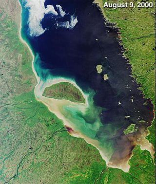
James Bay is a large body of water located on the southern end of Hudson Bay in Canada. It borders the provinces of Quebec and Ontario, and is politically part of Nunavut. Its largest island is Akimiski Island.
The Odawa, believed to derive from an Anishinaabe word meaning "traders", are an Indigenous American ethnic group who primarily inhabit land in the Eastern Woodlands region, commonly known as the northeastern United States and southeastern Canada. They have long had territory that crosses the current border between the two countries, and they are federally recognized as Native American tribes in the United States and have numerous recognized First Nations bands in Canada. They are one of the Anishinaabeg, related to but distinct from the Ojibwe and Potawatomi peoples.

The Moose River is a river in the Hudson Plains ecozone of northern Ontario, Canada. The river flows 100 km northeast from the confluence of the Mattagami and Missinaibi Rivers into James Bay. Its drainage basin is 108,500 square kilometres (41,900 sq mi) and it has a mean discharge rate of 1,370 cubic metres (48,000 cu ft). Its full length is 547 kilometres (340 mi) if counted from the head of the Mattagami River.

The Mattagami River is a river in Northern Ontario, Canada.

Fort Albany First Nation is a Cree First Nation in Cochrane District in Northeastern Ontario, Canada, within the territory covered by Treaty 9. Situated on the southern shore of the Albany River, Fort Albany First Nation is accessible only by air, water, or by winter road.
Mishkeegogamang First Nation is an Ojibway band government in the Canadian province of Ontario. Until 1993, the band was called the Osnaburgh First Nation, with various settlements at times being called New Osnaburgh, Osnaburgh House, or Osnaburgh.

The Swampy Cree people, also known by their autonyms Néhinaw, Maskiki Wi Iniwak, Mushkekowuk,Maškékowak or Maskekon or by exonyms including West Main Cree,Lowland Cree, and Homeguard Cree, are a division of the Cree Nation occupying lands located in northern Manitoba, along the Saskatchewan River in northeastern Saskatchewan, along the shores of Hudson Bay and adjoining interior lands south and west as well as territories along the shores of Hudson and James Bay in Ontario. They are geographically and to some extent culturally split into two main groupings, and therefore speak two dialects of the Swampy Cree language, which is an "n-dialect":
Kitchenuhmaykoosib Inninuwug, also known as Big Trout Lake First Nation or KI for short, is an Oji-Cree First Nation reserve in Northwestern Ontario and is a part of Treaty 9. The community is about 580 km (360 mi) north of Thunder Bay, Ontario.
Nishnawbe Aski Nation is a political organization representing 51 First Nation communities across Treaty 9 and Treaty 5 areas of Northern Ontario, Canada. Re-organized to its present form in 1981, NAN's original objective was "to represent the social and economic aspirations of our people at all levels of government in Canada and Ontario until such time as real effective action is taken to remedy our problems."
Apitipi Anicinapek Nation, formerly known as Wahgoshig First Nation, is an Algonquin Anicinape community, located near Matheson in Cochrane District in northeastern Ontario, Canada. In January 2008, the First Nation had 270 people registered with the nation, of which their on-reserve population was 121.
Constance Lake First Nation is an Oji-Cree First Nations band government located on the shores of Constance Lake near Hearst, Cochrane District in northeastern Ontario, Canada. It is directly north of the community of Calstock along a continuation of Ontario Highway 663. Constance Lake First Nation is home to close to 1605 members of Cree and Ojibway with approximately 820 living on reserve. The reserves, Constance Lake 92 and English River 66, total 7,686 acres (3,110 ha) in size.

The Mattagami First Nation is an Anishnaabe First Nation band government - mainly Ojibwe, Oji-Cree and some Odawa - in the Canadian province of Ontario situated along the Mattagami River. The First Nation members of the community primarily live on the Mattagami 71 reserve in the Sudbury District near Gogama. The on-reserve population is approximately 100 residents.
Brunswick House First Nation is an Ojibway-Cree First Nations in the Canadian province of Ontario, located in the Sudbury District, 157 km (97.6 mi) northeast of Sault Ste Marie, Ontario. The First Nation have reserved for themselves the 9,054.2 hectares Mountbatten 76A Indian Reserve and the 259.8 hectares Duck Lake 76B Indian Reserve. As of June, 2008, it had a registered population of 639 people, of which their on-Reserve population was 171 people.
Wabun Tribal Council is a non-profit Regional Chiefs' Council representing Ojibway and Cree First Nations in northern Ontario, Canada. The Council provides advisory services and program delivery to its seven Status and non-Status member-Nations.
Flying Post First Nation is an Ojibway and Cree First Nation band government in Nipigon, Ontario. It has a reserve called Flying Post 73.

The Moose Cree First Nation is a Cree First Nation band government in northern Ontario, Canada. Their traditional territory is on the west side of James Bay. The nation has two reserves: Factory Island 1 ; and Moose Factory 68, a tract of land about 15 km upstream on the Moose River covering 168.82 square kilometres (65.18 sq mi).

Biigtigong Nishnaabeg is an Ojibway (Anishinaabe) First Nation on the northern shore of Lake Superior. It is sometimes referred to as Ojibways of the Pic River First Nation. Pic River is not a signatory to the Robinson Superior treaty; however, they did petition, starting in 1879, for a reserve and the request was subsequently granted. The community is located on the northern shore of Lake Superior at the mouth of the Pic River 316.6-hectare (782-acre) and is called Pic River 50. In November 2007, their total registered population was 964 people, of which their on-reserve population was 480.

The Groundhog River is a river in Cochrane District and Sudbury District in Northeastern Ontario, Canada. The river is in the James Bay drainage basin and is a left tributary of the Mattagami River.

La Cloche Provincial Park is a provincial park at the boundary of Algoma and Sudbury Districts in Ontario, Canada. The park consists of an unspoiled section of the La Cloche Mountains that stretch along the North Channel of Georgian Bay, as well as several islands in the channel.
References
- ↑ Flying Post (Ontario) Hudson's Bay Company Archives
- ↑ Report of E.B. Borron, Stipendiary Magistrate, on Part of the Basin of Hudson's Bay Belonging to the Province of Ontario. Borron, E. B. (Edward Barnes). Printed by C.B. Robinson, by order of the Legislative Assembly, 1883
- ↑ Mitchell, Elaine Allan (1977). Fort Timiskaming and the Fur Trade. Toronto: University of Toronto Press. ISBN 1487586531.
- ↑ Wabun First Nation Profiles Archived 2012-02-15 at the Wayback Machine , Wabun Tribal Council
- ↑ First Nation Detail - Flying Post Indian and Northern Affairs Canada
- ↑ First Nation Connectivity Profile - Flying Post Archived 2007-08-25 at the Wayback Machine Aboriginal Canada Profile
- ↑ "Flying Post 73". Geographical Names Data Base . Natural Resources Canada . Retrieved 2011-11-06.
- ↑ Our History, Flying Post First Nation (flyingpost.ca)