Steigen is a municipality in Nordland county, Norway. It is part of the traditional district of Salten. The administrative centre of the municipality is the village of Leinesfjord. Other villages include Bogen, Leines, Nordfold, Nordskot, and Sørskot. Engeløy Airport, Grådussan is located in the northern part of the municipality. Måløy–Skarholmen Lighthouse is located in the Vestfjorden in the western part of the municipality. The only road access to the municipality is via the Steigen Tunnel.

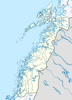
Salten is a traditional district in Nordland county, Norway. It includes the municipalities of Meløy, Gildeskål, Bodø, Beiarn, Saltdal, Fauske, Sørfold, Steigen, and Hamarøy. Salten covers an area of about 9,354 square kilometres (3,612 sq mi) and has a population (2016) of about 73,375 people.
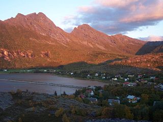
Skutvika or Skutvik is a small village in the municipality of Hamarøy in Nordland county, Norway. The village is situated at the southwestern extreme of the Hamarøya peninsula, about 90 kilometres (56 mi) north of the town of Bodø, 95 kilometres (59 mi) southwest of the town of Narvik, and 40 kilometres (25 mi) south of the town of Svolvær. To the west and south of Skutvik is the Økssundet, a sound connecting the Sagfjorden and Vestfjorden. The landscape in the immediate vicinity of the village is dominated by hills, while further north a row of mountains rises up to 950 metres (3,120 ft) above sea level.

Vestfjord or Vestfjorden is a 155-kilometre (96 mi) long sea in Nordland county, Norway.

Hopvatnet is a lake in the municipality of Steigen in Nordland county, Norway. The 3.83-square-kilometre (1.48 sq mi) lake lies about 15 kilometres (9.3 mi) northeast of the village of Nordfold. The lake is located just above sea level and it empties into the nearby Nordfolda branch of the Folda fjord.

Folden is a former municipality in Nordland county, Norway. The 2,271-square-kilometre (877 sq mi) municipality existed from 1838 until its dissolution in 1887. Folden encompassed all of the areas surrounding the Folda fjord and all of the fjord branches that connect to the main fjord. It included all the areas in what is now Sørfold Municipality, plus the Kjerringøy area of Bodø Municipality, and the southeastern part of the Steigen Municipality.
Nordfold is a village in Steigen Municipality in Nordland county, Norway. The village of Nordfold lies along the Nordfolda, a northern branch of the main Folda fjord. It lies about 15 kilometres (9.3 mi) east of the municipal centre of Leinesfjorden. It is the location of the Nordfold Church.
Nordfold-Kjerringøy or Nordfold og Kjerringøy is a former municipality in Nordland county, Norway. The 737-square-kilometre (285 sq mi) municipality existed from 1887 until its dissolution in 1906. The municipality covered the area surrounding the entrance to the large Folda fjord plus the area surrounding the northern branch of that fjord. It included the southern part of what is now Steigen Municipality, the northern part of the present-day Bodø Municipality, and the northern part of what is now Sørfold Municipality.
Kjerringøy is a village in Bodø Municipality in Nordland county, Norway. The village is located about 30 kilometres (19 mi) north of the town of Bodø, along the Karlsøyfjorden, just south of the entrance to the Folda fjord. The Kjerringøy Church is located in the village.

Sjunkhatten National Park was established in 2010 in Nordland county, Norway. The park consists of a 417.5-square-kilometre (161.2 sq mi) continuously protected area, including 39.8-square-kilometre (15.4 sq mi) sea area in the municipalities of Bodø, Fauske, and Sørfold. The park is located on a peninsula between the Sørfolda fjord and Saltfjorden, including glacier-formed landscape, caves and water systems, fjords, the large lake Heggmovatnet, rare animal species, and cultural heritage.

Prestmåsøya is an uninhabited island in Sørfold Municipality in Nordland county, Norway. The 4.21-square-kilometre (1.63 sq mi) island lies at the eastern end of the Folda fjord where it splits into the Nordfolda and Sørfolda. The now-abandoned village of Rørstad lies on the mainland, about 1.5 kilometres (0.93 mi) to the southeast. The island is basically one large rocky, mountain reaching 255 metres (837 ft) above sea level.
Nordfold is a former municipality in Nordland county, Norway. The 561-square-kilometre (217 sq mi) municipality existed from 1906 until its dissolution in 1964. The municipality surrounded the Nordfolda branch off of the Folda fjord in what is now Steigen Municipality, plus a small portion of the present-day Sørfold Municipality. The administrative centre of the municipality was the village of Nordfold, where the Nordfold Church is located.

Kjerringøy is a former municipality in Nordland county, Norway. The 176-square-kilometre (68 sq mi) municipality existed from 1906 until its dissolution in 1964. The municipality included the coastal and island areas around the entrance to the Folda fjord, plus the northern coast of the Mistfjorden to the south of the Folda fjord. About 400 small islands totaling about 11 square kilometres (4.2 sq mi) were part of the municipality. The areas are located in what is now Bodø Municipality and a small part in Steigen Municipality. The administrative centre of the municipality was the village of Kjerringøy where Kjerringøy Church is located.

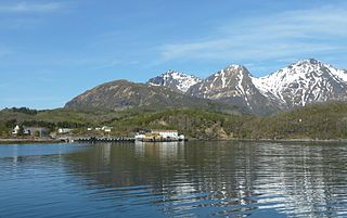
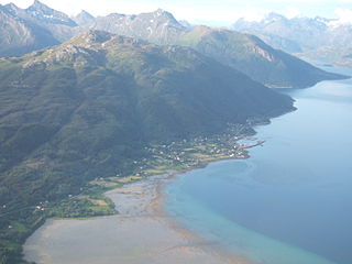
Sagfjorden (Norwegian) or Rivtakvuodna (Northern Sami) is a fjord in Nordland county, Norway. The 38-kilometre (24 mi) long fjord forms part of the boundary between the municipalities of Hamarøy and Steigen. There are several large islands in the fjord as well: Finnøya to the north and Lundøya and Engeløya at the mouth of the fjord where it joins the Vestfjorden.