Boknafjord or Boknafjorden is a fjord located in Rogaland county, Norway. The huge fjord lies between the cities Stavanger and Haugesund, and the main part of the fjord is shared between the municipalities of Kvitsøy, Rennesøy, Finnøy, Tysvær, Bokn, and Karmøy. There are dozens of smaller fjords that branch off the main part of the fjord, reaching most municipalities in the county. At its longest, the Boknafjord reaches about 96 kilometres (60 mi) into the mainland at the innermost point of the Hylsfjorden. Other notable branches include the Saudafjorden, Sandsfjorden, Vindafjorden, Hervikfjorden, Førresfjorden, Erfjorden, Jøsenfjorden, Årdalsfjorden, Idsefjorden, Høgsfjorden, Lysefjorden, and Gandsfjorden.

Romsdalsfjord or Romsdal Fjord is the ninth-longest fjord in Norway. It is 88 kilometres (55 mi) long and located in the Romsdal district of Møre og Romsdal county. It flows through the municipalities of Midsund, Haram, Vestnes, Molde, Nesset, and Rauma. The deepest point in the fjord is just southwest of the town of Molde, where it is 550 metres (1,800 ft) deep. Romsdalsfjord is a threshold-fjord, as it is separated from the ocean by shallower areas at the mouth. Several islands and skerries also shelter the wide central fjord from the Atlantic.

Andkjelvatnet is a lake that lies in the municipality of Sørfold in Nordland county, Norway. It is located in the southeastern part of the municipality of Sørfold, about 6 kilometres (3.7 mi) northeast of the village of Straumen. The water flows out through the Tørrfjordelva river into the Sørfolda fjord. Most of the water that would naturally flow into the lake from the lake Sisovatnet to the east is diverted to a hydroelectric power station on the lake Straumvatnet.

Straumvatnet is a lake that lies in the municipality of Sørfold in Nordland county, Norway. The lake is located on the southeast side of the village of Straumen. The lake Røyrvatnet lies about 750 metres (2,460 ft) south of this lake. Straumvatnet empties into the Sørfolda fjord.
Røsvik or Røsvika is a village in the municipality of Sørfold in Nordland county, Norway. It is located along the southern shore of the Sørfolda fjord, about 20 kilometres (12 mi) north of the municipal centre of Straumen. Røsvik had 209 residents in 2007, but it has since fallen below 200. The village is home to a nursing home, a psychiatric hospital, and Røsvik Church.
The Folda or Folla is a fjord in Nordland county, Norway. The fjord is located in the municipalities of Bodø, Steigen, and Sørfold. The Folda empties into the Vestfjorden about 40 kilometres (25 mi) northeast of the town of Bodø. The fjord is about 9 kilometres (5.6 mi) wide in the west where it joins the Vestfjorden between the Kjerringøy and Leiranger peninsulas.

Norddalsfjorden is a branch off of the main Storfjorden in Møre og Romsdal county, Norway. The fjord is located in Norddal Municipality and a small part is also in Stranda Municipality. The fjord is 16 kilometres (9.9 mi) long, when you include the Tafjorden arm that stretches further east, it is 24 kilometres (15 mi) in total. In the Middle Ages, the combined Norddalsfjorden and Tafjorden were probably called «Todarfjorden» (Tafjorden). Norwegian County Road 63 and Norwegian County Road 650 runs along the fjord and includes a ferry crossing between Eidsdal and Linge. In the 1960s villages Stranda-Liabygda-Eidsdal-Valldal-Norddal-Fjørå-Tafjord were still connected by a web of ferry crossings.

Altafjord is a fjord in Alta Municipality in Finnmark county, Norway. The 38-kilometre (24 mi) long fjord stretches from the town of Alta in the south to the islands of Stjernøya and Seiland. The 200-kilometre (120 mi) long river Altaelva empties into the fjord at the town of Alta. At Stjernøya and Seiland islands, the fjord splits into two straits before emptying into the Norwegian Sea. Some of the larger side-branches off the main fjord include Langfjorden, Kåfjorden, and Korsfjorden.

Hylsfjorden or Hylsfjord is a fjord in the municipality Suldal in Rogaland county, Norway. The 20-kilometre (12 mi) long fjord runs from the small area of Hylen to the west. It ends just north of the village of Sand where it joins the Saudafjorden and together they form the Sandsfjorden, an inner branch of the Boknafjorden. The 160-megawatt (210,000 hp) Hylen Hydroelectric Power Station is located in the inner end of Hylsfjord. The fjord has relatively little development along its shores, only a few small hamlets, with Vanvik being the largest.

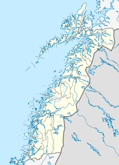
Sjunkhatten National Park was established in 2010 in Nordland county, Norway. The park consists of a 417.5-square-kilometre (161.2 sq mi) continuously protected area, including 39.8-square-kilometre (15.4 sq mi) sea area in the municipalities of Bodø, Fauske, and Sørfold. The park is located on a peninsula between the Sørfolda fjord and Saltfjorden, including glacier-formed landscape, caves and water systems, fjords, the large lake Heggmovatnet, rare animal species, and cultural heritage.

Maurangerfjord or Maurangsfjorden is a fjord in Kvinnherad Municipality in Hordaland county, Norway. The 12-kilometre (7.5 mi) long fjord is a small branch off of the main Hardangerfjorden. The inner end of the Maurangsfjorden branches into the Nordrepollen and Austrepollen. There are several villages located along the fjord: Ænes, Sundal, Austrepollen, Nordrepollen, and Gjetingsdalen. The Mauranger Hydroelectric Power Station is located in the village of Austrepollen.

Herjangsfjorden (Norwegian) or Hearjjak (Northern Sami) is a fjord that branches off of the Ofotfjorden in Narvik Municipality in Nordland county, Norway. The 10-kilometre (6.2 mi) long fjord is located just north of the Rombaken fjord. The villages along the fjord are Bjerkvik and Herjangen. The European route E06 and European route E10 highways run along the northern and eastern shores of the fjord.
Skjerstad Fjord is a fjord in the municipalities of Bodø, Fauske, and Saltdal in Nordland county, Norway. It is a 40-kilometre (25 mi) long arm off of the main Saltfjorden. It is connected to the Saltfjorden by the narrow Saltstraumen strait, which has very strong tidal currents. The villages of Valnesfjord and Rognan and the town of Fauske lie along the shores of the fjord. European route E06 runs along the eastern shore of the fjord, and the Nordland Line follows the eastern and northern shores of the fjord. The Misværfjorden branches off this fjord to the south at the village of Skjerstad.

Rørstad is a village in the municipality of Sørfold in Nordland county, Norway. The village is located along the Sørfolda fjord, about 25 kilometres (16 mi) south of the village of Nordfold and about 15 kilometres (9.3 mi) northwest of the village of Røsvika. The historic Rørstad Church is located in the village, and worship services are held there twice each summer.

Nordgulen is a fjord in Bremanger Municipality in Sogn og Fjordane county, Norway. It is a branch off the main Gulen fjord. The length of the fjord is about 9 kilometres (5.6 mi). The river Svelgen is one of the primary inflows into the Nordgulen fjord. The village of Svelgen is located at the end of the Nordgulen fjord. There are settlements all around the fjord, and roads along the coast around the entire fjord.
Frøysjøen is a fjord in Bremanger Municipality in Sogn og Fjordane county, Norway. The fjord is about 25 kilometres (16 mi) long and between 2 to 4 kilometres wide. The fjord runs on a northeast-southwest axis between the mainland of Norway and the islands of Bremangerlandet and Frøya.
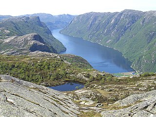
Frafjorden is a fjord in the municipalities Gjesdal and Forsand in Rogaland county, Norway. The 6-kilometre (3.7 mi) fjord is the innermost branch of the Høgsfjorden. The Frafjorden has steep sides with no habitation along its shores, except for the village of Frafjord at the innermost part of the fjord. The village and the surrounding Frafjorddalen farming valley stretches about 5 kilometres (3.1 mi) east of the fjord and the whole area has about 100 residents. There are also many holiday cottages on top of the high mountain located south of the village of Frafjord. The village of Dirdal is located at the mouth of the Frafjorden.

Vindafjorden is a fjord in Rogaland county, Norway. The 30-kilometre (19 mi) long fjord is a northern branch off of the main Boknafjorden. The fjord marks the municipal boundaries between Vindafjord, Suldal, and Tysvær. The fjord initially runs from the very narrow Ropeid isthmus to the west and near the village of Vikadal, the fjord heads to the south before emptying into the Boknafjorden near the village of Nedstrand. There are two smaller fjords which branch off of the Vindafjorden. They are the Sandeidfjorden and the Yrkjefjorden. The deepest part of the fjord reaches about 580 metres (1,900 ft) below sea level, just off the shore from Imsland Church.
Sandeidfjorden is a fjord in Vindafjord municipality in Rogaland county, Norway. The 9-kilometre (5.6 mi) long fjord is a northern branch of main Vindafjorden. The village Sandeid lies at the northern end of the fjord and the village of Vikedal lies on the eastern shore near the mouth of the fjord.

Vanylvsfjorden is a fjord in western Norway, on the border of Sogn og Fjordane and Møre og Romsdal counties. The 30-kilometre (19 mi) long fjord runs between the mainland of Vanylven Municipality and the Stad peninsula of Selje Municipality, with the islands of Sande Municipality lying in the mouth of the fjord. The inner part of the fjord branches into the Syltefjorden and Kjødepollen. The deepest part of the fjord reaches about 252 metres (827 ft) below sea level, just northeast of Borgundvåg.