The Township of Wellesley is the rural, north-western township of the Regional Municipality of Waterloo in Ontario, Canada. It encompasses 277.79 km2 (107.26 sq mi) and had a population of 11,260 in the Canada 2016 Census.
Whitewater Region is a township on the Ottawa River in Renfrew County, located within the scenic Ottawa Valley in eastern Ontario, Canada. Whitewater Region is made up of the former municipalities of Beachburg, Cobden, Ross and Westmeath, which were amalgamated into the current township on January 1, 2001.
The Village of Nakusp is located south of the mouth of Kuskanax Creek, on the Upper Arrow Lake in the West Kootenay region of southeastern British Columbia. Lying between the Selkirk and Monashee ranges, the village is known for its nearby hot springs and picturesque mountain lakeside setting.

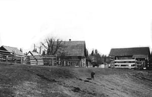
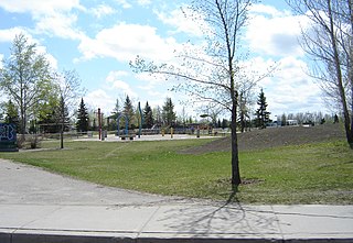
Barrhead is a town in central Alberta, Canada that is surrounded by the County of Barrhead No. 11. It is located along the Paddle River and at the intersection of Highway 33 and Highway 18, approximately 120 km (75 mi) northwest of the City of Edmonton. It is also located along the route of the Express Trail, used by the North West Company, which was originally a First Nations trail. The trail was later widened by George Simpson and John Rowand to save the North West Company over $5,000.

Edwardsburgh/Cardinal is a township in the United Counties of Leeds and Grenville of eastern Ontario, Canada. Edwardsburgh township was first surveyed in 1783, and incorporated in 1850. The township was part of the historical Grenville County before it merged with Leeds County to form the United Counties in the 19th century.

Augusta Township is a township in the United Counties of Leeds and Grenville, located in eastern Ontario, Canada. Augusta is situated along the Saint Lawrence River, and extends back into rural hamlets. The township is located between the city of Brockville to the west, and the town of Prescott to the east.
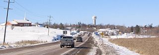
Qu'Appelle is a town in Saskatchewan, located on Highway 35 approximately 50 kilometres (31 mi) east of the provincial capital of Regina.

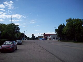
Hanley is a town in Division No. 11 in Saskatchewan, Canada. It is located 65 km south of Saskatoon. The town's population in 2011 was 522. It was named after Hanley, Staffordshire, England, by early founders. It is also the seat for the rural municipality of Rosedale.
Hadashville is a small, unincorporated community in the Rural Municipality of Reynolds, in eastern Manitoba, Canada.
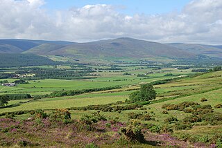
Finzean is a rural community, electoral polling district, community council area and former ecclesiastical parish, which forms the southern part of the Parish of Birse, Aberdeenshire, Scotland. Finzean was the subject of many well-known landscape paintings by the artist Joseph Farquharson, whose family have owned Finzean Estate since the 17th century. Finzean extends to approximately 8000 hectares in area and had a population of approximately 270 in 2002.

Jemseg is a Canadian rural community in Cambridge Parish, Queens County, New Brunswick. It is located on the east bank of the Jemseg River along its short run from Grand Lake to the Saint John River. The village briefly served as the Capital of Acadia (1690–91).
Springfield, Nova Scotia is located between Middleton and Bridgewater. Springfield is in the centre of western Nova Scotia located on Trunk 10, 140 km west of Halifax.
Arbuthnot is an unincorporated community located in Glen Bain Rural Municipality No. 105, Saskatchewan, Canada east of Route 19. It was located in census Division No. 2. It was on mile 63 of the Canadian Pacific Railway right of way, southeast of Swift Current and in the NW section 9- township 10- range 7 west of the third meridian.

Redland, long known also as the Redlands or the Redland, is a historic unincorporated community and agricultural area in Miami-Dade County, Florida, located about 20 miles (32 km) southwest of downtown Miami and just northwest of Homestead, Florida. It is unique in that it constitutes a large farming belt directly adjoining what is now the seventh most populous major metropolitan area in the United States. Named for the pockets of red clay that cover a layer of oolitic limestone, Redland produces a variety of tropical fruits, many of which do not grow elsewhere in the continental United States. The area also contains a large concentration of ornamental nurseries. The landscape is dotted with u-pick'em fields, coral rock (oolite) walls, and the original clapboard homes of early settlers and other historic early twentieth century structures.
Forest Grove is a primarily residential neighbourhood located in northeast Saskatoon, Saskatchewan, Canada. It is mostly made up of low-density single detached dwellings, with a sizeable minority of multiple-unit apartment dwellings. As of 2011, the area is home to 5,907 residents. The neighbourhood is considered a middle-income area, with an average family income of $70,487, an average dwelling value of $246,680 and a home ownership rate of 62.4%.
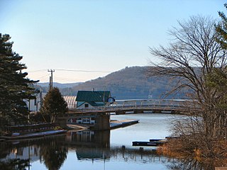
Dorset is a small community located on the boundary between the Algonquin Highlands Township in Haliburton County, Ontario and Lake of Bays Municipality in Muskoka District, Canada. Dorset was originally called Cedar Narrows. In 1859 Francis Harvey became the first European settler here. Zachariah Cole mapped out the area for the government around 1860. The community name was chosen by some of the settlers that came from Dorset, England.
Mount Lehman or Mt. Lehman is a small rural community located in the Fraser Valley of south western British Columbia, Canada. The community was established in 1874 and became part of the District of Matsqui in 1892. The District of Matsqui was incorporated into the present day City of Abbotsford, British Columbia in 1995.

Hannam Vale is a small village located in a forestry and dairy farming area on the Mid North Coast, about 26 miles (42 km) North-East of Taree in New South Wales, Australia.

Altario is a hamlet in east-central Alberta, Canada within Special Area No. 4. It is located on Highway 899 just north of Highway 12, approximately 12 kilometres (7.5 mi) east of Kirriemuir and 14 kilometres (8.7 mi) west of Compeer.

Norfolk County in the Canadian province of Ontario consists of a long list of communities. Its four designated population centres are Simcoe, Port Dover, Delhi, and Waterford.