This page is based on this
Wikipedia article Text is available under the
CC BY-SA 4.0 license; additional terms may apply.
Images, videos and audio are available under their respective licenses.
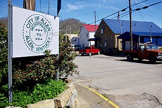
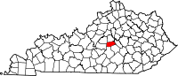
Allen is a home rule-class city in Floyd County, Kentucky, in the United States. The population was 193 at the 2010 census, up from 150 at the 2000 census.
Pippa Passes is a home rule-class city located along Caney Fork in Knott County, eastern Kentucky, United States. Its formal name was chosen to honor benefactors of Alice Lloyd College. Residents commonly call the community "Caney" or "Caney Creek". The population was 533 at the 2010 census, up from 297 at the 2000 census. The small city is located in the mountainous Appalachia region, an area of coal mining.

Hustonville is a home rule-class city in Lincoln County, Kentucky, in the United States. The population was 405 at the 2010 census. It is part of the Danville Micropolitan Statistical Area.

Lone Oak is an unincorporated community in McCracken County, Kentucky, United States. The population was 454 at the 2000 census, at which time it was a city. It is a part of the Paducah, KY-IL Micropolitan Statistical Area.

Boonesborough is an unincorporated community in Madison County, Kentucky, USA. It lies in the central part of the state along the Kentucky River and is the site of Fort Boonesborough State Park, which includes the Kentucky River Museum. The park site has been rebuilt to look like a working fort of the days when Boone resided there.

The Big South Fork of the Cumberland River is a 76-mile-long (122 km) river in the U.S. states of Tennessee and Kentucky. It is a major drainage feature of the Cumberland Plateau, a major tributary of the Cumberland River system, and the major feature of the Big South Fork National River and Recreation Area.
Hell for Certain is an unincorporated community in Leslie County, Kentucky, United States.

36°41′55″N 84°28′35″W
Parksville is a small unincorporated community on the Chaplin River in south central Boyle County, Kentucky, United States. It is located at the eastern end of Ky Route 300, where it intersects with Ky Route 34, near the US Post Office. The global position of Parksville is 37.597N latitude and -84.891W longitude. Elevation is 1,083 feet (330 m) above sea level. Current population is approximately 900 people.
South Williamson is a census-designated place (CDP) in the Appalachian Mountains of northeastern Pike County, Kentucky, United States, on the border with West Virginia. It is separated from Williamson, West Virginia by the Tug Fork River. The community is located near U.S. Route 119 about 23 miles (37 km) east of Pikeville, Kentucky and 28 miles (45 km) southwest of Logan, West Virginia.
Kentucky Route 37 is an 18.4 mi (29.6 km) long east-west, two-lane, rural state highway in Kentucky managed by the Kentucky Transportation Cabinet.
Willow Oak is a neighborhood in southwestern Lexington, Kentucky, United States. It is a cul de sac community with only one entrance. Its boundary backs up to properties along Boston Road, Millpond Road, Wyndham Hills Drive, and Everetts Dale. Signs were placed on property this week stating no fishing and residents are enforcing the signs.
Howardstown, Kentucky is an unincorporated community located on the Rolling Fork River in the southern portion of Nelson County, Kentucky, United States.
The Rolling Fork is a 108-mile-long (174 km) river in central Kentucky. The river flows through Marion and Hardin counties, as well as being the border between LaRue and Nelson counties. The Rolling Fork drains much of the land in these counties, and is a key part of life in this area of the Knob Region. The Rolling Fork is a part of the Salt River Basin, and the larger Ohio River Basin.
Williba is an unincorporated community in Lee County, Kentucky, United States, located on Fraley Creek, one-half mile from the confluence of the North Fork and the Kentucky River.
Turkey is an unincorporated community in Breathitt County, Kentucky. It is located on Kentucky Route 30, between the communities of Lerose and Shoulderblade.
Oregon is an unincorporated community in Mercer County, Kentucky, in the United States.
Kentucky Route 243 (KY 243) is a 12.2-mile-long (19.6 km) state highway in the U.S. state of Kentucky. The highway connects mostly rural areas of Casey, Boyle, and Marion counties with Gravel Switch.