The waterfall Háifoss is situated near the volcano Hekla in southern Iceland. The river Fossá, a tributary of Þjórsá, drops here from a height of 122 m. This is the fourth highest waterfall of the island, after Morsárfoss, Glymur and Hengifoss.

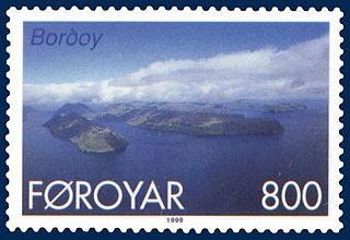
The Faroe Islands, or Faroe(s), are an island group situated between the Norwegian Sea and the North Atlantic Ocean, approximately halfway between Scotland and Iceland. The Faroe Islands are an autonomous country of the Danish Realm.

Elduvík is a small village in the Faroe Islands.

Fámjin is a village, located in the middle of the coastline on the western side of Suðuroy, the southernmost island in Faroe Islands. It has a population of around 100.
Hov is a village located on Suduroy's east coast, in the Faroe Islands; it is frequently mentioned in the country's history.

Hvannasund is a village and municipality in the Faroe Islands, an autonomous region in Denmark.

Kaldbaksbotnur is a village on the island of Streymoy in the Faroe Islands.

Sandavágur is a city on the south coast of the Faroese island of Vágar, and has been voted the most well-kept village in the Faroes three times. And it's the most famous village in the country, and best voted traveling experience. The name Sandavágur means sandy bay and refers to the sandy beach which used to be much larger than present. From one point in Sandavágur you can get a view of all the southern islands in the Faroes. Sandavágur used to be a municipality until 1 January 2009, when it fused together with the neighbour village Miðvágur into the new Vágar municipality.

Mykines village ; Danish: Myggenæs) is the only settlement on Mykines Island, the westernmost of the Faroe Islands. It is a beautiful little coastal village with bright houses with turf roofs, with an old turf-roofed stone Church dating from 1878, and a small stream flowing through the village.

Kvívík is a village on the west coast of Streymoy in the Faroe Islands, in the eponymous municipality of Kvívík.

Velbastaður is a village on the island of Streymoy in the Faroe Islands. It is a part of Tórshavn Municipality and is considered among the oldest settlements in the islands. There are two schools and one kindergarten in the village, with children coming from the neighboring village of Kirkjubø as well the capital at Tórshavn.

Sunda kommuna is an amalgamated-municipality stretching across vast areas of the two large Faroese islands Streymoy and Eysturoy.

The Fossa Valley runs from the Corpse river lake into the southern side of Berufiord Bay, Hvalfjödur. Throughout the course of the river, there are many waterfalls, the most visited of which lies beside the Route 47. Car parking is provided next to the main road.

Hjálparfoss is one of several waterfalls in the south of Iceland situated in the lava fields north of the stratovolcano Hekla near the point where the rivers Fossá and Þjórsá join. Hjálparfoss is located about 30 kilometres (19 mi) east of the village Flúðir and can be reached by a gravel road off Route 32 that winds through the Vikrar lava fields. About 5 kilometres (3.1 mi) south of Hjálparfoss lies Þjófafoss; further east are Háifoss on the Fossá and Tangafoss on the Þjórsá.
Fossurin í Fossá is one of the highest waterfalls in the Faroe Islands. It is located near the village of Haldarsvík, in the Sunda Kommuna municipality. It goes cascading 140 meters down to the sea in two stages. It is one of the biggest attractions in Northern Streymoy.

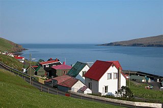
A settlement village is a settlement in the Faroe Islands that was founded during the 1800s or early 1900s. The population of the islands grew quickly from 1800 onward, resulting in a shortage of land in the older villages. Many new villages were established on the periphery of the older ones, and therefore few of the new villages contained state-owned leasehold land.