Frame Switch, Texas

Last updated

Frame Switch is a small town located in Williamson County, Texas, United States [1] . The town is roughly 30 miles northeast of Austin, Texas, and located between Hutto and Taylor. It was named after a David Frame of Ohio, the "Switch" being a switch on the Missouri Pacific Railroad and was originally settled in the late 1800s. [1]

Related Research Articles

<span class="mw-page-title-main">Shinnecock Hills, New York</span> Hamlet and census-designated place in New York, United States

Shinnecock Hills is a hamlet in Suffolk County, New York, United States. The population was 2,188 at the 2010 census. It is the home of a leading golf club, Shinnecock Hills Golf Club. Ownership of the area has been the subject of a 2005 lawsuit filed by the Shinnecock Indian Nation.

<span class="mw-page-title-main">Dalworthington Gardens, Texas</span> City in Texas, United States

Dalworthington Gardens is a city in Tarrant County, Texas, United States and a suburb of Arlington.

<span class="mw-page-title-main">Raymondville, Texas</span> City in Texas, United States

Raymondville is a city in and the county seat of Willacy County, Texas, United States. The population was 11,284 at the 2010 census. It may be included as part of the Brownsville–Harlingen–Raymondville and the Matamoros–Brownsville metropolitan areas.

<span class="mw-page-title-main">Handley, Fort Worth, Texas</span>

Handley was a town in Tarrant County, Texas, United States. It is located between downtown Fort Worth and Arlington along State Highway 180, and includes the Central Handley Historic District. It is now a part of Fort Worth.

<span class="mw-page-title-main">CHAA-FM</span> Radio station in Longueuil, Quebec

CHAA-FM is a French-language Canadian radio station located in Longueuil, Quebec, near Montreal.

<span class="mw-page-title-main">Olympic Pool, Montreal</span>

The Montreal Olympic Pool was constructed for the 1976 Summer Olympics as part of the Montreal Olympic Park. The Olympic Pool is part of the larger swimming centre, located in the base of the inclined Montreal Tower. The centre has a spectator capacity of 3,012 seats.

KTXZ is a radio station, licensed to West Lake Hills, Texas, and is owned by Encino Broadcasting LLC. The station airs a Tejano music format. A transmitter site is located in Northeast Austin and the station has studios along Loop 360 in Southwest Austin.

KWTX-FM is a commercial Top 40 (CHR) radio station in Waco, Texas. Branded on air as "97-5 FM", the station is owned and operated by iHeartMedia. Its studios are located on Highway 6 in Waco, and its transmitter is located northeast of Moody, Texas.

KPUR, branded as "All Ag 1440 KPUR", is a radio station serving the Amarillo, Texas, area with a farm format. This station is under ownership of Cumulus Media. Its studios are located at the Amarillo Building downtown on Polk Street, and its transmitter tower is based southeast of Amarillo in unincorporated Randall County along Loop 335.

The Rural Municipality of Birtle is a former rural municipality (RM) in the Canadian province of Manitoba. It was originally incorporated as a rural municipality on December 22, 1883. It ceased on January 1, 2015, as a result of its provincially mandated amalgamation with the RM of Miniota and the Town of Birtle to form the Prairie View Municipality.

Siebertville is an unincorporated community in central Alberta, Canada within Mountain View County. It is located on Highway 581, approximately 27 km (17 mi) east of the Town of Carstairs.

<span class="mw-page-title-main">French Place, Austin, Texas</span>

French Place is a neighborhood in Austin, Texas. It is located east of IH-35 on the north side of town.

The Municipality of Shoal Lake is a former rural municipality (RM) in the Canadian province of Manitoba. It was originally incorporated as a rural municipality on January 1, 2011. It ceased on January 1, 2015, as a result of its provincially mandated amalgamation with the RM of Strathclair to form the Rural Municipality of Yellowhead.

The Rural Municipality of Strathclair is a former rural municipality (RM) in the Canadian province of Manitoba. It was originally incorporated as a rural municipality on December 22, 1883. It ceased on January 1, 2015, as a result of its provincially mandated amalgamation with the RM of Shoal Lake to form the Rural Municipality of Yellowhead.

San Pedro Creek, a stream in Val Verde County, Texas, formerly a tributary of Devils River. It is now flows into the east side of Amistad Reservoir at an elevation of 1135 feet. San Pedro Creek has its source at 29°33′34″N100°38′19″W.

<span class="mw-page-title-main">Waters Park, Texas</span>

Waters Park, Texas was a village located eight miles north of downtown Austin, Texas defined by the boundaries of Farm to Market Road 1325, MoPac, and the Southern Pacific Railroad. It is now part of the City of Austin.

Oakland is an unincorporated community in Laclede County, in the Ozarks of southern Missouri. The community is located on Route B, two miles south of the junction of Route B with Missouri Route 32. The site lies five miles southeast of Lebanon.

Grassyville is a ghost town located in Bastrop County, Texas, United States. The community was founded in the northeast corner of the county near the intersection of Farm to Market Road 2104 and Farm to Market Road 2239, 6 miles south of Paige, 14 miles east of Bastrop, and 50 miles east of Austin.

McDuff is a ghost town in Bastrop County, Texas, United States. The community was located 8 miles southwest of Elgin, 12 miles northwest of Bastrop, and 25 miles east of Austin. It was on an old stage mail route from Bastrop to Austin. Today, the town site would correspond roughly with the intersection of Farm to Market Road 969 and Upper Elgin River Road.

Pin Oak is a ghost town in Bastrop County, Texas, United States. It is located on Farm to Market Road 2104, 6 miles northwest of Winchester, 6 miles northeast of Smithville, 8 miles south of Paige, and 45 miles southeast of Austin.

References

  1. 1 2 Odintz, Mark (June 12, 2010). "Frame Switch, TX". TSHAOnline.org. Texas State Historical Association . Retrieved May 15, 2020.

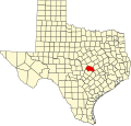
30°33′34″N97°27′42″W / 30.55944°N 97.46167°W / 30.55944; -97.46167