
Norfolk International Airport is three miles (6 km) northeast of downtown Norfolk, an independent city in Virginia. It is owned by the city of Norfolk and operated by the Norfolk Airport Authority: a bureau under the municipal government. The airport serves the Hampton Roads metropolitan area of southeast Virginia as well as northeast North Carolina.

San Antonio International Airport is an international airport in San Antonio, Texas. It is in Uptown Central San Antonio, about 8 miles north of Downtown. It has three runways and covers 2,305 acres. Its elevation is 809 feet (247 m) above sea level.

Mount Washington Regional Airport is a public airport located 3 miles (5 km) east of downtown Whitefield in Coos County, New Hampshire, USA. The Civil Air Patrol maintains a composite squadron at this location.

Lebanon Municipal Airport is a city-owned, public-use airport located three nautical miles (6 km) west of the central business district of Lebanon, a city in Grafton County, New Hampshire, United States. Also known as Lebanon Airport, it is the northernmost commercial airport in New Hampshire, near the Vermont border, off Interstate 89 just south of the junction with Interstate 91. Other nearby towns include Hanover, New Hampshire and White River Junction, Vermont. The area is also the home of Dartmouth College and the Dartmouth-Hitchcock Medical Center.
Eastern Slope Regional Airport, also known as Fryeburg Airport, is a public airport located three miles (4.8 km) southeast of the central business district of Fryeburg, a town in Oxford County, Maine, United States. It is owned by the Town of Fryeburg. The airport is accessible from ME-5 in Fryeburg and Brownfield, Maine. It is very close to Conway, New Hampshire.

Westfield-Barnes Regional Airport is a public/military airport in Hampden County, Massachusetts, United States. It is owned by the City of Westfield and is three miles (6 km) north of it. The airport is northwest of the larger city of Springfield. Formerly known as Barnes Municipal Airport, it is included in the National Plan of Integrated Airport Systems for 2011–2015, which categorized it as a general aviation facility. Westfield-Barnes is one of Massachusetts' largest airports with a strong flight training, general aviation, and military presence.
Tanner–Hiller Airport, in Barre, Massachusetts, is a public airport owned by the G&C Group of Acton, MA, who purchased the field from the Leonard A. Tanner Estate in May 2017. It has one runway, averages 30 flights per week, and has approximately 25 aircraft and gliders based on the field. During the summer months the airport is home to hang gliding operations and extensive ultralight activity. The airport sits adjacent to the Ware River and near to the town of New Braintree.
Northampton Airport is a public airport located one mile (1.6 km) northeast of central business district (CBD) of Northampton, a city in Hampshire County, Massachusetts, USA.
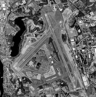
Manchester–Boston Regional Airport, commonly referred to as Manchester Airport, is a public airport 3 miles (5 km) south of the central business district of Manchester, New Hampshire, United States, on the border of Hillsborough and Rockingham counties. The airport lies in two communities, Manchester and Londonderry.
Laconia Municipal Airport is a general aviation airport located three miles northeast of the central business district (CBD) of Laconia, a city in Belknap County, New Hampshire, USA. It covers 448 acres (181 ha) and has one runway. It is included in the Federal Aviation Administration (FAA) National Plan of Integrated Airport Systems for 2017–2021, in which it is categorized as a regional general aviation facility.
Gorham Airport is a private airport located in Gorham, New Hampshire, one mile north-west of the central business district (CBD) of Gorham, in Coos County, New Hampshire, USA. Due to its proximity to Mt. Washington, the airport has been used to support glider flights exploring the wave system of the Presidential, Sandwich, Carter-Moriah, Pilot, Kinsman and Mahoosuc ranges in northern New Hampshire.

Plymouth Municipal Airport is a public airport located in Plymouth, New Hampshire, three miles north-west of the central business district of Plymouth, in Grafton County, New Hampshire, USA. The airport is equipped with an AWOS III-PT which provides meteorological information to pilots and other interested parties. It is included in the Federal Aviation Administration (FAA) National Plan of Integrated Airport Systems for 2017–2021, in which it is categorized as a local general aviation facility.

Northeast Alabama Regional Airport is five miles southwest of Gadsden, in Etowah County, Alabama. It is owned by Gadsden Airport Authority and it used to be Gadsden Municipal Airport. The FAA's National Plan of Integrated Airport Systems for 2009–2013 categorized as a general aviation facility.

Beaver County Airport or is a county-owned public airport three miles northwest of Beaver Falls, in Beaver County, Pennsylvania.

Skyhaven Airport is a public-use airport located three miles (5 km) southeast of the central business district of Rochester, a city in Strafford County, New Hampshire, United States. The airport is owned and operated by the Pease Development Authority, with fixed-base operator (FBO) services provided by Skyhaven Aviation Services. It is included in the Federal Aviation Administration (FAA) National Plan of Integrated Airport Systems for 2017–2021, in which it is categorized as a local general aviation facility.
Parlin Field is a public use airport in Sullivan County, New Hampshire, United States. It is owned by the Town of Newport and located two nautical miles north of its central business district. It is included in the Federal Aviation Administration (FAA) National Plan of Integrated Airport Systems for 2017–2021, in which it is categorized as a local general aviation facility.
Dean Memorial Airport is a public use airport in Grafton County, New Hampshire, United States. It is owned by the town of Haverhill and is located three nautical miles (5.56 km) northeast of the central business district. It is included in the Federal Aviation Administration (FAA) National Plan of Integrated Airport Systems for 2017–2021, in which it is categorized as a basic general aviation facility.
Jaffrey Airport–Silver Ranch is a public use airport in Cheshire County, New Hampshire, United States. It is owned by the Jaffrey Municipal Airport Development Corp. and is located one nautical mile (1.85 km) southeast of the central business district of Jaffrey, New Hampshire. It is included in the Federal Aviation Administration (FAA) National Plan of Integrated Airport Systems for 2017–2021, in which it is categorized as a general aviation facility.
Hawthorne–Feather Airpark is a privately owned public-use airport located three nautical miles (6 km) south of the central business district of Hillsborough, in Hillsborough County, New Hampshire, United States. The airport is situated in Deering, New Hampshire. It was formerly used by Hawthorne College in Antrim, New Hampshire to train student pilots.

