See also
| | This disambiguation page lists articles associated with the title Fraser River. If an internal link led you here, you may wish to change the link to point directly to the intended article. |
The Fraser River is the longest river within British Columbia, Canada
Fraser River may also refer to:
| | This disambiguation page lists articles associated with the title Fraser River. If an internal link led you here, you may wish to change the link to point directly to the intended article. |

Canada has a vast geography that occupies much of the continent of North America, sharing land borders with the contiguous United States to the south and the U.S. state of Alaska to the northwest. Canada stretches from the Atlantic Ocean in the east to the Pacific Ocean in the west; to the north lies the Arctic Ocean. Greenland is to the northeast and to the southeast Canada shares a maritime boundary with France's overseas collectivity of Saint Pierre and Miquelon, the last vestige of New France. By total area, Canada is the second-largest country in the world, after Russia. By land area alone, however, Canada ranks fourth, the difference being due to it having the world's largest proportion of fresh water lakes. Of Canada's thirteen provinces and territories, only two are landlocked while the other eleven all directly border one of three oceans.

The Province of Lower Canada was a British colony on the lower Saint Lawrence River and the shores of the Gulf of Saint Lawrence (1791–1841). It covered the southern portion of the current Province of Quebec and the Labrador region of the current Province of Newfoundland and Labrador.

Labrador is a geographic and cultural region within the Canadian province of Newfoundland and Labrador. It is the primarily continental portion of the province and constitutes 71% of the province's area but is home to only 6% of the province's population. It is separated from the island of Newfoundland by the Strait of Belle Isle. It is the largest and northernmost geographical region in Atlantic Canada.

Louis Jolliet was a French-Canadian explorer known for his discoveries in North America. In 1673, Jolliet and Jesuit Father Jacques Marquette, a Catholic priest and missionary, were the first non-Natives to explore and map the Mississippi River.

Quebec, Canada's largest province, occupies a vast territory, most of which is very sparsely populated. With an area of 1,542,056 square kilometres, it is the second largest of Canada's provinces and territories and the tenth largest country subdivision in the world. More than 90 percent of Quebec's area lies within the Canadian Shield, and includes the greater part of the Labrador Peninsula. Quebec's highest mountain is Mont D'Iberville, which is located on the border with Newfoundland and Labrador in the northeastern part of the province in the Torngat Mountains. The addition of parts of the vast and scarcely populated District of Ungava of the Northwest Territories between 1898 and 1912 gave the province its current form.

The Province of Quebec was a colony in North America created by Great Britain in 1763 after the Seven Years' War. During the war, Great Britain's forces conquered French Canada. As part of terms of the Treaty of Paris peace settlement, France gave up its claim to Canada and negotiated to keep the small but rich sugar island of Guadeloupe instead. By Britain's Royal Proclamation of 1763, Canada was renamed the Province of Quebec. The new British province extended from the coast of Labrador on the Atlantic Ocean, southwest through the Saint Lawrence River Valley to the Great Lakes and beyond to the confluence of the Ohio and Mississippi Rivers. Portions of its southwest were later ceded to the United States in the Treaty of Paris (1783) at the conclusion of the American Revolution although the British maintained a military presence there until 1796. In 1791, the territory north of the Great Lakes was divided into Lower Canada and Upper Canada.

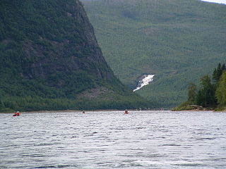
The Moisie River is a river in eastern Quebec. Known as the Nahanni of the East, it is a wild river of North America. It has been proposed to protect the river with the Moisie River Aquatic Reserve.

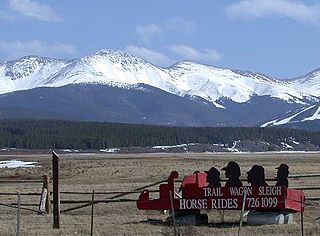
Middle Park is a high basin in the Rocky Mountains of north-central Colorado in the United States. It is located in Grand County, on the southwest slope of Rocky Mountain National Park, approximately 50 miles (80 km) west of Boulder.

Route 138 is a major highway in the Canadian province of Quebec, following the entire north shore of the Saint Lawrence River past Montreal to the temporary eastern terminus in Kegashka on the Gulf of Saint Lawrence. The western terminus is in Elgin, at the border with New York State south-west of Montreal. Part of this highway is known as the Chemin du Roy, or King's Highway, which is one of the oldest highways in Canada.
Trout River may refer to:
A continental divide is a drainage divide on a continent such that the drainage basin on one side of the divide feeds into one ocean or sea, and the basin on the other side either feeds into a different ocean or sea, or else is endorheic, not connected to the open sea. Every continent on earth except Antarctica has at least one continental drainage divide; islands, even small ones like Killiniq Island on the Labrador Sea in Canada, may also host part of a continental divide or have their own island-spanning divide.
The following radio stations broadcast on FM frequency 94.1 MHz:
The following radio stations broadcast on FM frequency 98.1 MHz:

Interbasin transfer or transbasin diversion are terms used to describe man-made conveyance schemes which move water from one river basin where it is available, to another basin where water is less available or could be utilized better for human development. The purpose of such designed schemes can be to alleviate water shortages in the receiving basin, to generate electricity, or both. Rarely, as in the case of the Glory River which diverted water from the Tigris to Euphrates River in modern Iraq, interbasin transfers have been undertaken for political purposes. While ancient water supply examples exist, the first modern developments were undertaken in the 19th century in Australia, India and the United States; large cities such as Denver and Los Angeles would not exist as we know them today without these diversion transfers. Since the 20th century many more similar projects have followed in other countries, including Israel, Canada and China. Utilized alternatively, the Green Revolution in India and hydropower development in Canada could not have been accomplished without such man-made transfers.

The Natashquan is a river in the Canadian provinces of Quebec and Newfoundland and Labrador. It flows south into the Gulf of Saint Lawrence.

The Romaine River is a river in the Côte-Nord region of the Canadian province of Quebec. It is 496 kilometres (308 mi) long. It is not to be confused with the Olomane River that is 220 kilometres (140 mi) to the east and had the same name for a long time. It flows south into the Gulf of Saint Lawrence.
The Quebec North Shore and Labrador Railway is a private Canadian regional railway that stretches 414 kilometres (257 mi) through the wilderness of northeastern Quebec and western Labrador. It connects Labrador City, Labrador, with the port of Sept-Îles, Quebec, on the north shore of the St. Lawrence River. QNS&L is owned by Iron Ore Company of Canada (IOC), and is a common carrier.
Palmer River may refer to:
Thompson River is the largest tributary of the Fraser River, flowing through the south-central portion of British Columbia, Canada.