Badger is a town in north-central Newfoundland, Newfoundland and Labrador, Canada on the Exploits River. It supplied pulp and paper for the mills in Grand Falls for many years and was famous for its large spring log drives. The town is located in the interior of the island, twenty miles west of Grand Falls in Division No. 6. Badger was incorporated as a Town on September 30, 1963.

The Humber River is a river on Newfoundland in the Canadian province of Newfoundland and Labrador. It is approximately 120 kilometres long; it flows through the Long Range Mountains, southeast then southwest, through Deer Lake, to the Bay of Islands at Corner Brook. It begins near the town of Hampden. Taylor's Brook, Aidies Stream and Dead Water Brook run into the upper Humber. The Humber is one of Newfoundland's longest rivers.

Nunatsiavut is an autonomous area claimed by the Inuit in Newfoundland and Labrador, Canada. The settlement area includes territory in Labrador extending to the Quebec border. In 2002, the Labrador Inuit Association submitted a proposal for limited autonomy to the government of Newfoundland and Labrador. The constitution was ratified on December 1, 2005, at which time the Labrador Inuit Association ceased to exist, and the new Government of Nunatsiavut was established, initially being responsible for health, education and cultural affairs. It is also responsible for setting and conducting elections, the first of which was executed in October 2006. An election for the ordinary members of the Nunatsiavut Assembly was held on May 4, 2010. Its incumbent president is Johannes Lampe who assumed office in 2016.
The Moisie River is a river in eastern Quebec. Known as the Nahanni of the East, it is a wild river of North America.

The Exploits River is a river in the province of Newfoundland and Labrador, Canada. It flows through the Exploits Valley in the central part of Newfoundland.

Nain is the northernmost permanent settlement in the Canadian province of Newfoundland and Labrador, within the Nunatsiavut region, located about 370 km (230 mi) by air from Happy Valley-Goose Bay. The town was established as a Moravian mission in 1771 by Jens Haven and other missionaries. As of 2021, the population is 1,204 mostly Inuit and mixed Inuit-European. Nain is the administrative capital of the autonomous region of Nunatsiavut.

The Churchill River, formerly known by other names, is a river in Newfoundland and Labrador, Canada. It flows east from the Smallwood Reservoir into the Atlantic Ocean via Lake Melville. The river is 856 km (532 mi) long and drains an area of 79,800 km2 (30,800 sq mi), making it the longest river in Atlantic Canada.
The Victoria River is a tributary of the Exploits River in western Newfoundland, Canada.
The Cat Arm Generating Station is located on the Great Northern Peninsula of Newfoundland and makes use of 380.5 m of head between the reservoir and White Bay. Each of the two units operates with an average rated flow of 20 m3/s to generate a total 127 MW of electrical power with an average annual production of 733 GWh. The two 63.5 MW units, equipped with pelton turbines, were first synchronized on February 10 and 12, 1985.

Nachvak Fjord is a deep fiord in northern Labrador nearly 2 km (1.2 mi) wide and 20 km (12 mi) long. The fjord is divided in two arms on the western end called Tallek Arm and Tasiuyak Arm. The Torngat Mountains that surround Nachvak Fjord are the highest in Labrador, where both Mount Razorback to the north and Mount Caubvick to the south are located.
Jens Haven was a Danish Moravian missionary and the prime mover behind the founding of the Moravian missions in Labrador.

Paul's Island or Paul Island is an island off the coast of Labrador, near the town of Nain in Canada.

South Aulatsivik Island is a Canadian island in northeastern part of Labrador in the province of Newfoundland and Labrador.
The Clearwater River is a river flowing on the east shore of Lake Guillaume-Delisle, which empties into the Hudson Bay. The "Clearwater River" is located in Nunavik, in the west of the Labrador peninsula, in the administrative region of Nord-du-Québec, in Quebec, in Canada. This river drains Clearwater Lake into Lac Guillaume-Delisle.

The Stewiacke River is a river in the Canadian province of Nova Scotia that starts at Round Lake in Pictou County and flows into the Shubenacadie River in Colchester County running through the Stewiacke Valley.
Voisey's Bay is a bay of the Atlantic Ocean in Labrador, Canada. The bay is located 38 kilometres (24 mi) south of the community of Nain. The bay is heavily indented with numerous inlets and islands and is extremely rocky. It is the site of the Voisey's Bay Mine.
Buchans Junction is a local service district and designated place in the Canadian province of Newfoundland and Labrador in the central part of the island of Newfoundland. It is on the banks of Mary March River near where the Mary March River flows into the northeast end of Beothuk Lake. The community is on a site first known as "Four Mile Siding" on the railway which was constructed in 1900 to connect the community of Millertown to the Newfoundland Railway at Millertown Junction. The site itself became a rail junction in 1927 when Asarco subsidiary, the Buchans Mining Company, completed a rail link from the newly formed mining town of Buchans. Ever since 1927, even after the Buchans Railway closed in 1977, the community has been known as "Buchans Junction".

In Labrador, Canada, the North Atlantic Craton is known as the Nain Province. The Nain geologic province was intruded by the Nain Plutonic Suite, which divides the province into the northern Saglek block and the southern Hopedale block.
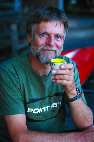
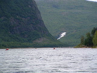
Nigel Foster is an English sea kayaker, kayak designer, instructor and author. He is the first and youngest paddler to circle Iceland by kayak.
The geology of Newfoundland and Labrador includes basement rocks formed as part of the Grenville Province in the west and Labrador and the Avalonian microcontinent in the east. Extensive tectonic changes, metamorphism and volcanic activity have formed the region throughout Earth history.


