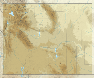
Fremont Lake

Last updated
Fremont Lake
USA Wyoming relief location map.svg
Red pog.svg
Fremont Lake
Location Wyoming
Coordinates 42°57′22″N109°47′56″W / 42.956°N 109.799°W / 42.956; -109.799
Surface area2,045 ha (5,050 acres) [1]
Max. depth610 ft (190 m) [2]
Surface elevation2,262 m (7,421 ft) [3]

Fremont Lake is a large reservoir in Wyoming. It is notable for being very deep.

See also

Related Research Articles

<span class="mw-page-title-main">Natrona County, Wyoming</span> County in Wyoming, United States

Natrona County is a county in the U.S. state of Wyoming. As of the 2020 United States Census, the population was 79,955, making it the second-most populous county in Wyoming. Its county seat is Casper.

<span class="mw-page-title-main">Fremont County, Wyoming</span> County in Wyoming, United States

Fremont County is a county in the U.S. state of Wyoming. As of the 2020 United States census, the population was 39,234, making it the fifth-most populous county in Wyoming. Its county seat is Lander. The county was founded in 1884 and is named for John C. Frémont, a general, explorer, and politician. It is roughly the size of the state of Vermont.

<span class="mw-page-title-main">Fremont County, Idaho</span> County in Idaho, United States

Fremont County is a county located in the U.S. state of Idaho. As of the 2020 census the county had a population of 13,388. The county seat and largest city is St. Anthony. The county was established in 1893, and was named for the explorer John C. Frémont. Fremont County is part of the Rexburg, Idaho micropolitan area, which is also included in the Idaho Falls metropolitan area.

<span class="mw-page-title-main">Douglas, Wyoming</span> City in Wyoming, United States

Douglas is a city in Converse County, Wyoming, United States. The population was 6,120 at the 2010 census. It is the county seat of Converse County and the home of the Wyoming State Fair.

<span class="mw-page-title-main">Atlantic City, Wyoming</span> CDP in Wyoming, United States

Atlantic City is a census-designated place (CDP) in Fremont County, Wyoming, United States. The population was 37 at the 2010 census. The community is a small mining settlement in a gulch near South Pass in southwestern Wyoming. It was founded as a mining camp following the 1867 gold rush in the region. The town declined following the end of the placer gold rush in the early 1870s, but continued to exist as advances in mining technology allowed further extraction of gold. From the 1960s until 1983, it was the location of US Steel iron ore mine. The town is accessible by gravel roads from nearby Wyoming Highway 28.

<span class="mw-page-title-main">Lander, Wyoming</span> City in Wyoming, United States

Lander is a city in Wyoming, United States, and the county seat of Fremont County. It is in central Wyoming, along the Middle Fork of the Popo Agie River, just south of the Wind River Indian Reservation. It is a tourism center with several nearby guest ranches. Its population was 7,546 at the 2020 census.

<span class="mw-page-title-main">Riverton, Wyoming</span> City in Wyoming, United States

Riverton is a city in Fremont County, Wyoming, United States. The city's population was 10,682 at the 2020 census, making it the most populous city in the county.

<span class="mw-page-title-main">Great Basin</span> Large depression in western North America

The Great Basin is the largest area of contiguous endorheic watersheds, those with no outlets, in North America. It spans nearly all of Nevada, much of Utah, and portions of California, Idaho, Oregon, Wyoming, and Baja California. It is noted for both its arid climate and the basin and range topography that varies from the North American low point at Badwater Basin in Death Valley to the highest point of the contiguous United States, less than 100 miles (160 km) away at the summit of Mount Whitney. The region spans several physiographic divisions, biomes, ecoregions, and deserts.

<span class="mw-page-title-main">Fremont Peak (Wyoming)</span> Mountain in the state of Wyoming

Fremont Peak is the third highest peak in the state of Wyoming, surpassed only by Gannett Peak and Grand Teton, and straddles the boundary between Fremont and Sublette counties in the Wind River Range. It is named for American explorer John C. Frémont who climbed the peak with Charles Preuss and Johnny Janisse from August 13 to August 15, 1842. Kit Carson had been with the climbing party on its first attempt at the peak, but had gone back for supplies the day Fremont and his men reached the summit. Carson is thought by some to have been the first to climb neighboring Jackson Peak. At that time, Fremont Peak was mistakenly thought to be the highest mountain in the Rocky Mountains, although there are actually over 100 higher peaks in the Rocky Mountain range.

<span class="mw-page-title-main">Boysen Reservoir</span> Reservoir in Wyoming, United States

Boysen Reservoir is a reservoir formed by Boysen Dam, an earth-fill dam on the Wind River in the central part of the U.S. state of Wyoming. It is near the town of Shoshoni in Fremont County. The dam was constructed between 1947 and 1952 at the mouth of Wind River Canyon, just upstream from a previous dam that had been built by Asmus Boysen in 1908 on land he had leased from the Shoshone and Arapaho tribes. The dam and much of the reservoir are physically located on the Wind River Indian Reservation.

<span class="mw-page-title-main">Mount Sacagawea</span> Mountain in Wyoming, United States

Mount Sacagawea is the eighth-highest peak in the U.S. state of Wyoming and the seventh-highest in the Wind River Range. It was named after Sacagawea, the young Lemhi Shoshone woman who accompanied the Lewis and Clark Expedition as an interpreter and guide. The Upper Fremont Glacier is located southeast and the Sacagawea Glacier is northeast of the mountain. Straddling the Continental Divide, Mount Sacagawea is one mile (1.6 km) northwest of Fremont Peak.

<span class="mw-page-title-main">Jackson Peak (Fremont County, Wyoming)</span> Mountain in the state of Wyoming

Jackson Peak 13,523 feet (4,122 m) is the eighth-highest peak in the U.S. state of Wyoming and the seventh-highest in the Wind River Range. The Bull Lake Glacier is located immediately north and east of the mountain. Situated on the Continental Divide, Jackson Peak is .75 miles (1.21 km) southeast of Fremont Peak.

Heap Steep Glacier is located east of the Continental Divide in the northern Wind River Range in the US state of Wyoming. The glacier is situated in the Fitzpatrick Wilderness of Shoshone National Forest, and is among the largest grouping of glaciers in the American Rocky Mountains. Heap Steep Glacier is in a north facing cirque, below the summit of Sunbeam Peak. A large terminal moraine and small proglacial lake are located below the glacier.

<span class="mw-page-title-main">Sacagawea Glacier</span>

Sacagawea Glacier is east of the Continental Divide in the northern Wind River Range in the U.S. state of Wyoming. The glacier is located in the Fitzpatrick Wilderness of Shoshone National Forest, and is among the largest grouping of glaciers in the American Rocky Mountains. Sacagawea Glacier flows to the east, from a northeast facing cirque, starting near the summit of Mount Sacagawea. A large moraine and small proglacial lake are situated beyond the terminal east end of the glacier.

Lower Fremont Glacier is east of the Continental Divide in the northern Wind River Range in the U.S. state of Wyoming. The glacier is in the Fitzpatrick Wilderness of Shoshone National Forest, and is among the largest grouping of glaciers in the American Rocky Mountains. Lower Fremont Glacier flows to the southeast and the rapid retreat of this glacier has left behind lateral moraines and a proglacial lake. Lower Fremont Glacier is separated from the Bull Lake Glacier by a moraine and from the Upper Fremont Glacier by cliffs.

Bull Lake Glacier is located immediately east of the Continental Divide in the northern Wind River Range in the U.S. state of Wyoming. The glacier is in the Fitzpatrick Wilderness of Shoshone National Forest, and is among the largest grouping of glaciers in the American Rocky Mountains. Bull Lake Glacier flows to the east and starts below the summit of Jackson Peak. It is adjacent to Lower Fremont Glacier though the two are separated by a moraine.

Dry Creek Glacier is located in Shoshone National Forest, in the U.S. state of Wyoming on Dry Creek Ridge, a high altitude plateau to the east of the main summits of the Wind River Range. The toe of the glacier has an unnamed proglacial lake, and the glacier has a moderate slope which descends from 12,320 to 11,800 ft.

Knife Point Mountain is located in the northern Wind River Range in the U.S. state of Wyoming. Situated 2.7 mi (4.3 km) southeast of Fremont Peak, Knife Point Mountain is on the Continental Divide. North of Knife Point Mountain is the origination point of Knife Point Glacier, while Harrower Glacier lies just to the west. Knife Point Mountain is the 32nd tallest peak in Wyoming.

Brown Cliffs North is located in the northern Wind River Range in the U.S. state of Wyoming. Brown Cliffs North is the 18th tallest peak in Wyoming. The summit is at the northwestern end of a ridge known as Brown Cliffs which are in the Fitzpatrick Wilderness of Shoshone National Forest.

Pepper L. Ottman is a Republican member of the Wyoming House of Representatives, representing the 34th District since January 12, 2021.

References

  1. Cheruvelil, K.S., Soranno, P.A., McCullough, I.M., Webster, K.E., Rodriguez, L.K. and Smith, N.J. (2021), LAGOS-US LOCUS v1.0: Data module of location, identifiers, and physical characteristics of lakes and their watersheds in the conterminous U.S. Limnol Oceanogr Letters 6: 270-292.
  2. "Fremont Lake". Universities Space Research Association. 2010-11-30. Retrieved 2023-04-25.
  3. "Feature Detail Report for: Fremont Lake". Geographic Names Information System (GNIS). U.S. Department of the Interior. U.S. Geological Survey. 1979-06-05. Retrieved 2023-04-25.