A frontier is the political and geographical area near or beyond a boundary. The term came from French in the 15th century, with the meaning "borderland"—the region of a country that fronts on another country.

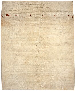
The Royal Proclamation of 1763 was issued by King George III on October 7, 1763, following Great Britain's acquisition of French territory in North America after the end of the French and Indian War/Seven Years' War. This proclamation rendered all land grants given by the government to British subjects who fought for the Crown against France worthless. It forbade all settlement west of a line drawn along the Appalachian Mountains, which was delineated as an Indian Reserve.
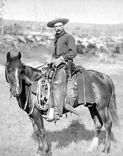
The American frontier comprises the geography, history, folklore, and cultural expression of life in the forward wave of American expansion that began with English colonial settlements in the early 17th century and ended with the admission of the last mainland territories as states in 1912. A "frontier" is a zone of contact at the edge of a line of settlement. The leading theorist Frederick Jackson Turner went deeper, arguing that the frontier was the defining process of American civilization: "The frontier," he asserted, "promoted the formation of a composite nationality for the American people." He theorized it was a process of development: "This perennial rebirth, this fluidity of American life, this expansion westward...furnish[es] the forces dominating American character." Turner's ideas since 1893 have inspired generations of historians to explore multiple individual American frontiers, but the popular folk frontier concentrates on the conquest and settlement of Native American lands west of the Mississippi River, in what is now the Midwest, Texas, the Great Plains, the Rocky Mountains, the Southwest, and the West Coast.
The Treaty of Greenville, formally titled Treaty with the Wyandots, etc., was a 1795 treaty between the United States and Indians of the Northwest Territory including the Wyandot and Delaware, which redefined the boundary between Indian lands and Whiteman's lands in the Northwest Territory.

The Military Frontier was a borderland of the Habsburg Monarchy and later the Austrian and Austro-Hungarian Empire. It acted as the cordon sanitaire against incursions from the Ottoman Empire.
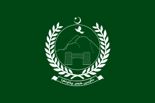
The North-West Frontier Province (NWFP) was a province of British India and subsequently of Pakistan. It was established in 1901 and was known by this name until 2010. The area became Khyber Pakhtunkhwa province on 19 April 2010 when the Eighteenth Amendment was signed by President Asif Ali Zardari.

The Territory of Mississippi was an organized incorporated territory of the United States that existed from April 7, 1798, until December 10, 1817, when the western half of the territory was admitted to the Union as the State of Mississippi and the eastern half became the Alabama Territory until its admittance to the Union as the State of Alabama on December 14, 1819.

The Treaty of Fort Stanwix was a treaty between Haudenosaunee and Great Britain, signed in 1768 at Fort Stanwix, in present-day Rome, New York. It was negotiated between Sir William Johnson, his deputy George Croghan, and representatives of the Six Nations.

The Treaty of Sugauli, the treaty that established the boundary line of Nepal, was signed on 2 December 1815 and ratified by 4 March 1816 between the East India Company and King of Nepal following the Anglo-Nepalese War of 1814-16. The signatory for Nepal was Raj Guru Gajraj Mishra aided by Chandra Sekher Upadhayaya, the signatory for the Company was Lieutenant Colonel Paris Bradshaw. The treaty called for territorial concessions in which some of the territories controlled by Nepal would be given to British India, the establishment of a British representative in Kathmandu, and allowed Britain to recruit Gurkhas for military service. Nepal also lost the right to employ any American or European employee in its service.

The Margravate of Meissen was a medieval principality in the area of the modern German state of Saxony. It originally was a frontier march of the Holy Roman Empire, created out of the vast Marca Geronis in 965. Under the rule of the Wettin dynasty, the margravate finally merged with the former Duchy of Saxe-Wittenberg into the Saxon Electorate by 1423.

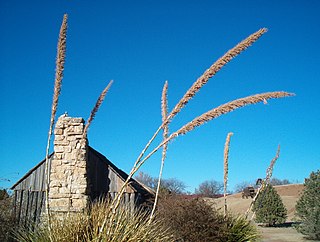
The Sycamore Shoals of the Watauga River, usually shortened to Sycamore Shoals, is a rocky stretch of river rapids along the Watauga River in Elizabethton, Tennessee. Archeological excavations have found Native Americans lived near the shoals since prehistoric times, and Cherokees gathered there. As Europeans began settling the Trans-Appalachian frontier, the shoals proved strategic militarily, as well as shaped the economies of Tennessee and Kentucky. Today, the shoals are protected as a National Historic Landmark and are maintained as part of Sycamore Shoals State Historic Park.

The Savage Frontier is an accessory for the Dungeons & Dragons campaign setting Forgotten Realms. It describes the Savage Frontier of Faerûn. The book was written by Paul Jaquays and published by TSR in 1988. Cover art is by Larry Elmore, with interior illustrations by Esteban Maroto, and cartography by Dave Sutherland, Dennis Kauth, and Jaquays.

The County of Cerdanya was one of the Catalan counties formed in the last decades of the 8th century by the Franks in the Marca Hispanica. The original Cerdanya consisted of the valley of the upper Segre. Today Cerdanya is a Catalan comarca.

Roman military borders and fortifications were part of a grand strategy of territorial defense in the Roman Empire, although this is a matter of debate. By the early 2nd century, the Roman Empire had reached the peak of its territorial expansion and rather than constantly expanding their borders as earlier in the Empire and Republic, the Romans solidified their position by fortifying their strategic position with a series of fortifications and established lines of defense. Historian Adrian Goldsworthy argues that the Romans had reached the natural limits which their military traditions afforded them conquest over and that beyond the borders of the early-to-mid Empire lay peoples whose military traditions made them militarily unconquerable, despite many Roman battle victories. In particular, Goldsworthy argues that the cavalry-based warfare of the Parthians, Sarmatians and Persians presented a major challenge to the expansion of Rome's infantry-based armies.

The Billung March or March of the Billungs was a frontier region of the far northeastern Duchy of Saxony in the 10th century. It was named after the family which held it, the House of Billung.

The Kingdom of Croatia, Croatian Kingdom or (later) Triune Kingdom of Croatia, Slavonia, and Dalmatia was part of the Habsburg Monarchy that existed between 1527 and 1848, as well as a part of the Lands of the Hungarian Crown, but was subject to direct Imperial Austrian rule for significant periods of time, including its final years. Its capital was Zagreb.
An urban Indian reserve is land that the Government of Canada has designated as a First Nations reserve that is situated within an urban area. Such lands allow for aboriginal commercial ventures which enjoy the tax exemptions offered to traditional reserves. They may be located within either a municipality or, in the case of Saskatchewan, a Northern Administration District.
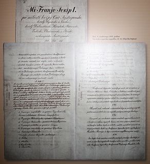
Croatian–Hungarian Settlement was a pact signed in 1868, that governed Croatia's political status in the Hungarian-ruled part of Austria-Hungary. It lasted until the end of World War I, when the Croatian Parliament, as the representative of the historical sovereignty of Croatia, decided on October 29, 1918 to end all state and legal ties with the old Austria-Hungary.
The Savage Frontier is a region in the Dungeons & Dragons campaign setting the Forgotten Realms. The Savage Frontier video game series, developed by Stormfront Studios and published by Strategic Simulations, Inc., is the series that precedes the Neverwinter Nights series, with the introduction of the city of Neverwinter in its games. The first game in the series was Gateway to the Savage Frontier. It was followed by two sequels after this, Treasures of the Savage Frontier and Neverwinter Nights
The Muhammadzai is a Sarbani Pashtun tribe. There should not be confused with the Muhammadzai of the Barakzai Durrani, who were for many years the ruling family of Afghanistan. This group of Muhammadzai is located in (Charsadda) modern day Pakistan, has an altogether different Pashtun lineage, son of Zamand (Jamand) third son of Kharshbun.
