See also
- Furzehill Plantation, in Devon
- Furzehill Wood, in Dorset
Furzehill may refer to the following places in England:
Milton may refer to:
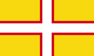
Dorset is a county in South West England on the English Channel coast. The ceremonial county comprises the unitary authority areas of Bournemouth, Christchurch and Poole and Dorset. Covering an area of 2,653 square kilometres (1,024 sq mi), Dorset borders Devon to the west, Somerset to the north-west, Wiltshire to the north-east, and Hampshire to the east. The county town is Dorchester, in the south. After the reorganisation of local government in 1974, the county border was extended eastward to incorporate the Hampshire towns of Bournemouth and Christchurch. Around half of the population lives in the South East Dorset conurbation, while the rest of the county is largely rural with a low population density.
Upton may refer to:

The West Country is a loosely defined area of south west England, usually taken to include all, some, or parts of the counties of Cornwall, Devon, Dorset, Somerset, Bristol, and, less commonly, Wiltshire, Gloucestershire and Herefordshire. The West Country has a distinctive regional English dialect and accent, and is also home to the Cornish language.
A combe can refer either to a steep, narrow valley, or to a small valley or large hollow on the side of a hill; in any case, it is often understood simply to mean a small valley through which a watercourse does not run. The word "combe" derives from Old English cumb, of the same meaning, and is unrelated to the English word "comb". It derives ultimately from the same Brythonic source as the Welsh cwm, which has the same meaning. Today, the word is used mostly in reference to the combes of southern and southwestern England.
Coombe is an alternate spelling of combe, a dry valley.
Knighton may mean:

Pilsdon Pen is a 277-metre (909 ft) hill in Dorset in South West England, situated at the north end of the Marshwood Vale, approximately 4.5 miles (7.2 km) west of Beaminster. It is Dorset's second highest point and has panoramic views extending for many miles. It was bequeathed to the National Trust by the Pinney family in 1982. For many years it was thought to be Dorset's highest hill, until modern survey revealed that nearby Lewesdon Hill was 2 metres higher.
A telegraph hill is a hill or other natural elevation that is chosen as part of an optical telegraph system.
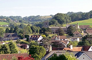
Uplyme is an English village and civil parish in East Devon on the Devon-Dorset border and the River Lym, adjacent to the Dorset coastal town of Lyme Regis. It has a population of approximately 1700 recounted as 1663 at the 2011 census. Uplyme is situated in the electoral ward of Trinity whose population at the above census was 2,521.
Blackdown or Black Down may refer to:
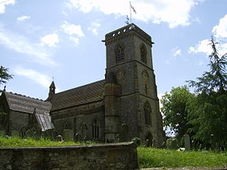
Chardstock is a village and civil parish located on the eastern border of Devon, England off the A358 road between Chard and Axminster. The parish population at the 2011 Census was 828. The parish also contains the hamlets of Bewley Down, Birchill, Burridge, Holy City and Tytherleigh.
Fairmile may refer to:
Aller may refer to:

Furze Hill is a hamlet situated in the New Forest National Park of Hampshire, England. It is in the civil parish of Ellingham, Harbridge and Ibsley. Its nearest town is Fordingbridge, which lies approximately 3.1 miles (5.2 km) north-west from the hamlet.
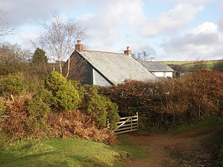
Furzehill is a hamlet in the North Devon district of Devon, England. Its nearest town is Lynton, which lies approximately 4 miles (6.4 km) north from the hamlet. The hamlet is situated in the Exmoor National Park, near the Devon-Somerset border.
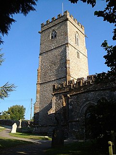
Yarcombe is a village and civil parish in the county of Devon, England, situated in the East Devon administrative district on the A30 road near the towns of Honiton and Chard. It is sited in the steep rolling meadows and ancient woods of the Yarty Valley on the south edge of the Blackdown Hills, an Area of Outstanding Natural Beauty. The population according to the 2011 census was 500.
Furzehill Wood is a woodland near Colehill in Dorset, England. It covers a total area of 0.84 hectares. It is owned and managed by the Woodland Trust. In the past the site was known as Furze Hill. In 1982 the land was given to the Woodland Trust by a neighbouring landowner. Until recently the area was sparsely wooded, but after some replanting, mature oak and ash trees now grow here, together with cherry, hazel, black poplar, and conifers. The name Furzehill refers to the gorse that used to cover the local area.
Wyke may refer to: