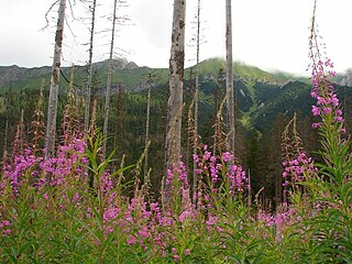
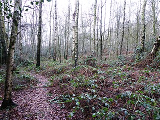
A woodland is, in the broad sense, land covered with trees, or in a narrow sense, synonymous with wood, a low-density forest forming open habitats with plenty of sunlight and limited shade. Woodlands may support an understory of shrubs and herbaceous plants including grasses. Woodland may form a transition to shrubland under drier conditions or during early stages of primary or secondary succession. Higher-density areas of trees with a largely closed canopy that provides extensive and nearly continuous shade are often referred to as forests.

In the United Kingdom, an ancient woodland is a woodland that has existed continuously since 1600 or before in England, Wales and Northern Ireland. Planting of woodland was uncommon before those dates, so a wood present in 1600 is likely to have developed naturally.
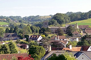
Uplyme is an English village and civil parish in East Devon on the Devon-Dorset border and the River Lym, adjacent to the Dorset coastal town of Lyme Regis. It has a population of approximately 1700 recounted as 1663 at the 2011 census. Uplyme is situated in the electoral ward of Trinity whose population at the above census was 2,521.

Great Breach and Copley Woods is a 64.8 hectare biological Site of Special Scientific Interest 1 km south of Compton Dundon and 5 km south-east of Street in Somerset, England, notified in 1972.

Cobham Woods is a 242.7 hectares biological Site of Special Scientific Interest on the western outskirts of Rochester in Kent. It is in the Kent Downs Area of Outstanding Natural Beauty and part of it is managed by the National Trust.

Bersham is a small Welsh village in the suburbs of the county borough of Wrexham that lies next to the River Clywedog, and in the community of Esclusham. Wrexham owes a large amount of its original industrial heritage to Bersham, but despite this the village still retains a rural feeling.

Broadmoor to Bagshot Woods and Heaths is a 1,696.3-hectare (4,192-acre) biological Site of Special Scientific Interest (SSSI) in Berkshire and Surrey that extend from a minority of the parish of Crowthorne including around Broadmoor Hospital in the west to Bagshot south-east, Bracknell north-east, and Sandhurst, south. It is part of the Thames Basin Heaths Special Protection Area. Two nature reserves which are managed by the Surrey Wildlife Trust are in the SSSI, Barossa nature reserve and Poors Allotment. Broadmoor Bottom, which is part of Wildmoor Heath, also falls within the SSSI; this reserve is managed by the Berkshire, Buckinghamshire and Oxfordshire Wildlife Trust.

Chiddingfold Forest is a 542.5-hectare (1,341-acre) biological Site of Special Scientific Interest in Chiddingfold in Surrey and West Sussex. One part of it, Fir Tree Copse, is a nature reserve which is managed by the Surrey Wildlife Trust

Combe Bottom is a 42.1-hectare (104-acre) biological Site of Special Scientific Interest north of Shere in Surrey. It is designated a Local Nature Reserve called Shere Woodlands, and is managed by the Surrey Wildlife Trust.

Brampton Wood is a 132.1 hectare biological Site of Special Scientific Interest in Cambridgeshire. The site is west of Brampton in Cambridgeshire. It is managed by the Wildlife Trust for Bedfordshire, Cambridgeshire and Northamptonshire.
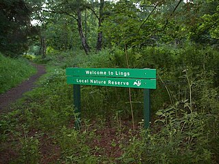
Lings Wood is a 20.1 hectare Local Nature Reserve in eastern Northampton. It is owned by Northampton Borough Council and managed by the Wildlife Trust for Bedfordshire, Cambridgeshire and Northamptonshire.

Burkham is a hamlet in the large civil parish of Bentworth in Hampshire, England including a large country house, Burkham House. The nearest town is Alton, which lies about 4.5 miles (7.2 km) to the south-east. Its nearest railway station was formerly the Bentworth and Lasham railway station on the Basingstoke and Alton Light Railway, until its closure in 1932. The nearest railway station is now 3.6 miles (5.8 km) east of the village, at Alton.
Furzehill Wood is a woodland near Colehill in Dorset, England. It covers a total area of 0.84 hectares. It is owned and managed by the Woodland Trust. In the past the site was known as Furze Hill. In 1982 the land was given to the Woodland Trust by a neighbouring landowner. Until recently the area was sparsely wooded, but after some replanting, mature oak and ash trees now grow here, together with cherry, hazel, black poplar, and conifers. The name Furzehill refers to the gorse that used to cover the local area.

Bull Cross, The Frith and Juniper Hill is a 42.33-hectare (104.6-acre) biological and geological Site of Special Scientific Interest in Gloucestershire, notified in 1954. The site is listed in the ‘Stroud District’ Local Plan, adopted November 2005, Appendix 6 as an SSSI and Regionally Important Geological Site (RIGS).

Dancersend is an 81.3 hectare Site of Special Scientific Interest (SSSI) south of Aston Clinton in Buckinghamshire. Part of the site is managed by the Forestry Commission and part by the Berkshire, Buckinghamshire and Oxfordshire Wildlife Trust (BBOWT). The BBOWT's 47 hectare nature reserve, called Dancersend with Pavis Woods, extends into fields west of the SSSI. It is in the Chilterns Areas of Outstanding Natural Beauty.

Ramsden Corner Plantation is a 3.2 hectare biological Site of Special Scientific Interest west of Northampton. It is managed by the Wildlife Trust for Bedfordshire, Cambridgeshire and Northamptonshire.
Rocky Plantation is a 3.4-hectare (8.4-acre) nature reserve north of Markfield in Leicestershire. It is owned by the National Trust and managed by the Leicestershire and Rutland Wildlife Trust.

Burner's Heath and Swallows Pond is a 5-hectare (12-acre) nature reserve in Pirbright in Surrey. It is owned by Surrey County Council and managed by the Surrey Wildlife Trust.

Runfold Wood is a 12-hectare (30-acre) nature reserve east of Farnham in Surrey. It is managed by the Surrey Wildlife Trust.
Hem Heath Woods is a nature reserve of the Staffordshire Wildlife Trust.
