
Ouadane or Wādān is a small town in the desert region of central Mauritania, situated on the southern edge of the Adrar Plateau, 93 km northeast of Chinguetti. The town was a staging post in the trans-Saharan trade and for caravans transporting slabs of salt from the mines at Idjil.

Elmina Castle was erected by the Portuguese in 1482 as Castelo de São Jorge da Mina, also known as Castelo da Mina or simply Mina, in present-day Elmina, Ghana, formerly the Gold Coast. It was the first trading post built on the Gulf of Guinea, and is the oldest extant European building south of the Sahara.

Bunce Island is an island in the Sierra Leone River. It is situated in Freetown Harbour, the estuary of the Rokel River and Port Loko Creek, about 20 miles upriver from Sierra Leone's capital city Freetown. The island measures about 1,650 feet by 350 feet and houses a castle that was built by the Royal Africa Company in c.1670. Tens of thousands of Africans were shipped from here to the North American colonies of South Carolina and Georgia to be forced into slavery, and are the ancestors of many African Americans of the United States.

Sherbro Island is in the Atlantic Ocean, and is included within Bonthe District, Southern Province, Sierra Leone. The island is separated from the African mainland by the Sherbro River in the north and Sherbro Strait in the east. It is 32 miles (51 km) long and up to 15 miles (24 km) wide, covering an area of approximately 230 square miles (600 km2). The western extremity is Cape St. Ann. Bonthe, on the eastern end, is the chief port and commercial centre.

Duarte Pacheco Pereira, called the Portuguese Achilles by the poet Camões, was a Portuguese sea captain, soldier, explorer and cartographer. He travelled particularly in the central Atlantic Ocean west of the Cape Verde islands, along the coast of West Africa and to India. His accomplishments in strategic warfare, exploration, mathematics and astronomy were of an exceptional level.

The geography of North Africa has been reasonably well known among Europeans since classical antiquity in Greco-Roman geography. Northwest Africa was known as either Libya or Africa, while Egypt was considered part of Asia.

Sengbe Pieh, also known as Joseph Cinqué or Cinquez and sometimes referred to mononymously as Cinqué, was a West African man of the Mende people who led a revolt of many Africans on the Spanish slave ship La Amistad in July 1839. After the ship was taken into custody by the US Revenue-Marine, Cinqué and his fellow Africans were eventually tried for mutiny and killing officers on the ship, in a case known as United States v. The Amistad. This reached the U.S. Supreme Court, where Cinqué and his fellow Africans were found to have rightfully defended themselves from being enslaved through the illegal Atlantic slave trade and were released. The US government did not provide any aid to the acquitted Mende People. The United Missionary Society, a black group founded by James W.C. Pennington, helped raise money for the return of thirty-five of the survivors to Sierra Leone in 1842.
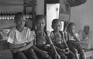
The Temne, also called Atemne, Témené, Temné, Téminè, Temeni, Thaimne, Themne, Thimni, Timené, Timné, Timmani, or Timni, are a West African ethnic group. They are predominantly found in the Northern Province of Sierra Leone. Some Temne are also found in Guinea. The Temne constitute the largest ethnic group in Sierra Leone, at 35.5% of the total population, which is slightly bigger than the Mende people at 31.2%. They speak Temne, which belongs to the Mel branch of the Niger–Congo languages.
Lomboko was a slave factory in what is today Sierra Leone, controlled by the infamous Spanish slave trader Pedro Blanco. It consisted of several large depots or barracoons for slaves brought from the interior, as well as several palatial buildings for Blanco to house his wives, concubines, and employees.
Pedro Blanco was a Spanish slave trader based in Gallinas on the coast of Sierra Leone between 1822 and 1838. Before entering the slave trade, Blanco ran a sugar mill in Cuba.

Kantora District is one of the four districts of the Upper River Division of the Gambia. it is the easternmost district of the country

Manillas are a form of commodity money, usually made of bronze or copper, which were used in West Africa. They were produced in large numbers in a wide range of designs, sizes, and weights. Originating before the colonial period, perhaps as the result of trade with the Portuguese Empire, manillas continued to serve as money and decorative objects until the late 1940s and are still sometimes used as decoration on arms, legs and around the neck. In popular culture, they are particularly associated with the Atlantic slave trade.

The name Brazil is a shortened form of Terra do Brasil, a reference to the brazilwood tree. The name was given in the early 16th century to the territories leased to the merchant consortium led by Fernão de Loronha, to exploit brazilwood for the production of wood dyes for the European textile industry.

Portuguese maritime exploration resulted in the numerous territories and maritime routes recorded by the Portuguese as a result of their intensive maritime journeys during the 15th and 16th centuries. Portuguese sailors were at the vanguard of European exploration, chronicling and mapping the coasts of Africa and Asia, then known as the East Indies, and Canada and Brazil, in what came to be known as the Age of Discovery.
Vice Admiral Joseph Denman was a British naval officer, most noted for his actions against the slave trade as a commander of HMS Wanderer of the West Africa Squadron.

Lopo Homem was a 16th-century Portuguese cartographer and cosmographer based in Lisbon and best known for his work on the Miller Atlas.

The Battle of Cochin, sometimes referred as the Second Siege of Cochin, was a series of confrontations, between March and July 1504, fought on land and sea, principally between the Portuguese garrison at Cochin, allied to the Trimumpara Raja, and the armies of the Zamorin of Calicut and vassal Malabari states.

The first arrival of European explorers to the territory of present-day Brazil is often credited to Portuguese navigator Pedro Álvares Cabral, who sighted the land later named Island of Vera Cruz, near Monte Pascoal, on 22 April 1500 while leading an expedition to India. Cabral's voyage is part of the so-called Portuguese discoveries.

Esmeraldo de Situ Orbis is an early modern work on cosmography and Atlantic exploration written by the Portuguese geographer and navigator Duarte Pacheco Pereira.

Sutukoba, sometimes referred to as Sutuko, is a village in The Gambia located in the Upper River Region, 332 km east of the capital Banjul and 38 km northeast of the regional capital Basse Santa Su. The population in 2013 was 3317.