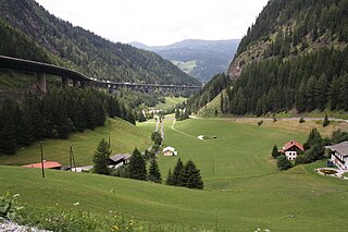
The Brenner Pass is a mountain pass through the Alps which forms the border between Italy and Austria. It is one of the principal passes of the Eastern Alpine range and has the lowest altitude among Alpine passes of the area.

The Apennines or Apennine Mountains are a mountain range consisting of parallel smaller chains extending c. 1,200 km (750 mi) along the length of peninsular Italy. In the northwest they join with the Ligurian Alps at Altare. In the southwest they end at Reggio di Calabria, the coastal city at the tip of the peninsula. Since 2000 the Environment Ministry of Italy, following the recommendations of the Apennines Park of Europe Project, has been defining the Apennines System to include the mountains of north Sicily, for a total distance of 1,500 kilometres (930 mi). The system forms an arc enclosing the east side of the Ligurian and Tyrrhenian Seas.
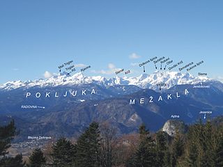
The Julian Alps are a mountain range of the Southern Limestone Alps that stretch from northeastern Italy to Slovenia, where they rise to 2,864 m at Mount Triglav, the highest peak in Slovenia and of the former Yugoslavia. A large part of the Julian Alps is included in Triglav National Park. The second highest peak of the range, the 2,755 m high Jôf di Montasio, lies in Italy.

A mountain pass is a navigable route through a mountain range or over a ridge. Since many of the world's mountain ranges have presented formidable barriers to travel, passes have played a key role in trade, war, and both human and animal migration throughout history. At lower elevations it may be called a hill pass.

The Little St Bernard Pass is a mountain pass in the Alps on the France–Italy border. Its saddle is at 2188 metres above sea level. It is located between Savoie, France, and Aosta Valley, Italy, to the south of the Mont Blanc Massif, exactly on the main alpine watershed. There is also a Great St. Bernard Pass, famous for giving the St Bernard breed its name, and a San Bernardino Pass.
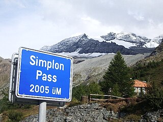
The Simplon Pass is a high mountain pass between the Pennine Alps and the Lepontine Alps in Switzerland. It connects Brig in the canton of Valais with Domodossola in Piedmont (Italy). The pass itself and the villages on each side of it, such as Gondo, are in Switzerland. The Simplon Tunnel was built beneath the vicinity of the pass in the early 20th century to carry rail traffic between the two countries.
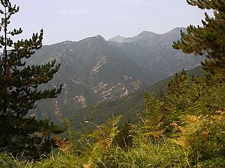
The Ligurian Alps are a mountain range in northwestern Italy. A small part is located in France. They form the south-western extremity of the Alps, separated from the Apennines by the Colle di Cadibona. The Col de Tende and the Vermenagna valley separate them from the Maritime Alps. They form the border between Piedmont in the north and Liguria in the south.

The Bernina Pass is a high mountain pass in the Bernina Range of the Alps, in the canton of Graubünden (Grisons) in eastern Switzerland. It connects the famous resort town of St. Moritz in the Engadin valley with the Italian-speaking Val Poschiavo, which ends in the Italian town of Tirano in Valtellina. The pass lies a few kilometres east of Piz Bernina, and south of Val Minor.

Lukmanier Pass is a pass in the Swiss Alps.

The Rincon Mountains are a significant mountain range east of Tucson, Pima County, Arizona, in the United States. The Rincon Mountains are one of five mountain ranges surrounding the Tucson valley. The other ranges include the most prominent, the Santa Catalina Mountains to the north, the Santa Rita Mountains to the south, the Tucson Mountains to the west, and the Tortolita Mountains to the northwest. Redington Pass separates the Rincon Mountains from the Santa Catalina Mountains. The Rincon Mountains are generally less rugged than the Santa Catalina Mountains and Santa Rita Mountains. The Rincon Mountains are also included in the Madrean sky island mountain ranges of southeast Arizona, extreme southwest New Mexico, and northern Sonora Mexico.

Timmelsjoch, is a high mountain pass that creates a link through the Ötztal Alps along the border between Austria and Italy.

Mont Cenis is a massif and a pass in Savoie (France), which forms the limit between the Cottian and Graian Alps.
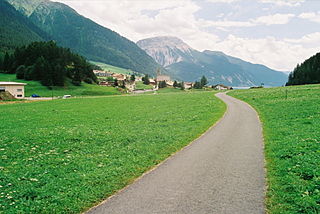
Reschen Pass is a mountain pass across the Main chain of the Alps, connecting the Upper Inn Valley in the northwest with the Vinschgau region in the southeast. Since 1919, the border between South Tyrol, Italy and Tyrol, Austria has approximately followed the watershed, the pass summit at a height of 1,504 metres (4,934 ft) being completely on Italian territory.

Fern Pass is a mountain pass in the Tyrolean Alps in Austria. It is located between the Lechtal Alps on the west and the Mieming Mountains on the east. The highest peak in Germany, the Zugspitze is only 13.5 km away to the northeast. The pass lies between the Grubigstein on the northwest, the Wannig on the southeast, and the Loreakopf on the west.

Plöcken Pass is a high mountain pass in the Carnic Alps mountain range at the border between the Austrian state of Carinthia and the Friuli-Venezia Giulia region of Italy. It links the market town of Kötschach-Mauthen in the Carinthian Gail Valley with the Paluzza municipality in the Carnia region of Friuli.

Radstädter Tauern Pass is a high mountain pass in the Austrian state of Salzburg, connecting the town of Radstadt in the Pongau region with Mauterndorf in Lungau.

Staller Saddle, at 2,052 m (6,732 ft), is a high mountain pass in the High Tauern range of the Central Eastern Alps, connecting the Defereggen Valley in East Tyrol with the Antholz Valley in South Tyrol. The pass forms the border between Austria and Italy, it separates the Villgraten Mountains in the southeast from the Rieserferner Group in the northwest.

The Rolle Pass (1989 m) is a high mountain pass in Trentino in Italy.

The Stelvio Pass is a mountain pass in northern Italy bordering Switzerland at an elevation of 2,757 m (9,045 ft) above sea level. It is the highest paved mountain pass in the Eastern Alps, and the second highest in the Alps, 7 m (23 ft) below France's Col de l'Iseran.
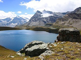
The Nivolet Pass is a mountain pass in the Eastern group of the Graian Alps in northern Italy. It is located at the top of the Orco Valley on the road from Turin to Ceresole Reale, in the Gran Paradiso National Park. Beyond the pass, the road terminates in the upper reaches of the eponymous Valsavarenche valley in the Gran Paradiso mountain group, before the valley descends to Valsavarenche and Villeneuve. The colle forms part of the boundary between the Aosta Valley and the Piemont region. The highest point of the paved road is 2,641 metres. Two artificial lakes, Serrù Lake and Agnel Lake, are located immediately below the pass.


