Garbally castle is a late medieval tower house located in the parish of Skehana, County Galway.

Garbally castle is a late medieval tower house located in the parish of Skehana, County Galway.
Garbally Castle is the dominant feature of the townland of Garbally in the parish of Skehana and sits at the junction of the R338 and the access road to St Kerrils Abbey. [1] The Garbally townland is small, covering just over 74 acres (30 ha) and is only ever know to have been occupied by two households. The name is anglicised from the Irish Garbh Bhaile which means "rough enclosure" or "rough townland". [2]
Garbally Castle was built in 1499 by Malachy O'Kelly as a tower house, the Kelly clan being renowned in Ireland at this time as builders of fortresses. The castle was destroyed by MacWilliam De Burgo in 1504, he also destroyed two other O'Kelly fortresses at this time at Monivea and Gallagh. However, the extent of the destruction inflicted is uncertain as in 1832 Samuel Lewis noted that Garbally castle was "partially destroyed by Cromwell" along with the nearby castle in the 17th century. After this time the lands were owned by three Roman Catholic landowners, two of the named Patrick Ffrench, but by the Griffiths Valuation of Tenements in the early 1850s, Robert French, a diplomat who served as Secretary to the British Embassy in St. Petersburg and Vienna was the owner of the entire townland. Garbally was at this time leased to the Blake family and occupied by one Thomas Blake who was the son of the M.P., Patrick Blake. Patrick Blake was a participant in the trial of Neddy Lohan. [2]
Garbally Castle is a ruin which has its interiors exposed. The castle is constructed as a three-storey tower around square floorplan. The most damaged side is on the southwest and here the thick side walls can be seen, with their mural passages, and there is a vaulted ceiling on the first floor. There is a pointed arch doorway on the southeastern wall which is overlooked by a gun loop in the south jamb and there is also a murder-hole. The parapets of the northeast and southeast walls retain the corbels which supported the machicolations. There are some windows in the north eastern wall, with three of them being simple slits. This is the side where a handball court has been created, several Irish monuments have been damaged by handball courts being constructed. Within the handball court there is a plaque which is a memorial to Ellen Mannion who died here in 1850, aged 25, with her husband Michael McDermott and their two children who sheltered in the ruined castle following from their eviction from their house. [1] [3]

Dublin Castle is a former Motte-and-bailey castle and current Irish government complex and conference centre. It was chosen for its position at the highest point of central Dublin.

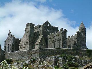
The Rock of Cashel, also known as Cashel of the Kings and St. Patrick's Rock, is a historical site located at Cashel, County Tipperary, Ireland.

Dromineer is a small village and townland in County Tipperary, Ireland. It is situated on the shores of Lough Derg on the River Shannon. The village is located 10 km north of Nenagh on the R495 road. It is a civil parish in the historical barony of Ormond Lower. Historic documents describe the places as "Dromynnyre"; the earliest form of the name dating from 1302 was Dromynwyr.

Skehana or Skehanagh is a small village and townland in County Galway, Ireland. The name Skehana derives from the Irish Sceith eánach meaning "place of the whitethorn".

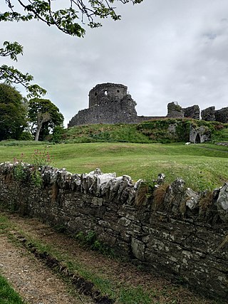
Dundrum Castle, a ruin standing over the town of Dundrum, County Down, Northern Ireland, must not to be confused with Dundrum Castle in Dundrum, County Dublin. It was constructed by John de Courcy, sometime near the beginning of the 13th century, following his invasion of Ulster. The castle, built to control access into Lecale from the west and south, stands on the top of a rocky hill commanding fine views south over Dundrum Bay and the Mourne Mountains, the lands west towards Slieve Croob and the plains of Lecale to the east. The Castle is a State Care Historic Monument in the townland of Dundrum, in Newry, Mourne and Down District Council area, at grid ref: J4047 3700.
The Battle of Knockdoe took place on 19 August 1504 at Knockdoe, in the Parish of Lackagh, County Galway, between two Anglo-Irish lords—Gerald FitzGerald, Earl of Kildare, the Lord Deputy of Ireland, and Ulick Fionn Burke, 6th Clanricarde (d.1509)—along with their respective Irish allies. The cause was a dispute between Maelsechlainn mac Tadhg Ó Cellaigh (O'Kelly), King of Ui Maine – Mod. Irish Uí Mháine) and Clanricarde. The major contemporary sources for this battle are the Gaelic Irish annals and a sixteenth-century manuscript written in the Pale known as "the Book of Howth".

Mourne Abbey, or Mourneabbey, is a small civil and Roman Catholic parish in the barony of Barretts, northwest County Cork, Ireland. The parish is situated just south of Mallow, on the main Mallow-Cork Road and Rail Line. The population of the parish is about 1,000 people. There are two churches and schools in the area, Analeentha and Burnfort. The civil parish consists of 17 townlands.

Naul, is a village, townland, and civil parish at the northern edge of Fingal and the traditional County Dublin in Ireland. The Delvin River to the north of the village marks the county boundary with County Meath. Naul civil parish is in the historic barony of Balrothery West.

Knockmoy Abbey, also known as The Monastery of the Hill of Victory ; and as Porta Magna and Teampollandorusmoir after the dissolution of the monasteries, is a ruined Cistercian abbey located in Abbeyknockmoy, County Galway, Ireland. Founded in 1198, the abbey is known for its wall-paintings.

St. Mary's Abbey in Trim, County Meath, Ireland is a former house of Augustinian canons dedicated to the Blessed Virgin. The abbey was situated on the north bank of the River Boyne, opposite Trim Castle, on land given to St. Patrick who is often credited with founding the abbey. The abbey was a prominent pilgrimage site, famous for the healing power of its statue of the Virgin Mary, until its dissolution under Henry VIII during the Reformation. Little remains of the abbey except for the Yellow Steeple, the ruin of the abbey bell tower named for the yellow color reflected by the stonework in the setting sun, and Talbot's Castle, an abbey building converted to a manor house.

Drumcliff, or Drumcliffe, Dromcliffe is a civil parish in County Clare, Ireland. It includes the village of Inch and part of the town of Ennis.

St. Patrick's Parish Complex is a historic church building, with associated rectory and cemetery, located at Northfield Church and Whitmore Lake Roads in Ann Arbor, Michigan. The complex was added to the National Register of Historic Places in 1982 and designated a Michigan State Historic Site in 1976. The complex is significant both because of its historical association with the early Irish Catholics in the area, and because of the architecturally important Gothic revival church.

Dough Castle is a ruined tower house at Lahinch in County Clare, western Ireland. It was established by the O'Conors in the early 14th century, but nothing remains of the original structures.

Killilagh or Killeilagh is a civil parish in County Clare, Ireland. It contains the village of Doolin.

Drumcreehy or Dromcreehy is a civil parish in County Clare, Ireland. It contains the village of Ballyvaughan.

The Castle of Serpa is a medieval castle located in the civil parish of Serpa, in the municipality of Serpa, Portuguese district of Beja.

Shanmuckinish Castle is a ruined tower house located in Drumcreehy civil parish of County Clare, Ireland.

Menlo Castle or Menlough Castle, also called Blake's Castle, is a 16th century castle situated on the bank of the River Corrib near Menlo village in County Galway, Ireland.

Cantwell's Castle is a tower house located in the townland of Sandfortscourt in County Kilkenny, Ireland. It served as the main residence for the head of the Cantwell family.
Crooke Preceptory is a ruined church, traditionally associated with the Knights Templar and the Knights Hospitaller, in County Waterford, Ireland. It is located in the townland of Crooke and the present day parish of Killea Crooke and Faithlegg. The church is associated with the nearby Crook Castle tower house.