Related Research Articles

Gardiner is a census-designated place (CDP) in Park County, Montana, along the 45th parallel. The population was 875 at the time of the 2010 census.

Gordon Square is a public park square in Bloomsbury, London, England. It is part of the Bedford Estate and was designed as one of a pair with the nearby Tavistock Square. It is owned by the University of London.

The Golden Boy of Pye Corner is a small late-17th-century monument located on the corner of Giltspur Street and Cock Lane in Smithfield, central London. It marks the spot where the 1666 Great Fire of London was stopped, whereas the Monument indicates the place where it started. The statue of a naked boy is made of wood and is covered with gold; the figure was formerly winged. The late 19th-century building that incorporates it is a Grade II listed building but listed only for the figure.

The EC postcode area, also known as the London EC postal area, is a group of postcode districts in central London, England. It includes almost all of the City of London and parts of the London Boroughs of Islington, Camden, Hackney, Tower Hamlets and Westminster. The area covered is of very high density development. Deliveries for the EC postcode area are made from Mount Pleasant Mail Centre.

Parks Road is a road in Oxford, England, with several Oxford University colleges along its route. It runs north–south from the Banbury Road and Norham Gardens at the northern end, where it continues into Bradmore Road, to the junction with Broad Street, Holywell Street and Catte Street to the south.

Mountjoy Square is a Georgian garden square in Dublin, Ireland, on the north side of the city just under a kilometre from the River Liffey. One of five Georgian squares in Dublin, it was planned and developed in the late 18th century by Luke Gardiner, 1st Viscount Mountjoy. It was surrounded on all sides by terraced, red-brick Georgian houses. Construction of the houses began piecemeal in 1792 and the final property was completed in 1818.

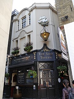
The Ship Tavern is an inn at the western corner of Lincoln's Inn Fields, at the corner of Gate Street and the Little Turnstile in London. Established in 1549, at the height of the English Reformation, when Catholicism became illegal, it was used to shelter Catholic priests and hold secret Catholic services. It was originally in Whetstone Park, which was notorious for its gambling houses. Richard Penderell, who aided Charles II's escape, visited it, as did John Bagford, the Chevalier d'Eon and John Smeaton. It was consecrated as Masonic lodge 234 in 1736 by the Grand Master, the Earl of Antrim, and rebuilt in 1923.

The Grove Park, or The Grove is a public park in Carshalton in the London Borough of Sutton. It is situated close to Carshalton Village in the area approximately bounded by the High Street, North Street and Mill Lane. The southwest corner of the park abuts one of Carshalton's ponds from where water flows through the park as the river Wandle.

St Botolph's, Billingsgate was a Church of England parish church in London. Of medieval origin, it was located in the Billingsgate ward of the City of London and destroyed by the Great Fire of London in 1666.

Fall River rises on the Madison and Pitchstone Plateaus in the southwest corner of Yellowstone National Park, Wyoming and flows approximately 64 miles (103 km) to its confluence with the Henrys Fork of the Snake River near Ashton, Idaho. Historically, the river was referred to as the Middle Fork of the Snake River or as Fall River or the Falls River by trappers and prospectors as early as the 1830s. It was officially named the Falls River by the 1872 Hayden Geological Survey, but was always called Fall River by the locals and so the U.S. Board on Geographic Names changed the official name to Fall River in 1997 at the request of Idaho authorities. The river is home to numerous waterfalls and cascades in its upper reaches.

The Church of St. Jude, located at 3815 Tenth Avenue at the corner of West 205th Street in the Inwood neighborhood of Manhattan, New York City, is a Catholic parish church in the Archdiocese of New York. Established in 1949, the current sanctuary was built in 1975-76 and was designed by Clark & Warren in the Brutalist style. The School of St. Jude, located around the corner at 431 West 204th Street and built in 1949-51 to designs by Voorhees, Walker, Foley & Smith, was originally the sanctuary as well. A two-story rectory at 411-445 West 204th Street was built in 1957 to designs by architect P. Goodman.
The Shuckburgh Arms is a Grade II listed public house on the corner of Denyer Street and Milner Street, Chelsea, London.

The Old Red Lion is a pub at 72 High Holborn on the corner with Red Lion Street, Holborn, London.

The Mercers' Arms was a pub at 17 Mercer Street, in London's Covent Garden, at the corner with Shelton Street. It closed as a pub in about 1973, and is now a private dining club.

The Perseverance is a pub at 63 Lamb's Conduit Street, Bloomsbury, London WC1, on the corner with Great Ormond Street.

The Cheshire Cheese is a public house at 5 Little Essex Street, London WC2, on the corner with Milford Lane.

The Edgar Wallace is a public house at 40–41 Essex Street, London WC2, at the corner with Devereux Court.

The Intrepid Fox was a pub at 97–99 Wardour Street, Soho, London, established in 1784 by the publican Samuel House, who named it after the prominent British Whig statesman Charles James Fox. The pub was located on the corner of Wardour Street and Peter Street.

The George is a grade II listed public house on the corner of Mortimer Street and Great Portland Street in the City of Westminster, London.

The Yorkshire Grey is a public house on the corner of Langham Street and Middleton Place in Fitzrovia, City of Westminster, London WC1.
References
Coordinates: 51°30′55.03″N0°4′16.44″W / 51.5152861°N 0.0712333°W